Safety Score: 2,7 of 5.0 based on data from 9 authorites. Meaning we advice caution when travelling to United States.
Travel warnings are updated daily. Source: Travel Warning United States. Last Update: 2024-08-13 08:21:03
Discover North End
North End in Hampden County (Massachusetts) is a place in United States about 322 mi (or 518 km) north-east of Washington DC, the country's capital city.
Current time in North End is now 11:00 PM (Friday). The local timezone is named America / New York with an UTC offset of -5 hours. We know of 12 airports near North End, of which 5 are larger airports. The closest airport in United States is Westover ARB/Metropolitan Airport in a distance of 7 mi (or 11 km), North-East. Besides the airports, there are other travel options available (check left side).
There is one Unesco world heritage site nearby. It's Statue of Liberty in a distance of 121 mi (or 194 km), South-West. Also, if you like playing golf, there are a few options in driving distance. If you need a hotel, we compiled a list of available hotels close to the map centre further down the page.
While being here, you might want to pay a visit to some of the following locations: Hartford, Worcester, Newfane, Keene and Johnston. To further explore this place, just scroll down and browse the available info.
Local weather forecast
Todays Local Weather Conditions & Forecast: 12°C / 54 °F
| Morning Temperature | 2°C / 36 °F |
| Evening Temperature | 9°C / 49 °F |
| Night Temperature | 5°C / 41 °F |
| Chance of rainfall | 0% |
| Air Humidity | 28% |
| Air Pressure | 1009 hPa |
| Wind Speed | Moderate breeze with 9 km/h (6 mph) from South-East |
| Cloud Conditions | Clear sky, covering 8% of sky |
| General Conditions | Sky is clear |
Saturday, 16th of November 2024
13°C (56 °F)
6°C (42 °F)
Sky is clear, gentle breeze, clear sky.
Sunday, 17th of November 2024
9°C (49 °F)
7°C (45 °F)
Light rain, moderate breeze, overcast clouds.
Monday, 18th of November 2024
10°C (51 °F)
6°C (43 °F)
Sky is clear, moderate breeze, clear sky.
Hotels and Places to Stay
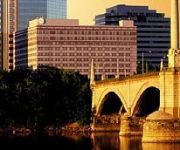
Springfield Marriott
Sheraton Springfield Monarch Place Hotel
Naomi's Inn Bed & Breakfast
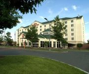
Hilton Garden Inn Springfield
Tru by Hilton Chicopee Springfield
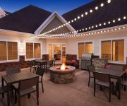
Residence Inn West Springfield
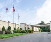
Clarion Hotel & Aqua Lagoon Waterpark
Hampton Inn - Suites - Springfield-Downtown MA
La Quinta Inn and Suites Springfield
Hampton Inn West-Springfield
Videos from this area
These are videos related to the place based on their proximity to this place.
Amtrak #449 from Springfield thru Westfield, MA
A ride looking out the passenger window of the westbound Lake Shore Limited.
Dental Services Springfield MA | Tel: 413-241-3263
Dental Services Springfield Massachusetts http://bit.ly/Dental-Services-Springfield-Massachusetts Taylor Street Dental Associates, in Springfield Massachusetts, provides quality dental services...
Dental Exams Springfield MA | Tel: 413-241-3263
Dental Exams Springfield Massachusetts http://bit.ly/Dental-Exams-Springfield Please call Taylor Street Dental Associates, in Springfield Massachusetts, at 413-241-3263 to schedule your dental...
Rehabilitation Services at Springfield Shriners Hospital For Children
Learn how Shriners Hospitals for Children physical and occupational therapists engage patients in individualized programs and group activities to improve body strength, basic life skills and...
City Tire Hunks
City Tire - the best place by far for your car! 11 locations through out New England.
Naomi's Inn - Eighteenth Century British Travel two room Suite
Queen Anne four-poster bed, living room with leather sofas, private en-suite bath.
Biomass vote pushed back
Springfield City Councilors have pushed back a controversial vote on biomass to next week.
Councilor wants answers on consultant
A Springfield City Councilor is asking the City's chief lawyer for answers about the relationship between Springfield's casino consultant and two companies that want to develop resort casinos...
Videos provided by Youtube are under the copyright of their owners.
Attractions and noteworthy things
Distances are based on the centre of the city/town and sightseeing location. This list contains brief abstracts about monuments, holiday activities, national parcs, museums, organisations and more from the area as well as interesting facts about the region itself. Where available, you'll find the corresponding homepage. Otherwise the related wikipedia article.
Springfield Union Station (Massachusetts)
Springfield Union Station is an Amtrak train station in Springfield, Massachusetts. Constructed in 1926, as of 2010, Springfield Union Station was the fifth busiest Amtrak station in Massachusetts, boarding or detraining an average of approximately 360 passengers daily. Each of the top four busiest stations was in Boston; however, Springfield's Amtrak station (at number five) featured nearly 5 times the amount of rail traffic of Massachusetts' number six Amtrak station at Haverhill.
Symphony Hall, Springfield
Symphony Hall is a concert venue in Springfield, Massachusetts. Constructed between 1911-1913 and originally known as "The Auditorium," Symphony Hall is renowned as much for its "perfect acoustics" as it is for its Greek Revival architecture. It is part of the architecturally significant Springfield Municipal Group, and sits beside an ornate, 300 foot tall Italianate Campanile, which, in turn, is located next to Springfield's Greek Revival City Hall.
WMAS-FM
WMAS-FM is an Adult Contemporary music formatted radio station licensed to Enfield, Connecticut. In the late 1960s WMAS-FM was an "underground" radio station. Advertising revenue came from the hippie boutiques, head shops, concert venues, and music stores that catered to the counter-cultural youth of the day. This format ended in September 1969 after complaints were made about expletives in a Wild Man Fischer song. A protest movement, in part organized by the DJs, failed to save the format.
WHLL
WHLL (1450 AM, "1450 The Hall") is a radio station broadcasting a sports format. Licensed to Springfield, Massachusetts, it serves the Springfield metropolitan area. It first began broadcasting under the call sign WMAS. Primarily, the station is formatted as a sports station, with programming from CBS Sports Radio. Saturday programming includes more locally-oriented talk shows, including a food show.
Memorial Bridge (Massachusetts)
The Memorial Bridge (or Springfield Memorial Bridge) is a reinforced-concrete arch bridge that spans the Connecticut River between Springfield, Massachusetts and West Springfield, Massachusetts, constructed in 1922. The bridge is owned by Massachusetts Highway Department and is located on Massachusetts Route 147. It spans 209 feet and rises 29.71 feet above the river.
Baystate Medical Center
Baystate Medical Center (BMC) in Springfield, Massachusetts is the largest of four hospitals for Baystate Health. BMC, the leading health facility in western Massachusetts. It is: A Regional Center of Care - BMC is the only tertiary care referral medical center and Level 1 Trauma Center in the region. It is also home to Western New England's only Neonatal and Pediatric Intensive Care Units.
Immaculate Conception Parish, Springfield
Immaculate Conception Parish - designated for Polish immigrants in Springfield, Massachusetts, United States. Founded 1905. It is one of the Polish-American Roman Catholic parishes in New England in the Diocese of Springfield in Massachusetts. Citing insufficient parishioners the diocese had planned to close the parish in 2009. Following closure it would have merged with Christ the King Parish in Ludlow.
Our Lady of the Rosary Parish, Springfield
Our Lady of the Rosary Parish - designated for Polish immigrants in Springfield, Massachusetts, United States. Founded 1917. It is one of the Polish-American Roman Catholic parishes in New England in the Diocese of Springfield in Massachusetts.
North End, Springfield, Massachusetts
The North End of Springfield, Massachusetts is a name that describes three distinct Springfield neighborhoods: Brightwood, Memorial Square, and Liberty Heights. For more than a century, Springfield's North End neighborhood has served as a first home for some of the city's various immigrant communities, from Greeks in Memorial Square to Russians in Liberty Heights.
Memorial Square, Springfield, Massachusetts
Memorial Square is a neighborhood located in the northwest corner of Springfield, Massachusetts. Memorial Square is geographically one of the smallest of the city's seventeen neighborhoods. It contains 274 acres, plus street and railroads. Its boundaries are the B & M Railroad to the west; the Chicopee city line to the north; Chestnut, Narragansett, and Bartlett Streets to the east; and Interstate 291 to the south.
Brightwood, Springfield, Massachusetts
The Brightwood neighborhood of Springfield, Massachusetts is located in the northwest corner of the city, along the Connecticut River; however, it is separated from the rest of Springfield by the Interstate 91 elevated highway. Many recent academic papers at the University of Massachusetts Amherst' School of Urban Design have focused on the detrimental physical and sociological effects that Interstate 91 has had on the Brightwood neighborhood, and on Springfield in general.
Merrick, West Springfield
Merrick is a neighborhood in the southeast corner of West Springfield, Massachusetts. Borders are, Park Ave to the north, Union St. and it's industrial buildings to the west, and Bridge St. (or New Bridge St. ) to the south and U.S. Route 5. Downtown is to the north and northwest and the neighborhood Memorial, is to the south and southwest. The Connecticut River is to the east. The population as of 2010 was 2,986.


