Safety Score: 2,7 of 5.0 based on data from 9 authorites. Meaning we advice caution when travelling to United States.
Travel warnings are updated daily. Source: Travel Warning United States. Last Update: 2024-08-13 08:21:03
Explore Pine Island
Pine Island in Essex County (Massachusetts) is a city in United States about 421 mi (or 677 km) north-east of Washington DC, the country's capital.
Local time in Pine Island is now 03:14 AM (Sunday). The local timezone is named America / New York with an UTC offset of -5 hours. We know of 8 airports in the vicinity of Pine Island, of which 3 are larger airports. The closest airport in United States is Portsmouth International at Pease Airport in a distance of 21 mi (or 34 km), North. Besides the airports, there are other travel options available (check left side).
Also, if you like golfing, there are multiple options in driving distance. We found 3 points of interest in the vicinity of this place. If you need a place to sleep, we compiled a list of available hotels close to the map centre further down the page.
Depending on your travel schedule, you might want to pay a visit to some of the following locations: Brentwood, Dover, Boston, Dedham and Allenstown. To further explore this place, just scroll down and browse the available info.
Local weather forecast
Todays Local Weather Conditions & Forecast: 8°C / 46 °F
| Morning Temperature | 7°C / 44 °F |
| Evening Temperature | 4°C / 40 °F |
| Night Temperature | 3°C / 37 °F |
| Chance of rainfall | 0% |
| Air Humidity | 54% |
| Air Pressure | 1003 hPa |
| Wind Speed | Fresh Breeze with 13 km/h (8 mph) from South-East |
| Cloud Conditions | Scattered clouds, covering 39% of sky |
| General Conditions | Scattered clouds |
Sunday, 24th of November 2024
7°C (45 °F)
5°C (41 °F)
Scattered clouds, moderate breeze.
Monday, 25th of November 2024
11°C (51 °F)
5°C (40 °F)
Light rain, moderate breeze, overcast clouds.
Tuesday, 26th of November 2024
6°C (43 °F)
4°C (39 °F)
Few clouds, moderate breeze.
Hotels and Places to Stay
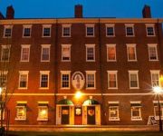
Compass Rose Inn
Clark Currier Inn
Fairfield Inn Amesbury
Hampton Inn Amesbury MA
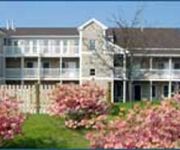
InnSeason Resorts Pollard Brook
Blue The Inn On The Beach
ESSEX STREET INN NEWBURYPORT
GARRISON INN
STRIPERS GRILL AND INN
Arbor Inn Motel
Videos from this area
These are videos related to the place based on their proximity to this place.
Custom House Maritime Museum Newburyport Massachusetts USA
Come discover Newburyport's rich maritime history.
Hurricane Sandy's Effects at Newburyport Harbor -Oct. 2012
Effects of Hurricane Sandy: Newburyport Harbor viewed from Rings Island, Salisbury, MA on Monday October, 29, 2012 at 3:35pm EST.
Shelby's Birthday Dinner Newburyport Lighthouse
Shelby's 18th birthday, family dinner atop the Newburyport Lighthouse, through the Lighthouse Preservation Society. Climb up the stairs, up the ladder and through the hatch, there's just enough...
Bay Circuit Trail Newburyport MA: Joppa Flats Start Point.
This is the first of a set of clips from a hike from the Newburyport commuter rail stop to it's Rowley counterpart. Joppa Flats is an education and research facility of the Massachusetts...
Newburyport MA Hale Park (short version)
Beautiful Hale Park off of Water Street in Newburyport MA on the way out to Plum Island. Nice place to take a stroll, but remember no pets allowed.
Great Marsh Glimpses Part 1: The road to Rough Meadows.
The Massachusetts Audubon Society recently opened the Rough Meadows Sanctuary in Rowley MA as part of a multi organization effort to preserve the vast Great Marsh, a grand expansive fish ...
Rough Seas 1
Rough day on Ben's boat. Taken with my camer phone...unfortunately. Sound didn't transfer.
Videos provided by Youtube are under the copyright of their owners.
Attractions and noteworthy things
Distances are based on the centre of the city/town and sightseeing location. This list contains brief abstracts about monuments, holiday activities, national parcs, museums, organisations and more from the area as well as interesting facts about the region itself. Where available, you'll find the corresponding homepage. Otherwise the related wikipedia article.
Plum Island (Massachusetts)
Plum Island, Massachusetts is an island located off the northeast coast of Massachusetts, north of Cape Ann. It is a barrier island approximately 11 miles (18 km) in length. The island is named for the wild beach plum shrubs that grow on its dunes. The island is located in parts of four municipalities in Essex County. From north to south they are the city of Newburyport, and the Towns of Newbury, Rowley, and Ipswich.
Plum Island, Massachusetts
Plum Island is a small village on the island of the same name in Essex County, Massachusetts, United States. It is located in the city of Newburyport and the town of Newbury. The Plum Island precinct of Newbury is the easternmost of three precincts in the town. The other two precincts are Old Town (Newbury Center) and Byfield, the westernmost precinct. Each precinct contains its own voting district, various town offices, and business center.
Coffin House
The Coffin House is a historic Colonial American house, currently estimated to have been constructed circa 1678. It is located at 14 High Road, Newbury, Massachusetts and operated as a non-profit museum by Historic New England. The house is open on the first and third Saturday of the month from June through October. The house began in 1678 as a simple structure of two or possibly three rooms on land owned by Tristram Coffin, Jr.
Dole-Little House
The Dole-Little House (circa 1715) is a historic house located at 289 High Road, Newbury, Massachusetts. It is now a non-profit museum operated by Historic New England and open to the public, for a fee, at rare intervals. Private tours can also be arranged. The original house was built around 1715 with materials salvaged from an earlier structure (perhaps c. 1670) for Richard Dole, a cattleman. It was built a two-room, central-chimney construction with a small kitchen shed at the rear.
Swett-Ilsley House
The Swett-Ilsley House (c. 1670) is a much extended Colonial house located at 4 High Road, Newbury, Massachusetts, USA. It is now owned by Historic New England, formerly the Society for the Preservation of New England Antiquities (SPNEA), and operated as a study museum. The house's original section was built in 1670 by Stephen Swett, one of Newbury's first settlers, on a south-facing single-room plan with chimney bay.
Mercury Brewing Company
Mercury Brewing Company is a brewery founded in 1999 in Ipswich, Massachusetts, USA.
Plum Island Airport
Plum Island Airport, in Newburyport, Massachusetts, is a privately owned, public-use airport owned by Historic New England and operated by Plum Island Aerodrome, Inc. , a non-profit corporation. It has two runways, averages 54 flights per week, and has approximately 8 based aircraft.
First Presbyterian Church (Newburyport, Massachusetts)
First Presbyterian Church, also known as Old South, is a Presbyterian congregation in Newburyport, Massachusetts that is part of the Presbyterian Church (USA). The self-declared mission of the church is to be “a biblically grounded Presbyterian Church seeking to be true to our rich historical heritage by providing a community of worship for all who wish to embrace a faith-centered life in the Christian tradition. ” The current pastor is the Reverend Rob John.


