Safety Score: 2,7 of 5.0 based on data from 9 authorites. Meaning we advice caution when travelling to United States.
Travel warnings are updated daily. Source: Travel Warning United States. Last Update: 2024-08-13 08:21:03
Delve into Flint Village
The district Flint Village of Fall River in Bristol County (Massachusetts) is a district located in United States about 366 mi north-east of Washington DC, the country's capital town.
In need of a room? We compiled a list of available hotels close to the map centre further down the page.
Since you are here already, you might want to pay a visit to some of the following locations: Taunton, Providence, Cranston, North Providence and Johnston. To further explore this place, just scroll down and browse the available info.
Local weather forecast
Todays Local Weather Conditions & Forecast: 2°C / 36 °F
| Morning Temperature | -3°C / 26 °F |
| Evening Temperature | -0°C / 31 °F |
| Night Temperature | -3°C / 27 °F |
| Chance of rainfall | 0% |
| Air Humidity | 41% |
| Air Pressure | 1022 hPa |
| Wind Speed | Gentle Breeze with 6 km/h (4 mph) from South-East |
| Cloud Conditions | Clear sky, covering 9% of sky |
| General Conditions | Sky is clear |
Wednesday, 4th of December 2024
2°C (35 °F)
6°C (42 °F)
Light rain, fresh breeze, clear sky.
Thursday, 5th of December 2024
5°C (41 °F)
-1°C (30 °F)
Rain and snow, fresh breeze, overcast clouds.
Friday, 6th of December 2024
0°C (32 °F)
-3°C (26 °F)
Sky is clear, fresh breeze, few clouds.
Hotels and Places to Stay
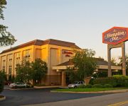
Hampton Inn Fall River-Westport
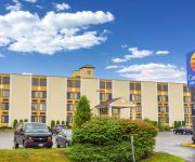
Comfort Inn & Suites Fall River
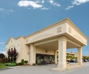
Quality Inn Somerset
SUPER 8 MOTEL - SOMERSET-FALL
Videos from this area
These are videos related to the place based on their proximity to this place.
Carlos de Medeiros, emigrante em Fall River, MA – USA
Numa viagem-sonho à América, por alturas do Natal e final de ano de 2014, foram feitas inúmeras recolhas de testemunhos, experiências de vida, bem como alguns costumes, tradições usos...
People of Fall River
NEW SHOW** a friend told me there is a FB page called "people of new bedford".... so she made me a page called "People of Fall River" and is posting my vids there..so colab time.. here is...
Fall River pool death report may lead to charges
A new report on the death of a woman in a Fall River public pool may lead to criminal charges, according to the Bristol County District Attorney's office.
Arson arrest made after Fall River fire
Fall River police have arrested 45-year-old Patrick Deloge on charges he started a fire at a multi-family home on Tremont Street.
Lazer Gate, Intro & Most Of Game 1 Of 3 (End Cut Off)
I place 1st. Too bad it was cut off...But the other 2 games are complete (i had to clip it due to my intro). If you live near or are ever near Fall River, MA, check out this GIANT 2 floor...
Fire guts Fall River home
The latest on the Fall River fire that gutted a multifamily home early this morning.
Videos provided by Youtube are under the copyright of their owners.
Attractions and noteworthy things
Distances are based on the centre of the city/town and sightseeing location. This list contains brief abstracts about monuments, holiday activities, national parcs, museums, organisations and more from the area as well as interesting facts about the region itself. Where available, you'll find the corresponding homepage. Otherwise the related wikipedia article.
North Westport, Massachusetts
North Westport is a census-designated place (CDP) in the town of Westport in Bristol County, Massachusetts, United States. The population was 4,571 at the 2010 census.
Bristol Community College
Bristol Community College (BCC) is a two-year community college located in Fall River, Massachusetts.
Battleship Cove
Battleship Cove, located in Fall River, Massachusetts, is a nonprofit maritime museum and war memorial that traces its origins to the wartime crew of the World War II battleship USS Massachusetts. This dedicated veterans group was responsible for the donation of the decommissioned vessel from the Navy and its subsequent public display in Fall River, Massachusetts. Formally registered as the U.S.S. Massachusetts Memorial Committee, Inc.
Roman Catholic Diocese of Fall River
The Roman Catholic Diocese of Fall River is an ecclesiastical territory or diocese of the Roman Catholic Church in the New England region of the United States. It is led by the prelature of a bishop administering the diocese from the mother church St. Mary's Cathedral in Fall River, Massachusetts. The diocese was canonically erected by Pope Saint Pius X on March 12, 1904, taking its territories from the Diocese of Providence in Rhode Island.
New Harbour Mall
New Harbour Mall is an enclosed shopping mall located in Fall River, Massachusetts, United States, at the intersection of Route 24 and Route 81. Opened in 1970, the mall is noted for being the only shopping center in the United States to feature rival department store chains Kmart and Wal-Mart as its anchor stores.
Charles M. Braga Jr. Memorial Bridge
The Charles M. Braga Jr. Memorial Bridge, also known as the Braga Bridge, is a high-level crossing that carries Interstate 195 over the Taunton River between the town of Somerset and the city of Fall River, near the mouth of the Quequechan River at the confluence with Mount Hope Bay. At just over a mile long, it is one of the longest bridges in Massachusetts. Opened to traffic in 1966, it provides an important link between Providence, Rhode Island, New Bedford and Cape Cod.
WHTB
WHTB/1400 A.M. is a Portuguese language radio station in Fall River, Massachusetts, operating with 1kW unlimited hours.
Quequechan River
The Quequechan River (pronounced "Quick-a-shan" by locals) is a river in Fall River, Massachusetts, that flows in a northwesterly direction from the South Watuppa Pond to the Taunton River. The word Quequechan means "falling water" in Wampanoag, hence the city's name. The river is 2.7 miles long and mostly placid, until it nears downtown Fall River, where a quickly declining grade causes it to turn rapid.
Brightman Street Bridge
The Brightman Street Bridge is a 922-foot long, four-lane wide drawbridge spanning the Taunton River between the town of Somerset and the city of Fall River, Massachusetts. It was authorized in 1903 by the state legislature, and building took place between 1906 and 1908, when it opened full time on October 10, 1908. It was closed to vehicular traffic on October 11, 2011.
Bishop Connolly High School
Bishop Connolly High School is a co-educational Catholic high school in Fall River, Massachusetts.
Slade's Ferry Bridge
The Slade's Ferry Bridge was a steel swing double layered truss bridge that spanned the Taunton River between Somerset, Massachusetts and Fall River, Massachusetts. It carried rail traffic on top and included a swing span to allow river traffic through. It was built in 1875 and removed in 1970. The alignment of the bridge carried it from Remington Street in Fall River to the junction of Riverside Avenue, Brayton Avenue and Wilbur Avenue in Somerset.
Veterans Memorial Bridge (Bristol County, Massachusetts)
The Veterans Memorial Bridge is a bascule bridge connecting Somerset, Massachusetts and Fall River, Massachusetts. The bridge carries U.S. Route 6 and Route 138 over the Taunton River, with connecting ramps to Route 79, and includes a bike path on its north side. The $290 million bridge was dedicated to area veterans on September 11, 2011. The bike path was also dedicated in a separate ceremony that same day in honor of Pvt. Michael E. Bouthot, who was killed in action in Iraq in 2006.
Watuppa Ponds
The Watuppa Ponds are two large, naturally occurring, spring-fed, glacially formed ponds located in Fall River and Westport, Massachusetts. Watuppa is a native word meaning "place of boats". The two ponds were originally one body of water, connected by a narrow rocky straight near what is now the boundary between Fall River and Westport. Together, the ponds have an overall north-south length of about 7.5 miles, and an average east-west width of about a mile.
Mark's Stadium
Mark's Stadium is a former soccer stadium located in North Tiverton, Rhode Island. During the 1920s and early 1930s it was the home of Fall River Marksmen, one of the era’s most successful soccer teams. It is one of the earliest examples of a soccer-specific stadium in the United States. After the demise of the Marksmen, the stadium was used as a home ground by other local teams, most notably Fall River F.C. and Ponta Delgada S.C..
PT Boat Museum
PT Boat Museum is located in Fall River, Massachusetts as part of Battleship Cove. It is a museum that exhibits two National Historic Landmark ships, an 80-foot Elco boat, PT 617, and a 78-foot Higgins boat, PT 796.
Prince Henry the Navigator (statue)
Prince Henry the Navigator is an historic statue located on a traffic median at the intersection of Eastern Avenue and Pleasant Street in the Flint Village section of Fall River, Massachusetts.
Fall River Government Center
Fall River Government Center (also known as "city hall") is the location of the municipal government offices in the city of Fall River, Massachusetts, United States. Located at One Government Center, and constructed directly over Interstate 195, it was the first public building built over a Federal interstate highway.
Old Colony & Fall River Railroad Museum
The Old Colony & Fall River Railroad Museum is a small railroad museum located in Fall River Massachusetts. The Old Colony and Fall River Railroad operated from 1854 to 1863, and later as part of the extensive Old Colony Railroad system. The museum is located directly across from the former Fall River Line Terminal, part of the Old Colony's "boat train" service between Boston and New York City.
St. Stanislaus Parish, Fall River
St. Stanislaus Parish is a Roman Catholic parish designated for Polish immigrants in Fall River, Massachusetts, United States. Founded in 1903, it is one of the Polish-American Roman Catholic parishes in New England in the Diocese of Fall River.
B.M.C. Durfee High School
B.M.C. Durfee High School is a public high school located in the city of Fall River, Massachusetts. It is a part of Fall River Public Schools and is the city's main public high school, the other being Diman Regional Vocational Technical High School. Durfee is one of the biggest high schools in Massachusetts, and is also the 3rd biggest high school in Southeastern Massachusetts behind Brockton and New Bedford.
Bradford Durfee College of Technology
The Bradford Durfee College of Technology was a college located in Fall River, Massachusetts. It was chartered in 1895 as the Bradford Durfee Textile School. It was then incorporated in 1899 and opened in 1904. The school was named after Bradford Durfee (1788-1843), a leading early Fall River industrialist.
Somerset Berkley Regional High School
Somerset Berkley Regional High School is the public high school for the towns of Somerset and Berkley, Massachusetts, beginning in September 2011.
Fall River (MBTA station)
Fall River is a future railroad station on the MBTA Commuter Rail's Providence/Stoughton Line located in Fall River, Massachusetts. It is being built as part of the state's effort to extend rail service to Fall River and New Bedford.
Battleship Cove (MBTA station)
Battleship Cove is a future railroad station on the MBTA Commuter Rail's Providence/Stoughton Line located in Fall River, Massachusetts. It is being built as part of the state's effort to extend rail service to Fall River and New Bedford. It will be located right next to its namesake Battleship Cove.
Diman Regional Vocational Technical High School
Diman Regional Vocational Technical High School is a public vocational high school located in Fall River, Massachusetts. The high school serves a regional school district comprising the city of Fall River, and the surrounding towns of Somerset, Swansea and Westport.


