Safety Score: 2,7 of 5.0 based on data from 9 authorites. Meaning we advice caution when travelling to United States.
Travel warnings are updated daily. Source: Travel Warning United States. Last Update: 2024-08-13 08:21:03
Delve into Eastondale
Eastondale in Bristol County (Massachusetts) is located in United States about 381 mi (or 614 km) north-east of Washington DC, the country's capital town.
Current time in Eastondale is now 01:14 PM (Tuesday). The local timezone is named America / New York with an UTC offset of -5 hours. We know of 10 airports close to Eastondale, of which 4 are larger airports. The closest airport in United States is General Edward Lawrence Logan International Airport in a distance of 23 mi (or 37 km), North. Besides the airports, there are other travel options available (check left side).
Also, if you like playing golf, there are some options within driving distance. We encountered 2 points of interest near this location. If you need a hotel, we compiled a list of available hotels close to the map centre further down the page.
While being here, you might want to pay a visit to some of the following locations: Taunton, Dedham, Boston, Providence and North Providence. To further explore this place, just scroll down and browse the available info.
Local weather forecast
Todays Local Weather Conditions & Forecast: 2°C / 36 °F
| Morning Temperature | -5°C / 23 °F |
| Evening Temperature | -1°C / 30 °F |
| Night Temperature | -3°C / 26 °F |
| Chance of rainfall | 0% |
| Air Humidity | 39% |
| Air Pressure | 1022 hPa |
| Wind Speed | Light breeze with 5 km/h (3 mph) from East |
| Cloud Conditions | Few clouds, covering 10% of sky |
| General Conditions | Sky is clear |
Tuesday, 3rd of December 2024
2°C (35 °F)
3°C (38 °F)
Light rain, gentle breeze, few clouds.
Wednesday, 4th of December 2024
5°C (41 °F)
-2°C (28 °F)
Rain and snow, fresh breeze, overcast clouds.
Thursday, 5th of December 2024
-1°C (31 °F)
-4°C (24 °F)
Sky is clear, moderate breeze, clear sky.
Hotels and Places to Stay
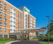
Holiday Inn Express BROCKTON - BOSTON
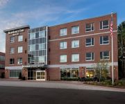
Residence Inn Boston Brockton
MA Brockton Country Inn and Suites by Radisson
Residence Inn Boston Bridgewater
Best Western Carlton House
MA Motel 6 Brockton
Holiday Inn TAUNTON-FOXBORO AREA
Rodeway Inn Brockton
SUPER 8 MOTEL - BROCKTON
Extended Stay America Foxboro Norton
Videos from this area
These are videos related to the place based on their proximity to this place.
Brockton Train Show 2008
Some layouts and pictures from the Brockton Train Show held at Brockton, MA on November 2nd, 2008.
Bay Circuit Trail Easton MA: Hockomock Swamp Wildlife Management Area Part 1.
The Hockomock is one of the few potential wilderness areas in eastern Massachusetts with an array of legends. The Bay Circuit Trail rides a power line access road along its northern edge....
Easton Indoor Farmers Market 2013
Every Saturday from 10-2 pm. Located at the Simpson Springs Bottling Company at 719 Washington Street, South Easton, MA. Near Brockton, Stoughton, Sharon, Mansfield, Norton, Taunton, West ...
Easton Indoor Farmers Market - 1st Day
http://velmas.org - We check out the Easton Indoor Farmers Market at the Simpson Spring Company in Easton, MA. 719 Washington Street (Route 138) South Easton. Saturdays 10-2 pm.
2014-05-15 Driving down Rote 24 to Rte 138 South in Raynham
On my way to taunton high School for the softball game driving down Route 24 to Route 106 then down Route 138.
2015-02-22 Driving from Easton 5 corners to Route 24
Driving from Easton Five Corners/Route 123 to Route 24 in North Randolph on my way home.
2014-05-04 144809 Driving from Jamie's to North Taunton
Going from Jamies restaurant in Whitman after my weekly brunch to Ruby Tuesday in Taunton.
Most Common Transmission Problems - Brockton Chrysler Jeep Dodge Ram Dealership
Most Common Transmission Problems - Brockton Chrysler Jeep Dodge Ram Dealership| http://chryslerjeepdodgeram24.com | CALL US: 877-229-8362 Jeep Dealer Hingham, MA | At Chrysler Jeep ...
2014-07-04 driving from West Brockton to Ruby Tuesday (1/2)
Going from the Dunkin Donuts in West Brockton to Ruby Tuesday in Taunton.
March 22, 2015
Who we are What does the Covenant Church believe? On one level, the answer is quite simple. When new members join a Covenant church, they are asked two questions about belief: ‚ Do you confess ...
Videos provided by Youtube are under the copyright of their owners.
Attractions and noteworthy things
Distances are based on the centre of the city/town and sightseeing location. This list contains brief abstracts about monuments, holiday activities, national parcs, museums, organisations and more from the area as well as interesting facts about the region itself. Where available, you'll find the corresponding homepage. Otherwise the related wikipedia article.
Stonehill College
Stonehill College is a private, non-profit, coeducational, Roman Catholic, Liberal Arts college located in Easton, Massachusetts, United States, founded in 1948. Situated in North Easton, Massachusetts, a suburban community of 23,329 people, Stonehill is located 22 miles south of Boston on a 375-acre campus, the original estate of Frederick Lothrop Ames. The campus map highlights 29 buildings that complement the original Georgian-style Ames mansion.
WWDP
WWDP is a television station in the United States, serving the Boston, Massachusetts market. The station broadcasts on digital VHF channel 10. It is licensed to Norwell, Massachusetts, airs home shopping programs from ShopNBC, and is owned by ValueVision Media.
Brockton High School
Brockton High School, established in 1871, is a high school located in Brockton, Massachusetts and is the largest high school in Massachusetts and New England. Brockton is the largest high school East of the Mississippi River, and is also one of the largest high schools in the United States.
WSHL-FM
WSHL-FM is a radio station broadcasting an Alternative music format. Licensed to Easton, Massachusetts, USA, the station serves the Greater Brockton-Easton area of Massachusetts, 24/7 in Stereo. The station is currently owned by Stonehill College, Inc. and has been operating since January, 1974. WSHL-FM is located on the 2nd floor of Merkert Gymnasium at Stonehill College.
WMSX
WMSX is a radio station that is silent. Licensed to Brockton, Massachusetts, USA, the station serves the South Shore area (though it markets itself to the Greater Boston area as a whole). The station was owned by the Kingdom Church. The station has been sold to Langer Broadcasting Group, LLC, which already owns WSRO in the area.
WXBR
WXBR is a radio station that broadcasts a brokered news and talk format from studios in Brockton, Massachusetts to Greater Boston, Southeastern Massachusetts, South Shore and Providence County, Rhode Island. Its transmitter is located in West Bridgewater, Massachusetts. The station is licensed to Azure Media based in Miami Gardens, Florida.
Temple Beth Emunah (Brockton, Massachusetts)
Temple Beth Emunah is a Conservative synagogue in Brockton, Massachusetts. In 2005 the synagogue installed a stained glass window that once belonged to Orthodox synagogue, Congregation Agudas Achim, founded in 1899 when Brockton had a large community of Jewish immigrants. The window was made for Agudas Achim's 1927 building. That building was torn down in the 1960s and the orthodox congregation continued in rented space until 2005.
W.B. Mason Stadium


