Safety Score: 2,7 of 5.0 based on data from 9 authorites. Meaning we advice caution when travelling to United States.
Travel warnings are updated daily. Source: Travel Warning United States. Last Update: 2024-08-13 08:21:03
Discover Rock Landing
Rock Landing in Barnstable County (Massachusetts) is a town in United States about 392 mi (or 631 km) north-east of Washington DC, the country's capital city.
Current time in Rock Landing is now 02:08 AM (Sunday). The local timezone is named America / New York with an UTC offset of -5 hours. We know of 11 airports near Rock Landing, of which 4 are larger airports. The closest airport in United States is Barnstable Municipal Boardman Polando Field in a distance of 12 mi (or 19 km), North-East. Besides the airports, there are other travel options available (check left side).
Also, if you like playing golf, there are a few options in driving distance. We discovered 1 points of interest in the vicinity of this place. Looking for a place to stay? we compiled a list of available hotels close to the map centre further down the page.
When in this area, you might want to pay a visit to some of the following locations: Edgartown, Barnstable, Nantucket, Taunton and Dedham. To further explore this place, just scroll down and browse the available info.
Local weather forecast
Todays Local Weather Conditions & Forecast: 8°C / 47 °F
| Morning Temperature | 7°C / 44 °F |
| Evening Temperature | 7°C / 44 °F |
| Night Temperature | 4°C / 40 °F |
| Chance of rainfall | 0% |
| Air Humidity | 55% |
| Air Pressure | 1005 hPa |
| Wind Speed | Fresh Breeze with 17 km/h (11 mph) from East |
| Cloud Conditions | Broken clouds, covering 76% of sky |
| General Conditions | Broken clouds |
Sunday, 24th of November 2024
8°C (46 °F)
8°C (46 °F)
Sky is clear, fresh breeze, clear sky.
Monday, 25th of November 2024
14°C (58 °F)
6°C (44 °F)
Light rain, fresh breeze, overcast clouds.
Tuesday, 26th of November 2024
6°C (43 °F)
6°C (42 °F)
Sky is clear, fresh breeze, clear sky.
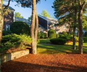
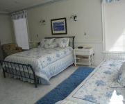
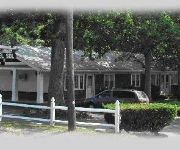
Hotels and Places to Stay
South Cape Resort
Alexander Hamilton House Cape Cod
Santuit Inn
La Plaza Del Sol
Cape Cod Holiday Estates
Videos from this area
These are videos related to the place based on their proximity to this place.
Windchime Luxury Condominium, Mashpee
Sold See for sale properties on Cape Cod http://www.MyBeachFrontHouse.com.
Direction from Exit2 Mid Cape HWY to the Mashpee Rotary
Direction from Exit2 Mid Cape HWY to the Mashpee Rotary.
OTIS Series 1 211H Hydraulic Elevator-2 Oak Street Mashpee Commons
Originally Uploaded: February 22, 2011 Originally Filmed: February 18, 2011 Another Series 1. :P Original Description: Filmed by SchindlerHaughton. In a small dual story office suite,...
Ron Lee's Gay Head Lighthouse kaleidoscope
Gay Head Lighthouse is a faithfully reproduced, hand made version of the famous historic lighthouse built in 1799, overlooking Vineyard Sound in Aquinnah on Martha's Vineyard (off Cape Cod)....
Marc Tickle's Barcelonita kaleidoscope, side view
Barcelonita is a collector's dream in that it best represents Marc's design aesthetic, meticulous craftsmanship, and inventive use of diverse materials. Viewed as a piece of glass sculpture,...
Sea Side LeMans 2010 (Best Clips!)
Compilation of the best clips from the 2010 Sea Side LeMans! This was the 10th annual running of the karts to benefit the Cape Cod Foundation supporting local Cape and Islands charities. ...
Henry Bergeson's King's Ransom kaleidoscope
A wonderful option for the discerning kaleidoscope lover, King's Ransom offers three different types of kaleidoscopes in one tidy case: a beautiful teleidoscope, a dry cell kaleidoscope with...
David Macdonald and Bob Butcher Kiteboarding on Waquoit Bay in Massachusetts
Two friends from Cape Cod in Massachusetts enjoy a Spring day on June 3, 2012. A slight wind brings colorful kites into the blue skies of Waquoit Bay, an exciting sport adventure is a joy to...
Is sailing off Cotuit on Cape Cod like watching paint dry?
Watch this clip of Don and I sailing off Cotuit in Nantucket Sound on a perfect Sunday in August and then you can tell me if this is boring or just the most relaxing and incredible way to spend...
Videos provided by Youtube are under the copyright of their owners.
Attractions and noteworthy things
Distances are based on the centre of the city/town and sightseeing location. This list contains brief abstracts about monuments, holiday activities, national parcs, museums, organisations and more from the area as well as interesting facts about the region itself. Where available, you'll find the corresponding homepage. Otherwise the related wikipedia article.
Monomoscoy Island, Massachusetts
Monomoscoy Island is a census-designated place (CDP) in the town of Mashpee in Barnstable County, Massachusetts, United States. As of the 2000 census, the island had a total population of 152.
New Seabury, Massachusetts
New Seabury is a census-designated place (CDP) in the town of Mashpee in Barnstable County, Massachusetts, United States, on Cape Cod. This area consists primarily of summer homes for wealthy families. Several attractions include two world renowned country clubs, Popponesset Beach, Popponesset Marketplace, Fells Pond, Daniels Island, and Littleneck Bay. The population was 815 at the 2000 census.
Popponesset Island, Massachusetts
Popponesset Island is a census-designated place (CDP) in the town of Mashpee in Barnstable County, Massachusetts, United States. The population was 39 at the 2000 census.
Popponesset, Massachusetts
Popponesset is a census-designated place (CDP) in the town of Mashpee in Barnstable County, Massachusetts, United States. The population was 310 at the 2000 census.
Seconsett Island, Massachusetts
Seconsett Island is a census-designated place (CDP) in the town of Mashpee in Barnstable County, Massachusetts, United States. The population was 81 at the 2000 census.
Seabrook, Massachusetts
Seabrook is a census-designated place (CDP) in the town of Mashpee in Barnstable County, Massachusetts, United States. The population was 477 at the 2000 census.
Popponesset Bay
Popponesset Bay System is a group of bays located at the towns of Mashpee (north & west) and Barnstable (east), on Cape Cod, Massachusetts with a southern shore bounded by water from Nantucket Sound. Popponesset Bay has the following tributary sub-embayments: Ockway Bay Shoestring Bay Mashpee River Estuary Pinquickset Cove The bay system is fed by the Mashpee River and Santuit River.
Holly Marsh
Holly Marsh is a small saltwater marshland in Mashpee, Massachusetts on the shores of Popponesset Bay, Cape Cod. The marsh starts at Daniel's Island (a peninsula) and extends down both the mainland side and the Popponesset Island side of the Popponesset Creek.


