Safety Score: 2,7 of 5.0 based on data from 9 authorites. Meaning we advice caution when travelling to United States.
Travel warnings are updated daily. Source: Travel Warning United States. Last Update: 2024-08-13 08:21:03
Delve into Tilghmanton Heights
Tilghmanton Heights in Washington County (Maryland) is a town located in United States about 58 mi (or 94 km) north-west of Washington DC, the country's capital town.
Time in Tilghmanton Heights is now 12:17 PM (Thursday). The local timezone is named America / New York with an UTC offset of -5 hours. We know of 8 airports closer to Tilghmanton Heights, of which 3 are larger airports. The closest airport in United States is Hagerstown Regional Richard A Henson Field in a distance of 11 mi (or 19 km), North. Besides the airports, there are other travel options available (check left side).
There is one Unesco world heritage site nearby. It's Monticello and the University of Virginia in Charlottesville in a distance of 105 mi (or 169 km), South. Also, if you like the game of golf, there are some options within driving distance. We saw 1 points of interest near this location. In need of a room? We compiled a list of available hotels close to the map centre further down the page.
Since you are here already, you might want to pay a visit to some of the following locations: Hagerstown, Martinsburg, Charles Town, Frederick and Chambersburg. To further explore this place, just scroll down and browse the available info.
Local weather forecast
Todays Local Weather Conditions & Forecast: 9°C / 47 °F
| Morning Temperature | 3°C / 38 °F |
| Evening Temperature | 4°C / 40 °F |
| Night Temperature | 2°C / 35 °F |
| Chance of rainfall | 6% |
| Air Humidity | 57% |
| Air Pressure | 1004 hPa |
| Wind Speed | Moderate breeze with 11 km/h (7 mph) from South-East |
| Cloud Conditions | Scattered clouds, covering 39% of sky |
| General Conditions | Moderate rain |
Thursday, 21st of November 2024
3°C (38 °F)
3°C (37 °F)
Rain and snow, fresh breeze, overcast clouds.
Friday, 22nd of November 2024
7°C (45 °F)
8°C (47 °F)
Broken clouds, fresh breeze.
Saturday, 23rd of November 2024
9°C (47 °F)
4°C (40 °F)
Overcast clouds, moderate breeze.
Hotels and Places to Stay
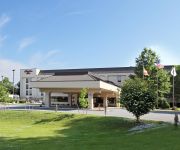
Comfort Suites Hagerstown
Courtyard Hagerstown
Hampton Inn Hagerstown
SpringHill Suites Hagerstown
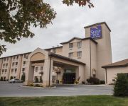
Sleep Inn & Suites Hagerstown
MD Hagerstown Country Inn and Suites by Radisson
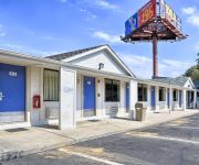
MOTEL 6 HAGERSTOWN MD
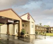
MD Red Roof Inn Hagerstown - Williamsport
Videos from this area
These are videos related to the place based on their proximity to this place.
Hagerstown, MD Tesla Superchargers
TeslaRoadTrip arrives at the Hagerstown, Maryland Tesla Superchargers.
My Business - Sharing the Journey: Clark's Farm and Clark's Elioak Farm
Ginger S. Myers of the University of Maryland Extension interviews Martha Clark and Nora Crist of Clark's Elioak Farm and Clark's Farm located in Ellicott City, Maryland. http://www.clarklandfarm.c...
Rodeo to benefit Clear Spring FFA alumni
http://www.herald-mail.com/?cmd=displaystory&story_id=197560&format=html Click or copy and paste the link to view the story that ran June 30, 2008. A rodeo was held Sunday at the Washington...
T580G Test Flight @ Red Hill 10-07-14
More raw video from the T580G. Tested in winds that were a constant 13-15 mph with gusts over 30 mph. Once again, used the RC Logger Pro cam for video. Still amazed at the stability of this...
Antietam Bloody Lane
A second video from the Sunken Road (Bloody Lane) on the Antietam National Battlefield, near Sharpsburg, Maryland. This is a tour of the Bloody Lane area starting with the view from the...
CSX Q400 Crew Change with 8 Engines
csx q400 stops at point of rocks station with ex-cr sd60, maryland.
Tours-TV.com: Antietam National Battlefield Memorial
Memorial in commemoration of 3600 soldiers, fallen in one of the most bloody battles of Civil War, which occured at the town of Sharpsburg on the Antietam Creek in september of 1867. United...
The Opening Shots - Antietam 150th
Antietam National Battlfefield Volunteers fire the first artillery shots during the early morning "Cornfield walk" on the 150th Anniversary of the Battle of Antietam. 09/17/12.
Videos provided by Youtube are under the copyright of their owners.
Attractions and noteworthy things
Distances are based on the centre of the city/town and sightseeing location. This list contains brief abstracts about monuments, holiday activities, national parcs, museums, organisations and more from the area as well as interesting facts about the region itself. Where available, you'll find the corresponding homepage. Otherwise the related wikipedia article.
St. James, Maryland
St. James is a census-designated place (CDP) in Washington County, Maryland, United States. The population was 1,657 at the 2000 census. It is also the home of St. James School, Hagerstown, a small, Episcopalian, boarding school.
St. James School, Maryland
Saint James School is an independent, secondary, boarding and day school. Founded in 1842 as the College of Saint James, the school is a coeducational college preparatory school.
Van Lear, Maryland
Van Lear is an unincorporated community in Washington County, Maryland. The community is part of the Hagerstown-Martinsburg, MD-WV MSA (Metropolitan Statistical Area). Van Lear is located between Halfway, Maryland and Williamsport, Maryland.
Fairplay, Maryland
Fairplay is an unincorporated community not considered as a census-designated place (CDP) in Washington County, Maryland, United States. It is sometimes recognized along with neighboring Tilghmanton as Fairplay-Tilghmanton; the two communities share a post office as well as a fire company. Fairplay is between Hagerstown, Maryland and Sharpsburg, Maryland along Maryland Route 65 and is part of the Hagerstown Metropolitan Area.
Mercersville, Maryland
Mercersville is an unincorporated community in Washington County, Maryland. It lies at an elevation of 341 feet (104 m).
Burtner, Maryland
Burtner is an unincorporated community in Washington County, Maryland, United States.
Spielman, Maryland
Spielman is an unincorporated community in Washington County, Maryland, United States.


