Safety Score: 2,7 of 5.0 based on data from 9 authorites. Meaning we advice caution when travelling to United States.
Travel warnings are updated daily. Source: Travel Warning United States. Last Update: 2024-08-13 08:21:03
Delve into Southwind
Southwind in Queen Anne's County (Maryland) is a city located in United States about 40 mi (or 64 km) east of Washington DC, the country's capital town.
Current time in Southwind is now 03:54 AM (Friday). The local timezone is named America / New York with an UTC offset of -5 hours. We know of 8 airports closer to Southwind, of which 4 are larger airports. The closest airport in United States is Baltimore/Washington International Thurgood Marshal Airport in a distance of 27 mi (or 43 km), North-West. Besides the airports, there are other travel options available (check left side).
There are two Unesco world heritage sites nearby. The closest heritage site in United States is Monticello and the University of Virginia in Charlottesville in a distance of 89 mi (or 143 km), South-West. Also, if you like playing golf, there are some options within driving distance. We saw 10 points of interest near this location. In need of a room? We compiled a list of available hotels close to the map centre further down the page.
Since you are here already, you might want to pay a visit to some of the following locations: Annapolis, Centreville, Easton, Chestertown and Cambridge. To further explore this place, just scroll down and browse the available info.
Local weather forecast
Todays Local Weather Conditions & Forecast: 6°C / 42 °F
| Morning Temperature | 2°C / 36 °F |
| Evening Temperature | 4°C / 38 °F |
| Night Temperature | 4°C / 40 °F |
| Chance of rainfall | 6% |
| Air Humidity | 51% |
| Air Pressure | 1000 hPa |
| Wind Speed | Moderate breeze with 13 km/h (8 mph) from South-East |
| Cloud Conditions | Scattered clouds, covering 35% of sky |
| General Conditions | Rain and snow |
Friday, 22nd of November 2024
9°C (47 °F)
9°C (48 °F)
Light rain, fresh breeze, clear sky.
Saturday, 23rd of November 2024
10°C (50 °F)
7°C (45 °F)
Overcast clouds, moderate breeze.
Sunday, 24th of November 2024
10°C (50 °F)
12°C (53 °F)
Light rain, light breeze, broken clouds.
Hotels and Places to Stay
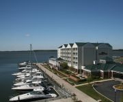
The Waterfront Historic Kent Manor Inn
Hilton Garden Inn Kent Island
THE INN AT CHESAPEAKE BAY BEACH CLUB
BEST WESTERN KENT NARROWS INN
Holiday Inn Express ANNAPOLIS EAST-KENT ISLAND
Videos from this area
These are videos related to the place based on their proximity to this place.
Eastern Shore Wedding DJ At Silver Swan Bayside In Stevensville - Steve Moody
Visit www.SteveMoody.com or call 1-800-410-3013 for more information on the area's most awarded wedding disc jockey service. Your Requests Will Be Played, Your Dance Floor Will Be Packed,...
1974 BMW 2002 Used Cars Stevensville MD
http://www.lowesautomotive.com This 1974 BMW 2002 is available from Lowes Automotive. For details, call us at 410-604-0566.
2923 COX NECK ROAD CHESTER MD 21619- DINA BAXTER REALTOR
Dina Baxter Waterfront Real Estate Agent STEVENSVILLE REALTOR ® 410-643-2166 (office) 410-507-1936 (mobile) 888-422-8041 (fax) E-mail: dina@dinabaxter.com Rosendale Realty Kent Island...
DINA BAXTER REALTOR
Dina Baxter Waterfront Real Estate Agent STEVENSVILLE REALTOR ® 410-643-2166 (office) 410-507-1936 (mobile) 888-422-8041 (fax) E-mail: dina@dinabaxter.com Rosendale Realty Kent Island...
215 TRIPP WAY CHESTER MD 21619-DINA BAXTER REALTOR
Dina Baxter Waterfront Real Estate Agent STEVENSVILLE REALTOR ® 410-643-2166 (office) 410-507-1936 (mobile) 888-422-8041 (fax) E-mail: dina@dinabaxter.com Rosendale Realty Kent Island...
Wreath's Across America 2012
This amazing caravan came through our little town of Stevensville, Md. to stop and have lunch at our local American Legion. They then proceeded to make their delivery to Arlington National Cemetery.
Ethel, at Chesapeake Cats and Dogs
This is a video of a cat who is available for adoption from Chesapeake Cats and Dogs in Stevensville, MD.
Mean 180 Fit Camp | March 1st, 2013
This Fat-burning Friday workout uses small spaces and simple exercises to burn a ton of calories really fast. Core stability, bodyweight exercises and tons of cardio challenge even the fittest...
Take off/Landing Practice
Take off and landing practice at Bay Bridge Airport in the Auto Gyro Calidus.
Videos provided by Youtube are under the copyright of their owners.
Attractions and noteworthy things
Distances are based on the centre of the city/town and sightseeing location. This list contains brief abstracts about monuments, holiday activities, national parcs, museums, organisations and more from the area as well as interesting facts about the region itself. Where available, you'll find the corresponding homepage. Otherwise the related wikipedia article.
Kent Island, Maryland
Kent Island is the largest island in the Chesapeake Bay, and a historic place in Maryland. To the east, a narrow channel known as the Kent Narrows barely separates the island from the Delmarva Peninsula, and on the other side, the island is separated from Sandy Point, an area near Annapolis, by roughly four miles (6.4 km) of water. At only four miles wide, the main waterway of the bay is at its narrowest at this point and is spanned here by the Chesapeake Bay Bridge.
Romancoke, Maryland
Romancoke is an unincorporated community on Kent Island in Maryland, located at the southern end of Maryland Route 8. The United States Census Bureau defines an urban cluster for Romancoke, but not a census-designated place. The name "Romancoke" comes from the Algonquian word for "circling of the water. "http://www. leearchive. info/shelf/romancoke/index. html William Claiborne, who founded Kent Island, also had a plantation in Virginia named Romancoke. http://www. rootsweb. ancestry.
Eastern Bay
The Eastern Bay is a tributary of the Chesapeake Bay located between Queen Anne's County, Maryland and Talbot County, Maryland on the Eastern Shore. Its main tributaries include the Miles River and the Wye River. It is located south of the Chester River and north of the Choptank River and is connected to the Chester River via Kent Narrows.


