Safety Score: 2,7 of 5.0 based on data from 9 authorites. Meaning we advice caution when travelling to United States.
Travel warnings are updated daily. Source: Travel Warning United States. Last Update: 2024-08-13 08:21:03
Delve into Overbrook
The district Overbrook of Patuxent Riding in Prince George's County (Maryland) is a district located in United States about 18 mi north-east of Washington DC, the country's capital town.
In need of a room? We compiled a list of available hotels close to the map centre further down the page.
Since you are here already, you might want to pay a visit to some of the following locations: Upper Marlboro, Annapolis, Ellicott City, Washington DC and Baltimore. To further explore this place, just scroll down and browse the available info.
Local weather forecast
Todays Local Weather Conditions & Forecast: 6°C / 42 °F
| Morning Temperature | 1°C / 34 °F |
| Evening Temperature | 3°C / 38 °F |
| Night Temperature | 4°C / 38 °F |
| Chance of rainfall | 6% |
| Air Humidity | 49% |
| Air Pressure | 1000 hPa |
| Wind Speed | Moderate breeze with 11 km/h (7 mph) from South-East |
| Cloud Conditions | Scattered clouds, covering 48% of sky |
| General Conditions | Rain and snow |
Saturday, 23rd of November 2024
8°C (47 °F)
8°C (46 °F)
Sky is clear, moderate breeze, clear sky.
Sunday, 24th of November 2024
10°C (50 °F)
6°C (43 °F)
Overcast clouds, gentle breeze.
Monday, 25th of November 2024
10°C (50 °F)
11°C (52 °F)
Light rain, light breeze, overcast clouds.
Hotels and Places to Stay
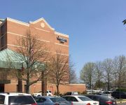
Hampton Inn Bowie
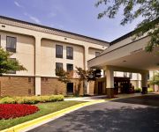
Comfort Inn Conference Center
TownePlace Suites Bowie Town Center
Videos from this area
These are videos related to the place based on their proximity to this place.
2826 Belair Drive, Bowie MD
WOW! JUST HIT THE MARKET APRIL 4 - WILL NOT LAST!!! Most sought after Cape Cod, across from ICONIC tree lined driveway! Well maintained & TASTEFUL! UPDATED KIT w/SS! HUGE addition in ...
2014 State of the City, Bowie MD
Mayor G. Frederick Robinson gives Bowie, MD's 2014 State of the City.
Bowie Fair Housing Roundtable
City of Bowie Fair Housing Roundtable April 8, 2015 City Manager's Office Office of Grant Development & Administration A Special Thanks to Panel Members Steven Paikin, Director U.S. Department...
Crofton Chiropractor Helping Neck Pain, Headaches, and Shoulder Pain.
http://www.DrLHands.com Precise Chiropractic & Rehabilitation (410) 370-0600 Are you suffering from neck pain or back pain? Did you know that the nerves in the shoulders, arms, hands, legs,...
Avoiding Chronic Pain & Computer Use - Chiropractors in Crofton, MD - Precise Chiropractic & Rehab
Avoiding Chronic Pain with Computer Use - Chiropractors in Crofton, MD - Precise Chiropractic & Rehabilitation Precise Chiropractic & Rehabilitation 2191 Defense Highway, Suite 308 Crofton,...
Chiropractor in Crofton, MD | Training Proper Movements | Precise Chiropractic & Rehabilitation
As a chiropractor in Crofton MD part of our services is Training Proper Movements. Training Proper Movements means training your body and mind to heal and strengthen to live a more full life,...
Chiropractic treatment Crofton, MD - Balance Board - Precise Chiropractic & Rehabilitation
Precise Chiropractic & Rehabilitation 2191 Defense Highway, Suite 308 Crofton, MD 21114 Phone: (410) 370-0600 http://drlhands.com.
Auto Accident Chiropractic Care in Bowie, MD - Precise Chiropractic & Rehabilitation
Precise Chiropractic & Rehabilitation 2191 Defense Hwy, Suite 308 Crofton, MD 21114 (410) 370-0600 www.DrLHands.com We help patient recover from injuries sustained in an auto accident. Our...
Sport Fit Bowie
A video short of some photos from Sport Fit Bowie, MD. One of the largest independent fitness centers in the country with Fitness, Swim, Tennis, Weights, Cardio, Basketball, Racquetball and...
Videos provided by Youtube are under the copyright of their owners.
Attractions and noteworthy things
Distances are based on the centre of the city/town and sightseeing location. This list contains brief abstracts about monuments, holiday activities, national parcs, museums, organisations and more from the area as well as interesting facts about the region itself. Where available, you'll find the corresponding homepage. Otherwise the related wikipedia article.
Odenton, Maryland
Odenton is a census-designated place (CDP) in Anne Arundel County, Maryland, United States. The population was 20,534 at the 2000 census. According to the 2010 Census the town's population has grown to 37,132. Its population grew by 80.8% and had the fastest population growth of any single town in western Anne Arundel County from 2000-2010. The town is named after former Governor of Maryland, Oden Bowie.
Bowie, Maryland
Bowie is a city in Prince George's County, Maryland, United States. The population was 54,727 at the 2010 census. Bowie has grown from a small railroad stop to the largest municipality in Prince George's County, and the fifth most populous city and third largest city by area in the state of Maryland.
Glenn Dale, Maryland
Glenn Dale is an unincorporated area and census-designated place (CDP) in Prince George's County, Maryland, United States. The population was 13,466 at the 2010 census. Glenn Dale is home to the Glenn Dale Hospital, an abandoned sanatorium, and the USDA Plant Introduction Station.
Woodmore, Maryland
Woodmore is an unincorporated area and census-designated place composed of a gated community and country club near Mitchellville, Maryland, one of the most affluent predominantly African-American communities in the United States. The population of Woodmore was 3,936 at the 2010 census. Centered around the country club, the community is planned to consist of 398 single-family homes on 799 acres .
Bowie State University
Bowie State University ("Bowie State"), is a public university located on 355½ acres (1.4 km²) in unincorporated Prince George's County, Maryland, United States, north of the suburban city of Bowie. Bowie State is part of the University System of Maryland. Bowie State is Maryland's oldest historically black university and one of the ten oldest in the country. Bowie State is a member-school of the Thurgood Marshall College Fund.
Prince George's Stadium
Prince George's Stadium is a multipurpose sports venue located in Bowie, Maryland primarily used for baseball. It is home of the Baltimore Orioles' AA affiliate in the Eastern League, the Bowie Baysox. The stadium is the result of a cooperative venture between Maryland Baseball Limited Partnership and the Maryland-National Capital Park and Planning Commission, and is built on park property.
Belair Stud
Belair Stud was an American thoroughbred horse racing stable and breeding farm founded by Provincial Governor of Maryland, Samuel Ogle in 1747 in Collington, Prince Georges County, Maryland in Colonial America.
Piney Orchard, Maryland
Piney Orchard, is a community within Odenton, Maryland. Piney Orchard was begun as a Planned Unit Development, and was a project of the Constellation Real Estate Group, Inc. , a wholly owned subsidiary of the Constellation Energy Group, which itself, is now owned by Exelon.
WLZL
WLZL is a radio station broadcasting a Spanish language format. Licensed to Annapolis, Maryland, USA, the station is currently owned by CBS Radio, and serves the Baltimore, Maryland/Washington, D.C. metropolitan area.
Patuxent Wildlife Research Center
The Patuxent Wildlife Research Center is a biological research center in Maryland. It is one of 17 research centers in the United States run by the U.S. Geological Survey (USGS). The center is located on the grounds of the 12,841-acre Patuxent Research Refuge, managed by the U.S. Fish and Wildlife Service. This is the only National Wildlife Refuge with the purpose of supporting wildlife research.
WNEW-FM
WNEW-FM (99.1 FM; "All-News 99.1") is a radio station broadcasting an all-news format. Licensed to the suburb of Bowie, Maryland, it serves the Baltimore, Maryland/Washington, D.C. metropolitan area. The station is currently owned by CBS Radio. Its transmitter is located near Crofton, Maryland.
Freeway Airport
Freeway Airport is a privately owned, public-use airport located two miles (3 km) northwest of the central business district of Mitchellville, in Prince Georges County, Maryland, United States.
Country Club at Woodmore
The Country Club at Woodmore is a private country club, golf course, and gated community in Mitchellville, an unincorporated and affluent predominantly African-American community in Prince George's County, Maryland, United States. The nearby gated community, Woodmore, is also unincorporated. Founded as the Beaver Dam Golf and Country Club in 1923, it was renamed the Prince Georges Golf and Country Club in 1941.
Bowie Race Track
The Bowie Race Track was a horse racing track located just outside the city limits of Bowie, Maryland. The one mile oval racetrack, known as Prince George's Park, was opened October 1, 1914 under the auspices of the Southern Maryland Agricultural Society. A major attraction in the area, easy access for racetrack patrons was available from the WB&A Railroad which ran trains every five minutes from the Liberty Street Station in Baltimore for which they charged 65¢ for a round-trip ticket.
Sacred Heart Church (Bowie, Maryland)
Sacred Heart Church in Bowie, Maryland is a Catholic Church established in 1729.
Bowie State (MARC station)
Bowie State is a passenger rail station on the MARC Penn Line between Washington, D.C. , Baltimore, MD and Perryville, MD. This station is also on the southern section of the Northeast Corridor however, Amtrak does not stop at this station. Bowie State Station was built in 1989 as a replacement for the original Bowie Station built by the Baltimore and Potomac Railroad Company, and acquired by the Pennsylvania Railroad.
Bowie Police Department (Maryland)
The Bowie City Police Department (BPD) is the primary law enforcement agency for Bowie, Maryland, servicing a population of 54,884 in 16 square miles of the municipality.
Bowie High School (Maryland)
Bowie High School is a public high school in Bowie, Maryland. It is part of Prince George's County Public Schools.
Bowie Town Center
Bowie Town Center is a shopping center in Bowie, Maryland.
Samuel Ogle Middle School
Samuel Ogle Middle School is a public middle school located in Bowie, Maryland in Prince George's County. It is part of the Prince George's County Public Schools system. Four elementary schools, Rockledge, Whitehall, High Bridge, and Yorktown, feed into it and graduates go on to Bowie High School. The current principal is Mark E. Covington and is considered to be one of the best schools in PG county.
Allen Pond Park
Allen Pond Park is an 85-acre multi-use park located in Bowie, Maryland and is part of the Prince Georges County Parks and Recreation Department. The park includes an Ice Arena, Amphitheater, boat rentals, Skate Park, 10-acre stocked pond, 6 lighted ballfields, picnic areas and pavilions, walking and biking trails, a lighted basketball court, fitness station and several playground areas.
Reid Temple A.M.E. Church
The Reid Temple A.M.E. Church is an African Methodist Episcopal megachurch located in Glenn Dale, Maryland, USA to the northeast of Washington, DC. In 2008, Outreach Magazine reported that attendance was 7,500, making it the 88th largest church in the USA. As of 2010 membership exceeded 8,000.
Fairwood, Maryland
Fairwood is an unincorporated area and census-designated place (CDP) in Prince George's County, Maryland, United States. The population was 5,031 at the 2010 census.
National Capitol Radio & Television Museum
The National Capitol Radio & Television Museum, located in Bowie, Maryland, displays the history of radio and TV from telegraph through the rise of television.
Governor's Bridge (Patuxent River)
Governor's Bridge is an historic single-lane bridge over the Patuxent River near Bowie, Maryland. A bridge has been located on this site since the mid-18th century although the current bridge is estimated to have been constructed circa 1907. The first bridge was constructed by Governor Samuel Ogle to travel between his mansion in Collington and the state capital in Annapolis. Although a common bridge type, Governor's Bridge is one of only two surviving truss bridges in Prince George's County.


