Safety Score: 2,7 of 5.0 based on data from 9 authorites. Meaning we advice caution when travelling to United States.
Travel warnings are updated daily. Source: Travel Warning United States. Last Update: 2024-08-13 08:21:03
Explore Norbeck
Norbeck in Montgomery County (Maryland) is located in United States about 15 mi (or 24 km) north of Washington DC, the country's capital.
Local time in Norbeck is now 04:00 PM (Monday). The local timezone is named America / New York with an UTC offset of -5 hours. We know of 8 airports in the wider vicinity of Norbeck, of which 4 are larger airports. The closest airport in United States is Ronald Reagan Washington National Airport in a distance of 18 mi (or 29 km), South. Besides the airports, there are other travel options available (check left side).
There is one Unesco world heritage site nearby. It's Monticello and the University of Virginia in Charlottesville in a distance of 78 mi (or 125 km), South. Also, if you like golfing, there are multiple options in driving distance. We found 9 points of interest in the vicinity of this place. If you need a place to sleep, we compiled a list of available hotels close to the map centre further down the page.
Depending on your travel schedule, you might want to pay a visit to some of the following locations: Rockville, Washington DC, Arlington, Falls Church and Alexandria. To further explore this place, just scroll down and browse the available info.
Local weather forecast
Todays Local Weather Conditions & Forecast: 11°C / 52 °F
| Morning Temperature | 3°C / 37 °F |
| Evening Temperature | 13°C / 56 °F |
| Night Temperature | 12°C / 54 °F |
| Chance of rainfall | 0% |
| Air Humidity | 51% |
| Air Pressure | 1019 hPa |
| Wind Speed | Gentle Breeze with 5 km/h (3 mph) from North |
| Cloud Conditions | Clear sky, covering 5% of sky |
| General Conditions | Sky is clear |
Monday, 25th of November 2024
13°C (56 °F)
6°C (43 °F)
Moderate rain, moderate breeze, scattered clouds.
Tuesday, 26th of November 2024
10°C (49 °F)
9°C (48 °F)
Broken clouds, light breeze.
Wednesday, 27th of November 2024
7°C (44 °F)
5°C (42 °F)
Moderate rain, gentle breeze, overcast clouds.
Hotels and Places to Stay
Hilton Washington DC-Rockville Hotel - Executive Meeting Ctr
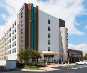
EVEN Hotels ROCKVILLE - WASHINGTON DC AREA
Canopy by Hilton Washington DC Bethesda North
Bethesda North Marriott Hotel & Conference Center
Cambria hotel & suites Rockville
LOCKHEED MARTIN C.L.E.
Videos from this area
These are videos related to the place based on their proximity to this place.
Jack at Olney Skateboard Park
Jack Lillis from upstate New York showed the boys in Olney a few moves.
Learn To Ollie!!!!¡!¡!
I Ollie over grass and made it. Learn to ollie it's the key to all tricks, but you got Ollie big to do flip-tricks, rails, and even tricks on the half-pipe. Learn to Ollie and you'll be a good...
Learn From Coach Andy
Ollie off curb , kickflip off curb, coach Andy , gig gig giyah Filmed at Olney Skatepark in Olney, MD (USA). (Submitted using the media mapping mobile app for skateboarding, Skate It All,...
Learn a this Trick!!¡!
Learn how to do a backward board side. It takes long to get it. Filmed at Olney Skatepark in Olney, MD (USA). (Submitted using the media mapping mobile app for skateboarding, Skate It All,...
Asphalt Work -- Aspen Hill, MD July 13 2012
Asphalt and repaving work and workers. Parkland Dr and Heathfield Rd in Aspen Hill, MD, July 13 2012.
Piloxing Demo 4
Guest instructor Jeanne Leider leads a Piloxing demo at the Aspen Hill Club in May 2012.
Piloxing Demo 2
Guest instructor Jeanne Leider leads a Piloxing demo at the Aspen Hill Club in May 2012.
Piloxing Demo 1
Guest instructor Jeanne Leider leads a Piloxing demo at the Aspen Hill Club in May 2012.
Topped Out
Me cutting whats left of the top of a tall Poplar tree. The rope was tied to our skidloader. The Poplar was located at Manor Country golf course.
Videos provided by Youtube are under the copyright of their owners.
Attractions and noteworthy things
Distances are based on the centre of the city/town and sightseeing location. This list contains brief abstracts about monuments, holiday activities, national parcs, museums, organisations and more from the area as well as interesting facts about the region itself. Where available, you'll find the corresponding homepage. Otherwise the related wikipedia article.
Aspen Hill, Maryland
Aspen Hill is a census-designated place and an unincorporated area in Montgomery County, Maryland. It got its name from aspen trees that once were found near the first post office in the area. The post office was located in a general store on what was then known as the Washington-Brookeville Pike and opened around 1864. Aspen Hill was one of the locations in which a fatal shooting took place in October 2002 as part of the Beltway sniper attacks.
Leisure World, Maryland
Leisure World is a census-designated place and unincorporated area in Montgomery County, Maryland, United States. It is an age-restricted development primarily inhabited by retirees. It was known as the Rossmoor census-designated place for the 2000 census, at which time it had a population of 7,569.
Lake Bernard Frank
Lake Bernard Frank (Lake Frank), is a 54-acre reservoir on the North Branch of Rock Creek in Derwood, Maryland, United States, just east of Rockville. It is named after Bernard Frank, a wilderness activist and a co-founder of The Wilderness Society. The lake's boundaries are, approximately, Route 28, East Gude Drive, Avery Road, and Muncaster Mill Road. Lake Frank was created in 1966 to aid in flood and sediment control, as well as to provide recreation.
Norbeck, Maryland
Norbeck is the area of Montgomery County, Maryland around Norbeck Road east of Georgia Avenue to Layhill Road. A museum in Sandy Spring, Maryland provides the information that Norbeck is the:Southwestern outpost of the greater Sandy Spring neighborhood [and and] put down roots as a free-black community shortly before the Civil War. With emancipation it grew, with the largest population concentrated in a community known as Mt. Pleasant between present Georgia Avenue and Muncaster Mill Road.
Parkland Middle School
Parkland Magnet Middle School is a middle school currently located in Rockville, Maryland that is part of the Montgomery County Public Schools system. It is part of the MCPS Middle School Magnet Consortium, consisting of Parkland Magnet Middle School for Aerospace Technology, A. Mario Loiederman Middle School for the Creative and Performing Arts, and Argyle Magnet Middle School for Digital Design and Development. The original school building was being rebuilt and has been completed.
Washington Christian Academy
Washington Christian Academy (WCA) is a private Christian school originally established in 1960 and presently located in Olney, Maryland at a new campus that was finished in 2008. The school is known for its reverent, adventurous, and academically serious education in the historic Reformed tradition, as well as its tightly-knit community that has been developing over the past 50-plus years of its existence. Washington Christian Academy is currently a member of Christian Schools International.
Matthew Henson State Park
Matthew Henson State Park is a greenway along the Turkey Branch of Rock Creek in Aspen Hill, Maryland. The park takes its name from arctic explorer Matthew Henson. A hiking/biking trail through the park was completed in 2009. The state park is managed by Montgomery County under an agreement with the Maryland Department of Natural Resources.
Maryland House of Delegates District 19
The 19th House of Delegates District is a district represented in the Maryland General Assembly. At present, the district consists of Montgomery County communities of Silver Spring, Wheaton, Leisure World, Northwood, Four Corners, Aspen Hill, Kemp Mill, Olney, Derwood, Laytonsville and unincorporated areas of Rockville and Gaithersburg.


