Safety Score: 2,7 of 5.0 based on data from 9 authorites. Meaning we advice caution when travelling to United States.
Travel warnings are updated daily. Source: Travel Warning United States. Last Update: 2024-08-13 08:21:03
Explore Morrell Park
Morrell Park in City of Baltimore (Maryland) is located in United States about 33 mi (or 52 km) north-east of Washington DC, the country's capital.
Local time in Morrell Park is now 08:09 AM (Friday). The local timezone is named America / New York with an UTC offset of -5 hours. We know of 8 airports in the wider vicinity of Morrell Park, of which 3 are larger airports. The closest airport in United States is Baltimore/Washington International Thurgood Marshal Airport in a distance of 6 mi (or 10 km), South. Besides the airports, there are other travel options available (check left side).
There is one Unesco world heritage site nearby. It's Monticello and the University of Virginia in Charlottesville in a distance of 96 mi (or 155 km), South-West. Also, if you like golfing, there are multiple options in driving distance. We found 10 points of interest in the vicinity of this place. If you need a place to sleep, we compiled a list of available hotels close to the map centre further down the page.
Depending on your travel schedule, you might want to pay a visit to some of the following locations: Baltimore, Ellicott City, Towson, Annapolis and Bel Air. To further explore this place, just scroll down and browse the available info.
Local weather forecast
Todays Local Weather Conditions & Forecast: 4°C / 40 °F
| Morning Temperature | 2°C / 36 °F |
| Evening Temperature | 3°C / 38 °F |
| Night Temperature | 3°C / 38 °F |
| Chance of rainfall | 2% |
| Air Humidity | 59% |
| Air Pressure | 999 hPa |
| Wind Speed | Moderate breeze with 10 km/h (6 mph) from East |
| Cloud Conditions | Broken clouds, covering 72% of sky |
| General Conditions | Rain and snow |
Friday, 22nd of November 2024
8°C (46 °F)
8°C (47 °F)
Sky is clear, moderate breeze, clear sky.
Saturday, 23rd of November 2024
10°C (50 °F)
8°C (46 °F)
Overcast clouds, moderate breeze.
Sunday, 24th of November 2024
10°C (50 °F)
11°C (53 °F)
Light rain, light breeze, overcast clouds.
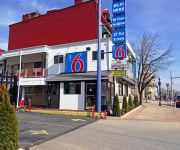
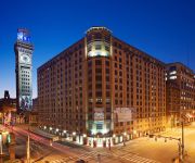
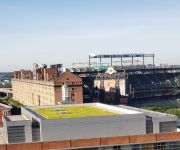
Hotels and Places to Stay
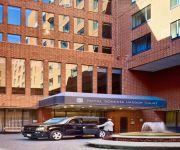
Royal Sonesta Harbor Court Baltimore
Hilton Baltimore
Royal Sonesta Harbor Court
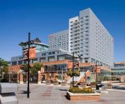
Sheraton Inner Harbor Hotel
Delta Hotels Baltimore Inner Harbor
Hyatt Regency Baltimore Inner Harbor
Baltimore Marriott Inner Harbor at Camden Yards
Bridgestreet at Camden Court
Holiday Inn BALTIMORE-INNER HARBOR (DWTN)
Hampton Inn Baltimore-Downtown-Convention Center
Videos from this area
These are videos related to the place based on their proximity to this place.
RBBX Circus Train In Mount Clare Yard Part 1
Ringling Brothers and Barnum & Bailey Circus Train parks in Baltimore City, MD.
One Journey. Many Paths.
Breast Cancer affects more than just the patient. It affects that patient's friends and family as well.
CSX EMD SD40-3 In Baltimore City
CSX Q438. an eastbound mixed freight train as seen from Gable Avenue, Baltimore City, maryland.
VEDA no.23- Port Of Baltimore,Baltimore City Landscape
On one of my friend`s taxi fares dropping off people for a Cruise ship adventure and filming the Baltimore city landscape of 2 stadiums together and the train systems here.
MARC GP40 Engine 69 Baltimore City MD
please rate, comment, and subscribe - ADVERTISE YOURSELF on my channel & my videos! -- I encourage spamming on my channel,...
A CSX Meet In West Baltimore
an eastbound intermodal meets a westbound mixed freight train in Baltimore City, Maryland.
Driving To The Ringling Brothers Circus Train
Ringling brothers and Barnum &Bailey circus train parked in mt clare yard in Baltimore city.
Videos provided by Youtube are under the copyright of their owners.
Attractions and noteworthy things
Distances are based on the centre of the city/town and sightseeing location. This list contains brief abstracts about monuments, holiday activities, national parcs, museums, organisations and more from the area as well as interesting facts about the region itself. Where available, you'll find the corresponding homepage. Otherwise the related wikipedia article.
WRBS-FM
WRBS-FM (95.1) is a radio station broadcasting contemporary Christian music. Licensed to Baltimore, Maryland, the station serves the Baltimore-Washington, D.C. metropolitan area. The station is owned by Peter & John Radio Fellowship, Inc.
Samuel J. Seymour
Samuel James Seymour (March 28, 1860 – April 12, 1956) was the last surviving person who had been present in Ford's Theater the night of the assassination of U.S. President Abraham Lincoln on April 14, 1865. He was from Maryland and lived in Arlington, Virginia in his later years. At age five, Seymour's godmother, Mrs. George S. Goldsboro, took him to see Our American Cousin. He claimed the two sat in the balcony on the side opposite Lincoln's box.
Morrell Park, Baltimore
Morrell Park is a neighborhood located in southwest Baltimore, Maryland, United States.
Mount Olivet Cemetery (Baltimore)
Mount Olivet Cemetery is an old cemetery in western Baltimore, Maryland, on Frederick Avenue. It is known as "The Resting Place of Methodist Bishops. " Methodist Episcopal Church Bishops Francis Asbury, John Emory, Enoch George, and Beverly Waugh are all buried here. Other Methodist leaders, including Jesse Lee, Robert Strawbridge, and Missionary E. Stanley Jones are, as well.
Seton Keough High School
Seton Keough High School is an all-girls college preparatory private, Roman Catholic high school in Baltimore, Maryland. It is located in the Roman Catholic Archdiocese of Baltimore, at 1201 Caton Avenue just inside the city line of Baltimore. It was founded in 1988 after the joining of the two schools, Archbishop Keough and Seton High School.
Cardinal Gibbons School
The Cardinal Gibbons School, also referred to as Cardinal Gibbons, CG and most commonly as Gibbons, was a Roman Catholic high school and middle school for boys in Baltimore, Maryland, USA A private institution for grades 6–12, Gibbons drew its enrollment from the neighborhoods of southwest Baltimore and the surrounding areas and counties, including as far as Carroll and Frederick counties.
Violetville, Baltimore
Violetville is a neighborhood in southwest Baltimore, Maryland and Baltimore County. The community is characterized by its "well-kept 1950s and 60s era rowhouses and older farmhouses that date back to the turn of the previous century. " In 1958, the community united to form a strong and feisty community association. Filbert Field (what is currently known as Violetville Park) was established and various recreational programs were created.
St. Agnes Hospital (Baltimore)
St. Agnes Hospital in Baltimore, Maryland is a full-service teaching hospital located at 900 S. Caton Avenue. It is licensed and accredited with a Gold Seal of Approval from the JCAHO, is designated as an American Society for Bariatric Surgery Bariatric Surgery Center of Excellence and is a Level IIIB Perinatal Referral Center for Maryland. St. Agnes Hospital is a member of Ascension Health, the largest non-profit health care organization in the nation.
Gwynns Falls
Gwynns Falls is a 24.9-mile-long stream located in Baltimore County and Baltimore City, Maryland. The headwaters are located in Reisterstown in Baltimore County, and the stream flows southeast, entering the city of Baltimore and emptying into the Middle Branch of the Patapsco River. The Patapsco drains into the Chesapeake Bay. The watershed area of Gwynns Falls is 66 square miles . The stream was named for Richard Gwinn, who opened a trading post along it in 1669.
Mount Winans, Baltimore
Mt. Winans is a mixed use residential, commercial and industrial neighborhood in southwest Baltimore, Maryland. Its north, south and east boundaries are marked by the CSX Railroad. Hollins Ferry Road draws its west boundary. The neighborhood was named after Ross Winans, an inventor of railway steam engines.
Lakeland, Baltimore
Lakeland is a neighborhood in south Baltimore, Maryland. Its borders are Annapolis Road on the east, the Baltimore city/county line to the south, a CSX/MARC Railroad line to the west, and the same railroad line to the north.
Gwynn's Falls, Baltimore
Gwynn's Falls is a neighborhood in the Southwestern District of Baltimore, located between Irvington (west) Gwynns Falls Leakin Park (east). Frederick Avenue marks the neighborhood's boundary to the north; Wilkens Avenue draws its southern edge. Caton Avenue separates it from Irvington to the west. Before 1977, the neighborhood was known as Carroll Station, for a station of the Pennsylvania Railroad formerly located here.


