Safety Score: 2,7 of 5.0 based on data from 9 authorites. Meaning we advice caution when travelling to United States.
Travel warnings are updated daily. Source: Travel Warning United States. Last Update: 2024-08-13 08:21:03
Delve into Westerlee
Westerlee in Baltimore County (Maryland) is a town located in United States about 31 mi (or 50 km) north-east of Washington DC, the country's capital town.
Time in Westerlee is now 11:21 AM (Tuesday). The local timezone is named America / New York with an UTC offset of -5 hours. We know of 8 airports closer to Westerlee, of which 3 are larger airports. The closest airport in United States is Baltimore/Washington International Thurgood Marshal Airport in a distance of 10 mi (or 15 km), South-East. Besides the airports, there are other travel options available (check left side).
There is one Unesco world heritage site nearby. It's Monticello and the University of Virginia in Charlottesville in a distance of 96 mi (or 154 km), South-West. Also, if you like the game of golf, there are some options within driving distance. We saw 10 points of interest near this location. In need of a room? We compiled a list of available hotels close to the map centre further down the page.
Since you are here already, you might want to pay a visit to some of the following locations: Ellicott City, Baltimore, Towson, Westminster and Annapolis. To further explore this place, just scroll down and browse the available info.
Local weather forecast
Todays Local Weather Conditions & Forecast: 17°C / 63 °F
| Morning Temperature | 12°C / 54 °F |
| Evening Temperature | 22°C / 71 °F |
| Night Temperature | 18°C / 64 °F |
| Chance of rainfall | 0% |
| Air Humidity | 73% |
| Air Pressure | 1024 hPa |
| Wind Speed | Gentle Breeze with 8 km/h (5 mph) from North-East |
| Cloud Conditions | Overcast clouds, covering 89% of sky |
| General Conditions | Overcast clouds |
Tuesday, 5th of November 2024
23°C (73 °F)
20°C (68 °F)
Scattered clouds, gentle breeze.
Wednesday, 6th of November 2024
24°C (74 °F)
17°C (63 °F)
Light rain, gentle breeze, broken clouds.
Thursday, 7th of November 2024
16°C (60 °F)
15°C (58 °F)
Overcast clouds, light breeze.
Hotels and Places to Stay
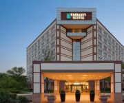
Embassy Suites by Hilton Baltimore at BWI Airport
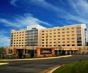
The Westin Baltimore Washington Airport - BWI
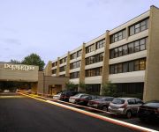
DoubleTree by Hilton Columbia
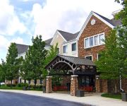
Sonesta ES Suites Columbia
Quality Inn Catonsville
BALTIMORE WEST
Hilton Garden Inn Columbia
Hampton Inn - Suites Baltimore-Woodlawn Maryland
Residence Inn Columbia
Holiday Inn Express & Suites COLUMBIA EAST - ELKRIDGE
Videos from this area
These are videos related to the place based on their proximity to this place.
Buying a Howard County & Catonsville home without HICCUPS.
Howard County & Catonsville Real Estate without Hiccups. Need a Howard County/Catonsville Realtor in Maryland? Call Ellie McIntire & the McIntire Team of Keller Williams Realty for a Hiccup-free...
Traffic Violation Lawyer in Columbia MD - DUI Attorney Columbia, Ellicott city and Catonsville MD
Do you have issue with speeding ticket, driving on a suspended license, or a DUI or DWI in Columbia MD? Please contact me today. More details about my columb...
Long Coal Train Near Union Dam
A long eastbound coal train heading down the old main line through the Patapsco Valley State Park, heading towards Ellicott City. Taken Saturday Dec. 28, 2013. Anyone know any companies looking...
Camping at Patapsco State Park
Me and the Family @ Patapsco State Park Camping in late June and what a great time we all had.you will see befor we go to the Park and while were @ the Park & a nice camp fire. I'm not that...
CSX 864 & 7764 Diesel Engines thru Ellicott City, Maryland. Camera 2
CSX 864 & 7764 hauling mixed freight thru Ellicott City, Maryland. Soft horn. Camera 2.
CSX Exiting Union Dam Tunnel
with some EMD's eastbound on the Old Main Line near Ellicott City, Maryland.
Videos provided by Youtube are under the copyright of their owners.
Attractions and noteworthy things
Distances are based on the centre of the city/town and sightseeing location. This list contains brief abstracts about monuments, holiday activities, national parcs, museums, organisations and more from the area as well as interesting facts about the region itself. Where available, you'll find the corresponding homepage. Otherwise the related wikipedia article.
Catonsville, Maryland
Catonsville is a census-designated place (CDP) in Baltimore County, Maryland, United States. The population was 41,567 at the 2010 census. The community lies to the west of Baltimore along the city's border. Catonsville is the home of the University of Maryland, Baltimore County (UMBC), a public research university with over 12,000 students.
Woodlawn, Baltimore County, Maryland
Woodlawn is an unincorporated community and census-designated place in Baltimore County, Maryland, United States. The population was 37,879 at the 2010 census. It is home to the headquarters of the Social Security Administration (SSA) and the Centers for Medicare and Medicaid Services (CMS).
WUTB
WUTB, digital channel 41, is the MyNetworkTV owned-and-operated television station for Baltimore, Maryland. Its transmitter is located near Gilson Park in Catonsville. The station has studios on Seton Drive in Baltimore near the city and county line. Syndicated programming on WUTB includes: The Big Bang Theory, Two and a Half Men, Everybody Loves Raymond, The Office, My Name Is Earl, Divorce Court, and Judge Alex.
WPOC
WPOC is a radio station in Baltimore, Maryland, broadcasting a country music format focusing on newer artists and signature songs of the 1990s. WPOC has been voted "Baltimore's Best Country Station" several times along with many other industry awards. The station is home to The Laurie DeYoung Morning Show. Laurie DeYoung was inducted into the Country Music DJ Hall of Fame in 2010. The call letters originally were said to stand for Pride Of the Chesapeake.
Woodlawn High School (Baltimore)
Woodlawn High School (WHS) is a four-year public high school in Baltimore County, Maryland, United States. A high school was built in Woodlawn in 1922, but housed only 9th through 12th grade. The first 4-year high school was built in 1941. In 1948, a new school was constructed, and in 1958, another new building was constructed. This building still stands today.
Security Square Mall
Security Square Mall is a large mall in the suburbs of Baltimore, Maryland, United States. The mall features over 100 stores and restaurants, as well as a food court, with Burlington Coat Factory, Macy's, Old Navy and Sears serving as anchor stores. One section of the mall, Seoul Plaza, previously included Korean shops and restaurants, however most of these establishments had closed by 2010. Modell's Sporting Goods at Security closed down in late 2008 and now is a USA Discounters store.
Trolley Line Number 9 Trail
The Historical Ellicott City/Baltimore Trolley Line #9 Trail is a 1.25-mile trail in western Baltimore County, Maryland. It begins at the west end of Edmonson Avenue and extends from Catonsville through Oella to Main Street, Ellicott City. The easy-to-walk, shade-covered trail follows what was originally part of a trolley line that shuttled passengers between Ellicott City and Baltimore from the late 1890s to the mid-1950s.
Mount Gilboa Chapel
Mt. Gilboa Chapel is a historic African Methodist Episcopal Church located at Oella, Baltimore County, Maryland. It is a small stone church measuring 28 feet by 42 feet, built about 1859 by free African Americans. The front façade is ashlar masonry, but the sides and rear are of rubble. It replaced an earlier log chapel, where neighbor Benjamin Banneker may have attended services. It was listed on the National Register of Historic Places in 1976.


