Safety Score: 2,7 of 5.0 based on data from 9 authorites. Meaning we advice caution when travelling to United States.
Travel warnings are updated daily. Source: Travel Warning United States. Last Update: 2024-08-13 08:21:03
Explore Hilton Place
Hilton Place in Baltimore County (Maryland) is a city in United States about 29 mi (or 47 km) north-east of Washington DC, the country's capital.
Local time in Hilton Place is now 02:06 PM (Monday). The local timezone is named America / New York with an UTC offset of -5 hours. We know of 8 airports in the vicinity of Hilton Place, of which 3 are larger airports. The closest airport in United States is Baltimore/Washington International Thurgood Marshal Airport in a distance of 4 mi (or 6 km), South-East. Besides the airports, there are other travel options available (check left side).
There is one Unesco world heritage site nearby. It's Monticello and the University of Virginia in Charlottesville in a distance of 93 mi (or 150 km), South-West. Also, if you like golfing, there are multiple options in driving distance. We found 10 points of interest in the vicinity of this place. If you need a place to sleep, we compiled a list of available hotels close to the map centre further down the page.
Depending on your travel schedule, you might want to pay a visit to some of the following locations: Ellicott City, Baltimore, Towson, Annapolis and Upper Marlboro. To further explore this place, just scroll down and browse the available info.
Local weather forecast
Todays Local Weather Conditions & Forecast: 11°C / 52 °F
| Morning Temperature | 3°C / 38 °F |
| Evening Temperature | 13°C / 55 °F |
| Night Temperature | 12°C / 53 °F |
| Chance of rainfall | 0% |
| Air Humidity | 50% |
| Air Pressure | 1019 hPa |
| Wind Speed | Light breeze with 5 km/h (3 mph) from North |
| Cloud Conditions | Few clouds, covering 10% of sky |
| General Conditions | Sky is clear |
Monday, 25th of November 2024
14°C (57 °F)
7°C (45 °F)
Light rain, moderate breeze, scattered clouds.
Tuesday, 26th of November 2024
10°C (50 °F)
9°C (47 °F)
Overcast clouds, light breeze.
Wednesday, 27th of November 2024
7°C (45 °F)
6°C (42 °F)
Moderate rain, gentle breeze, overcast clouds.
Hotels and Places to Stay
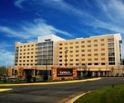
The Westin Baltimore Washington Airport - BWI
DoubleTree Baltimore - BWI Airport
Embassy Suites by Hilton Baltimore at BWI Airport
BWI Airport Marriott
Sheraton Baltimore Washington Airport Hotel - BWI
Candlewood Suites BALTIMORE-BWI AIRPORT
Residence Inn Baltimore BWI Airport
La Quinta Inn and Suites Baltimore BWI Airport
Fairfield Inn & Suites Baltimore BWI Airport
TownePlace Suites Baltimore BWI Airport
Videos from this area
These are videos related to the place based on their proximity to this place.
Loud CSX #999 In Baltimore City
eastbound trailer train travelling underneath Russell Street in Baltimore City, with some great Ray Lewis graffiti!
Loram Ballast Vacuum Cleaner in St Denis
unfortunately, not operating, but traveling through st. denis into baltimore city.
CSX Rock Runner Pulling Through St Denis
eastbound through St Denis station, heading into Baltimore City, MD.
Union Pacific & Canadian Pacific on CSX K059
westbound through Baltimore City, past M&T Bank stadium.
Coal Train Slowing For Avalon Restricting Signal
CSX coal train moving through Relay, approaching a restricting signal at East Avalon.
CSX Q217 Through Avalon With Lots of Graffiti
west on the Old Main Line through Patapsco Valley State Park.
Videos provided by Youtube are under the copyright of their owners.
Attractions and noteworthy things
Distances are based on the centre of the city/town and sightseeing location. This list contains brief abstracts about monuments, holiday activities, national parcs, museums, organisations and more from the area as well as interesting facts about the region itself. Where available, you'll find the corresponding homepage. Otherwise the related wikipedia article.
Arbutus, Maryland
Arbutus is an unincorporated community and a census-designated place in Baltimore County, Maryland, United States. The population was 20,483 at the 2010 census. The census area also contains the communities of Halethorpe and Relay, in which all three names were used during the 1960 census when the area had a population of 22,402. Residents of Arbutus are often called Arbutians.
Thomas Viaduct
The Thomas Viaduct spans the Patapsco River and Patapsco Valley between Relay and Elkridge, Maryland, USA. It is the first multi-span masonry railroad bridge in the United States to be built on a curve. Construction of the bridge commenced on July 4, 1833, and was completed on July 4, 1835. It was named for Philip E. Thomas, the first president of the Baltimore and Ohio Railroad (B&O), which the viaduct carried.
St. Denis, Maryland
St. Denis is a locality in Central Maryland in the United States, located in Arbutus, south of Baltimore. It is located on the CSX main line between Halethorpe and Relay (the latter being the site of the Thomas Viaduct), and is best known as a stop on the MARC commuter rail (on the Camden line). In former years a station building stood here similar to that in Germantown, but all that remains are the platforms.
Halethorpe (MARC station)
Halethorpe is a passenger rail station on the MARC Penn Line between Washington, D.C. , Baltimore and Perryville, Maryland, United States. This station is also on the southern section of the Northeast Corridor; however, Amtrak does not stop at this station. Halethorpe Station is located along Southwestern Boulevard beneath a bridge for Francis Avenue, which also contains a staircase leading between the station and the bridge.
St. Denis (MARC station)
St. Denis is a passenger rail station on the MARC Camden Line in the Maryland town of the same name. While the small station is the line's closest station to its terminus at Camden Yards in Baltimore, it has low ridership and is designated a flag stop: trains do not stop unless the engineer sees passengers who are waiting to be picked up, or the conductor is aware that there are passengers who want to be dropped off. St. Denis station contains two platforms and three tracks.
The Baseball Factory Field at UMBC
The Baseball Factory Field at UMBC is a baseball field located on the campus of the University of Maryland, Baltimore County in Catonsville, Maryland, United States. The field is home to the UMBC Retrievers baseball team of the NCAA Division I America East Conference. The field is located adjacent to UMBC Stadium. It has a capacity of 1,000 spectators.
Heavy Seas Beer
Heavy Seas Beer is brewed by Clipper City Brewing Company, in Baltimore, Maryland. The brewery was established by Hugh Sisson in 1995. Previously, Sisson operated Maryland's first brewpub, Sisson's. In 2010, the brewery rebranded. While the name of the brewery remains Clipper City, all of its beer falls under the Heavy Seas brand. Heavy Seas hosts free tours every Saturday at 11 a.m. , 12:30 p.m. , 2 p.m. , and 3:30 p.m.
Deep Run (Patapsco River)
Deep Run is a 11.9-mile-long tributary of the Patapsco River in central Maryland in the United States of America. The main stem arises in the vicinity of Ellicott City and the lower course forms part of the border between Howard and Anne Arundel Counties.


