Safety Score: 2,7 of 5.0 based on data from 9 authorites. Meaning we advice caution when travelling to United States.
Travel warnings are updated daily. Source: Travel Warning United States. Last Update: 2024-08-13 08:21:03
Discover Sweetser Heights
Sweetser Heights in Anne Arundel County (Maryland) is a place in United States about 31 mi (or 49 km) north-east of Washington DC, the country's capital city.
Current time in Sweetser Heights is now 08:57 PM (Tuesday). The local timezone is named America / New York with an UTC offset of -5 hours. We know of 8 airports near Sweetser Heights, of which 3 are larger airports. The closest airport in United States is Baltimore/Washington International Thurgood Marshal Airport in a distance of 4 mi (or 6 km), South. Besides the airports, there are other travel options available (check left side).
There is one Unesco world heritage site nearby. It's Monticello and the University of Virginia in Charlottesville in a distance of 94 mi (or 152 km), South-West. Also, if you like playing golf, there are a few options in driving distance. We encountered 10 points of interest in the vicinity of this place. If you need a hotel, we compiled a list of available hotels close to the map centre further down the page.
While being here, you might want to pay a visit to some of the following locations: Baltimore, Ellicott City, Towson, Annapolis and Upper Marlboro. To further explore this place, just scroll down and browse the available info.
Local weather forecast
Todays Local Weather Conditions & Forecast: 24°C / 75 °F
| Morning Temperature | 17°C / 63 °F |
| Evening Temperature | 23°C / 73 °F |
| Night Temperature | 20°C / 68 °F |
| Chance of rainfall | 0% |
| Air Humidity | 59% |
| Air Pressure | 1019 hPa |
| Wind Speed | Gentle Breeze with 8 km/h (5 mph) from North-East |
| Cloud Conditions | Few clouds, covering 15% of sky |
| General Conditions | Few clouds |
Wednesday, 6th of November 2024
19°C (67 °F)
18°C (65 °F)
Light rain, light breeze, overcast clouds.
Thursday, 7th of November 2024
16°C (61 °F)
17°C (62 °F)
Overcast clouds, gentle breeze.
Friday, 8th of November 2024
15°C (59 °F)
15°C (58 °F)
Light rain, gentle breeze, overcast clouds.
Hotels and Places to Stay
BWI Airport Marriott
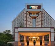
Embassy Suites by Hilton Baltimore at BWI Airport
Hilton Baltimore BWI Airport
Aloft BWI Baltimore Washington International Airport
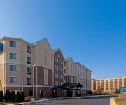
Staybridge Suites BALTIMORE BWI AIRPORT
Fairfield Inn & Suites Baltimore BWI Airport
La Quinta Inn and Suites Baltimore BWI Airport
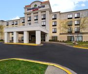
SpringHill Suites Baltimore BWI Airport
Candlewood Suites BALTIMORE-BWI AIRPORT
Courtyard Baltimore BWI Airport
Videos from this area
These are videos related to the place based on their proximity to this place.
'Nailed'- country version cover of 'Clavado En Un Bar' (Mana)
Cold Hard Truth plays a country cover of Fher's (Mana') rock classic Clavado En Un Bar Revised lyrics by 'Country' Bob Cutler (formerly of Toxic Substance)
Fresh Flowers Delivery in Baltimore Maryland/ 100% Guaranteed
House of Arnold Florist is a local family owned business located in baltimore maryland since 1971, with a reputation for quality and topnotch service unequaled in our industry. Ranked among...
Commuter Rail Traffic in Baltimore
MARC & Light Rail traffic past M&T Bank Stadium in Baltimore City.
Baltimore Highlands Spider
I was walking on a trail in Maryland. Located right outside of baltimore city. At Baltimore Highlands Park. When I spotted one of the largest spiders. I have ever seen in the area. Fourtuanetley...
CN / Illinois Central On CSX in Lansdowne
Ex- LMS GE C40-8W parked on CSX Q216 in Lansdowne, MD as an intermodal train heads west.
Videos provided by Youtube are under the copyright of their owners.
Attractions and noteworthy things
Distances are based on the centre of the city/town and sightseeing location. This list contains brief abstracts about monuments, holiday activities, national parcs, museums, organisations and more from the area as well as interesting facts about the region itself. Where available, you'll find the corresponding homepage. Otherwise the related wikipedia article.
Pumphrey, Maryland
Pumphrey was a census-designated place (CDP) in Anne Arundel County, Maryland, United States, for the 2000 census, at which time the population was 5,317. It was split between the Linthicum and Brooklyn Park CDPs for the 2010 census.
Lansdowne-Baltimore Highlands, Maryland
Lansdowne-Baltimore Highlands was a census-designated place (CDP) in Baltimore County, Maryland, United States. The population was 15,724 at the 2000 census. At the 2010 census the area was split into two separate CDPs, the unincorporated communities of Lansdowne and Baltimore Highlands.
Lansdowne, Maryland
Lansdowne is a census-designated place in southern Baltimore County, Maryland, just south of Baltimore city. As of the 2010 census, it had a population of 8,409. At the 2000 census and earlier, the area was delineated as part of the Lansdowne-Baltimore Highlands CDP.
Baltimore Highlands, Maryland
Baltimore Highlands is a census-designated place (CDP) in Baltimore County, Maryland, United States, directly south of the city of Baltimore. The population was 7,019 at the 2010 census. At the 2000 census and earlier, the area was delineated as part of the Lansdowne-Baltimore Highlands CDP.
Lansdowne High School
Lansdowne High School (LHS), formerly known as Lansdowne Sr. High School, and currently known as the Lansdowne High School Academy for Advanced Professional Studies, is a four-year public high school in Baltimore County, Maryland, United States.
Nursery Road (Baltimore Light Rail station)
Nursery Road is a stop on the Baltimore Light Rail system, located in Pumphrey, Maryland. There are 37 free parking spaces and connections can be made to MTA Maryland's Route 17 bus from here. Though officially located at 6825 Baltimore-Annapolis Boulevard the actual location of the Nursery Road stop is at the corner of Nursery Road and South Old Annapolis Road. Nursery Road is designated Maryland Route 168 west of Baltimore & Annapolis Boulevard, and a local street east of Route 648.
North Linthicum (Baltimore Light Rail station)
North Linthicum is a stop on the Baltimore Light Rail system. There are currently 347 free parking spaces at this station. No bus connections can be made from here.
Heavy Seas Beer
Heavy Seas Beer is brewed by Clipper City Brewing Company, in Baltimore, Maryland. The brewery was established by Hugh Sisson in 1995. Previously, Sisson operated Maryland's first brewpub, Sisson's. In 2010, the brewery rebranded. While the name of the brewery remains Clipper City, all of its beer falls under the Heavy Seas brand. Heavy Seas hosts free tours every Saturday at 11 a.m. , 12:30 p.m. , 2 p.m. , and 3:30 p.m.


