Safety Score: 2,7 of 5.0 based on data from 9 authorites. Meaning we advice caution when travelling to United States.
Travel warnings are updated daily. Source: Travel Warning United States. Last Update: 2024-08-13 08:21:03
Touring South River
South River in Anne Arundel County (Maryland) is a town located in United States about 26 mi (or 41 km) east of Washington DC, the country's capital place.
Time in South River is now 04:23 AM (Friday). The local timezone is named America / New York with an UTC offset of -5 hours. We know of 8 airports nearby South River, of which 3 are larger airports. The closest airport in United States is Baltimore/Washington International Thurgood Marshal Airport in a distance of 20 mi (or 32 km), North. Besides the airports, there are other travel options available (check left side).
There are two Unesco world heritage sites nearby. The closest heritage site in United States is Monticello and the University of Virginia in Charlottesville in a distance of 79 mi (or 126 km), South-West. Also, if you like the game of golf, there are several options within driving distance. We collected 10 points of interest near this location. Need some hints on where to stay? We compiled a list of available hotels close to the map centre further down the page.
Being here already, you might want to pay a visit to some of the following locations: Annapolis, Upper Marlboro, Prince Frederick, Baltimore and Ellicott City. To further explore this place, just scroll down and browse the available info.
Local weather forecast
Todays Local Weather Conditions & Forecast: 6°C / 42 °F
| Morning Temperature | 2°C / 35 °F |
| Evening Temperature | 3°C / 38 °F |
| Night Temperature | 4°C / 39 °F |
| Chance of rainfall | 6% |
| Air Humidity | 50% |
| Air Pressure | 1000 hPa |
| Wind Speed | Moderate breeze with 11 km/h (7 mph) from South-East |
| Cloud Conditions | Scattered clouds, covering 38% of sky |
| General Conditions | Rain and snow |
Friday, 22nd of November 2024
9°C (47 °F)
8°C (47 °F)
Sky is clear, moderate breeze, clear sky.
Saturday, 23rd of November 2024
10°C (50 °F)
6°C (43 °F)
Overcast clouds, moderate breeze.
Sunday, 24th of November 2024
10°C (50 °F)
11°C (53 °F)
Light rain, light breeze, broken clouds.
Hotels and Places to Stay
Annapolis Waterfront Hotel Autograph Collection
The Westin Annapolis
DoubleTree by Hilton Hotel Annapolis
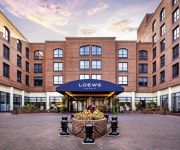
Loews Annapolis Hotel
Crowne Plaza ANNAPOLIS
Historic Inns of Annapolis
O'Callaghan Annapolis Hotel
MD Annapolis Country Inn and Suites by Radisson
SpringHill Suites Annapolis
Residence Inn Annapolis
Videos from this area
These are videos related to the place based on their proximity to this place.
Fluffy dog swimming at SPCA Puppy Plunge, Clancy the Keeshond
Lots of wet doggie fun! Thank you to everyone who donated to support Clancy's plunge into the Rhode River (just off of the Chesapeake Bay) to raise money for the Anne Arundel County, MD SPCA....
Setting the Crabbing Trotline
Showing how to set a trotline for crabbing in the South River off the Chesapeake Bay.
Patio Enclosures, Screened Porches, Decks- Edgewater, Riva, Severna Park Md
Fence & Deck Connection Inc.- Custom Screened Porch & Patio Enclosure (Installation Contractor), Deck Builder: Severna Park, Edgewater, Riva Md. http://www.fenceanddeckconnection.com ...
Intermodal Traffic Through Baltimore City
LIKE➍LIKE☆JUST ASK☆ SUB➍SUB ☆☸ڿڰۣ.•*¨*ღ☆ツI APPROVE ALL COMMENTS!! -☸ڿڰۣ.•*¨*ღ ☆Post your Vid links here !!☆SPAM MY 4000 VIDS FOR MORE...
Fast CSX Train Thru Washington Grove
Baltimore City. ツ☆ S U B ➃ S U B ☆ Promote Yourself Here!! ☆ツ☆ADVERTISE HERE . ツ☆ SPAM MY PAGE FOR...
DFU + Retul Fitting Session with Hunter Allen and Scott Moninger
Parvilla Cycles continues to fit the finest cyclists and professional riders in the country. Stu Waring fits Peaks Coaching Group's, Hunter Allen and Scott Moninger using both Guru's Dynamic...
Blizzard in Edgewater MD December 2009
About a foot of snow had fallen at this point, with another 6" expected.
Videos provided by Youtube are under the copyright of their owners.
Attractions and noteworthy things
Distances are based on the centre of the city/town and sightseeing location. This list contains brief abstracts about monuments, holiday activities, national parcs, museums, organisations and more from the area as well as interesting facts about the region itself. Where available, you'll find the corresponding homepage. Otherwise the related wikipedia article.
Londontowne, Maryland
Londontowne is an unincorporated area and former census-designated place (CDP) in Anne Arundel County, Maryland, United States. The population was 7,595 at the 2000 census. At the 2010 census, the area was delineated as the Edgewater CDP.
Selby-on-the-Bay, Maryland
Selby-on-the-Bay was a census-designated place (CDP) in Anne Arundel County, Maryland, United States, for the 2000 census, at which time its population was 3,674. It was added to the Mayo CDP for the 2010 census.
Smithsonian Environmental Research Center
The Smithsonian Environmental Research Center (SERC) is a United States 2,800-acre environmental research and educational facility operated by the Smithsonian Institution. It is located on the Rhode and West Rivers near Edgewater in Anne Arundel County, Maryland, near the western shore of Chesapeake Bay. The center's focus of study is the ecosystems of coastal zones, particularly in the Chesapeake Bay estuary and nearby wetlands.
South River High School (Maryland)
South River High School is a public high school in Edgewater, Maryland. It was built in 1978 and has 2060 students currently enrolled. It received a Blue Ribbon in education. Due to recent overcrowding in the Crofton area, students are bused in from Crofton, in addition to Davidsonville, Mayo, and Edgewater. The class of 2009 graduated with over $8.5 million in scholarships, and 5 senior students received Scholarships for Scholars from the Anne Arundel County Government.
Birds Mill Swamp
Birds Mill Swamp is a swamp located just west of the Chesapeake Bay in Anne Arundel County on the Atlantic Coastal Plain region of Maryland in the United States. It lies between Route 468 (also known as Muddy Creek Road) and Route 2 and is just south of Mill Swamp Road. Its coordinates are {{#invoke:Coordinates|coord}}{{#coordinates:38.88167|-76.57444|type:waterbody_region:US|||||| |primary |name= }}.
Lee Airport
Lee Airport is a public use airport located in Anne Arundel County, Maryland, United States. The airport is five nautical miles southwest of the central business district of Annapolis. It is privately owned by the Lee Airport Authority in Edgewater, Maryland.
Camp Letts
YMCA Camp Letts is a 2,600-acre, co-educational summer residence camp and conference center located on the Rhode River, south of Annapolis, Maryland. , that is run by the YMCA of Metropolitan Washington. The camp was founded in 1906.
William Brown House (London Town, Maryland)
William Brown House in Edgewater, Maryland is a historic house built by William Brown between 1758 and 1764. It is one of two buildings that survive from colonial London Town. 32px 30px This article about a building or structure in Maryland is a stub. You can help Wikipedia by expanding it. vte


