Safety Score: 2,7 of 5.0 based on data from 9 authorites. Meaning we advice caution when travelling to United States.
Travel warnings are updated daily. Source: Travel Warning United States. Last Update: 2024-08-13 08:21:03
Delve into Woodland
Woodland in Allegany County (Maryland) with it's 113 habitants is a town located in United States about 114 mi (or 183 km) north-west of Washington DC, the country's capital town.
Time in Woodland is now 02:31 PM (Saturday). The local timezone is named America / New York with an UTC offset of -4 hours. We know of 13 airports closer to Woodland, of which 5 are larger airports. The closest airport in United States is John Murtha Johnstown Cambria County Airport in a distance of 49 mi (or 79 km), North. Besides the airports, there are other travel options available (check left side).
There is one Unesco world heritage site nearby. It's Monticello and the University of Virginia in Charlottesville in a distance of 134 mi (or 216 km), South-East. Also, if you like the game of golf, there are some options within driving distance. In need of a room? We compiled a list of available hotels close to the map centre further down the page.
Since you are here already, you might want to pay a visit to some of the following locations: Keyser, Cumberland, Romney, Somerset and Oakland. To further explore this place, just scroll down and browse the available info.
Local weather forecast
Todays Local Weather Conditions & Forecast: 11°C / 52 °F
| Morning Temperature | 2°C / 36 °F |
| Evening Temperature | 9°C / 47 °F |
| Night Temperature | 4°C / 38 °F |
| Chance of rainfall | 0% |
| Air Humidity | 48% |
| Air Pressure | 1029 hPa |
| Wind Speed | Light breeze with 5 km/h (3 mph) from South-East |
| Cloud Conditions | Broken clouds, covering 69% of sky |
| General Conditions | Broken clouds |
Saturday, 2nd of November 2024
10°C (49 °F)
4°C (39 °F)
Overcast clouds, gentle breeze.
Sunday, 3rd of November 2024
10°C (50 °F)
7°C (44 °F)
Overcast clouds, light breeze.
Monday, 4th of November 2024
17°C (62 °F)
12°C (54 °F)
Broken clouds, light breeze.
Hotels and Places to Stay
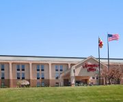
Hampton Inn Frostburg
Allegheny Trail House
Gunter Hotel
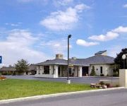
DAYS INN & SUITES FROSTBURG
Videos from this area
These are videos related to the place based on their proximity to this place.
Klotz Throwing Company, 2011-2012.m4v
Shot at the last surviving silk mill from the mid 20th century, these are a series of still images made June 2011 - June 2012.
Justin Shields - Frostburg State University's Mr. ASA 2012
Justin Shields Frostburg State University's wins Mr. ASA 2012!
Frostburg game tying field goal vs. Alfred University
After Alfred made it 40-37 with thirty seconds to go in the fourth quarter, Frostburg drove 45 yards (after starting at its own 30) to the Alfred 25. After a timeout by Frostburg with six seconds...
WMSR 734 on the Frostburg Turntable
Western Maryland 734 Turning around on the Frostburg Turntable, for the trip back to Cumberland...
A Mix of Breeds Have Fun Playing Together At The Frostburg Dog Park
Caleb, the Yellow Labrador, and Fern, the Irish Water Spaniel stay busy retrieving their toy while Schatzi, the American Eskimo and Jerome, the Yorkshire Terrier, join in the fun at the Frostburg...
Focus Frostburg- Recycling on Campus
We need to do a presentation at this years Focus Frostburg. Me and my team decided to do a video instead of a poster. We wanted to get a look at what the students on campus thought about the...
Western Maryland Scenic Railroad at Frostburg MD
Arrival of the STEAM engine passenger train in Frostburg, MD.
Salisbury University's game winner against Frostburg State.
Down 70-69 to their arch rivals, Salisbury goes the length of the court in six seconds. All within 1-1.5 seconds, Travon Vann puts a shot up, misses, gets his own rebound and then puts in the...
Videos provided by Youtube are under the copyright of their owners.
Attractions and noteworthy things
Distances are based on the centre of the city/town and sightseeing location. This list contains brief abstracts about monuments, holiday activities, national parcs, museums, organisations and more from the area as well as interesting facts about the region itself. Where available, you'll find the corresponding homepage. Otherwise the related wikipedia article.
Midland, Maryland
Midland is a town in Allegany County, Maryland, United States, located along the Georges Creek Valley. It is part of the Cumberland, MD-WV Metropolitan Statistical Area. The population was 446 at the 2010 census. The town of Midland is 1,600 feet above sea level, is located 5 miles south of Frostburg, Maryland and 3 miles north of Lonaconing, Maryland.
Georges Creek
Georges Creek is a 17.6-mile-long tributary stream of the North Branch Potomac River in western Maryland. The creek has its headwaters near Frostburg and empties into the North Branch Potomac River at Westernport, all in western Allegany County. Along the Georges Creek Valley, there exists a series of small towns founded in the nineteenth century for miners' homes. The Georges Creek Valley is rich in wide veins of coal, once extracted by deep mines but still mined today through surface mining.
Georges Creek Valley
Georges Creek Valley is located in Allegany County, Maryland along the George's Creek. The valley is rich in wide veins of coal, known historically as the "The Big Vein. " Coal was once extracted by deep mines but is only mined today through surface mining. The Georges Creek Valley was once a major center for the US coal industry.
God's Ark of Safety
God's Ark of Safety is a non-denominational Christian ministry in Frostburg, Maryland, led by Pastor Richard Greene. On Easter, 1976, Greene began building a replica of Noah's Ark atop a prominent hillside along Interstate 68 featuring a sign that announces to passing travelers: "Noah's Ark Being Rebuilt Here!" Ground was broken for the ark in September 1976 with over 3,000 tons of concrete.
The Big Vein
The Big Vein refers to a 14-foot thick seam of bituminous coal discovered in the Georges Creek Valley of Western Maryland in the early 19th century. This coal vein became famous for its clean-burning low sulfur content that made it ideal for powering ocean steamers, river boats, locomotives, steam mills, and machines shops. By 1850, almost 30 coal companies were mining the valley, producing over 60 million tons of coal between 1854 to 1891.
Frostburg State University
Frostburg State University (FSU) is a four-year university located on a 260-acre campus in Frostburg, Maryland, in Western Maryland, and is part of the University System of Maryland. FSU is accredited by the Middle States Association of Colleges and Schools.
Dan's Mountain Wildlife Management Area
Dan's Mountain Wildlife Management Area is a Wildlife Management Area in Allegany County, Maryland.
Grahamtown, Maryland
Grahamtown is a small ghost town in Allegany County, Maryland, located at the southeast edge of Frostburg, Maryland. The town takes its name from Curtin Graham, who owned a farmhouse at this site, surrounded by several small service buildings in the 1880s. A fire gutted the farmhouse in 1995, leaving only an uninhabited shell. Grahamtown is also known as Wright's Crossing, marking the point where Maryland Route 36 crosses Welsh Hill.


