Safety Score: 2,7 of 5.0 based on data from 9 authorites. Meaning we advice caution when travelling to United States.
Travel warnings are updated daily. Source: Travel Warning United States. Last Update: 2024-08-13 08:21:03
Delve into Charlestown
Charlestown in Allegany County (Maryland) is located in United States about 113 mi (or 182 km) north-west of Washington DC, the country's capital town.
Current time in Charlestown is now 09:23 AM (Friday). The local timezone is named America / New York with an UTC offset of -5 hours. We know of 13 airports close to Charlestown, of which 5 are larger airports. The closest airport in United States is Morgantown Municipal Walter L. Bill Hart Field in a distance of 50 mi (or 81 km), West. Besides the airports, there are other travel options available (check left side).
There is one Unesco world heritage site nearby. It's Monticello and the University of Virginia in Charlottesville in a distance of 132 mi (or 212 km), South-East. Also, if you like playing golf, there are some options within driving distance. If you need a hotel, we compiled a list of available hotels close to the map centre further down the page.
While being here, you might want to pay a visit to some of the following locations: Keyser, Cumberland, Romney, Oakland and Somerset. To further explore this place, just scroll down and browse the available info.
Local weather forecast
Todays Local Weather Conditions & Forecast: -1°C / 31 °F
| Morning Temperature | -4°C / 25 °F |
| Evening Temperature | 1°C / 33 °F |
| Night Temperature | 0°C / 33 °F |
| Chance of rainfall | 8% |
| Air Humidity | 85% |
| Air Pressure | 998 hPa |
| Wind Speed | Strong breeze with 19 km/h (12 mph) from East |
| Cloud Conditions | Overcast clouds, covering 100% of sky |
| General Conditions | Snow |
Friday, 22nd of November 2024
3°C (37 °F)
3°C (38 °F)
Rain and snow, fresh breeze, overcast clouds.
Saturday, 23rd of November 2024
4°C (39 °F)
2°C (35 °F)
Overcast clouds, moderate breeze.
Sunday, 24th of November 2024
8°C (46 °F)
9°C (48 °F)
Moderate rain, light breeze, overcast clouds.
Hotels and Places to Stay
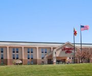
Hampton Inn Frostburg
Videos from this area
These are videos related to the place based on their proximity to this place.
Klotz Throwing Company, 2011-2012.m4v
Shot at the last surviving silk mill from the mid 20th century, these are a series of still images made June 2011 - June 2012.
Scenes from the Tri-Towns (Luke, Piedmont, Westernport) 1940s - 1960s
Excerpts from the Biggs family home movies taken between the 1940s and 1960s.
SavageMan Triathlon Westernport Wall
Handlebar view of a successful summit of the SavageMan Triathlon Westernport Wall.
Savageman 2010 Westernport Wall
Bjorn Anderson and Phil Graves are the first 2 triathletes to reach the wall. Phil will eventually go on to win the race, but "hats off" to Bjorn who defended his 2-time title only 1 week...
Furniture Outlet Store Westernport | Roderick Furniture Outlet
http://rodericksfurnitureoutletstore.com/ Roderick Furniture Outlet, your headquarters for quality, service, selection, and value in home furnishings. A LONG LIST of manufacturers means great...
Savageman 70 2010
Triathletes taking on the Westernport Wall @ the the Savageman 70 2010 on September 19, 2010.
97 west hampshire street house fire
videos and pics of units responding to 97 e hampshire street in piedmont wv. some units are eng tanker 22 eng 221 ladder 24 eng 24-11 squad 22 tanker 36 ems 50 eng tanker 19 eng rescue 19 squad.
Videos provided by Youtube are under the copyright of their owners.
Attractions and noteworthy things
Distances are based on the centre of the city/town and sightseeing location. This list contains brief abstracts about monuments, holiday activities, national parcs, museums, organisations and more from the area as well as interesting facts about the region itself. Where available, you'll find the corresponding homepage. Otherwise the related wikipedia article.
Lonaconing, Maryland
Lonaconing is a town in Allegany County, Maryland, United States located along the Georges Creek Valley. It is part of the Cumberland, MD-WV Metropolitan Statistical Area. The population was 1,214 at the 2010 census.
Midland, Maryland
Midland is a town in Allegany County, Maryland, United States, located along the Georges Creek Valley. It is part of the Cumberland, MD-WV Metropolitan Statistical Area. The population was 446 at the 2010 census. The town of Midland is 1,600 feet above sea level, is located 5 miles south of Frostburg, Maryland and 3 miles north of Lonaconing, Maryland.
Georges Creek Valley
Georges Creek Valley is located in Allegany County, Maryland along the George's Creek. The valley is rich in wide veins of coal, known historically as the "The Big Vein. " Coal was once extracted by deep mines but is only mined today through surface mining. The Georges Creek Valley was once a major center for the US coal industry.
The Big Vein
The Big Vein refers to a 14-foot thick seam of bituminous coal discovered in the Georges Creek Valley of Western Maryland in the early 19th century. This coal vein became famous for its clean-burning low sulfur content that made it ideal for powering ocean steamers, river boats, locomotives, steam mills, and machines shops. By 1850, almost 30 coal companies were mining the valley, producing over 60 million tons of coal between 1854 to 1891.
Laurel Run (Georges Creek)
Laurel Run is a 4.5-mile-long tributary stream of Georges Creek in Allegany County, Maryland. The creek rises about 3 miles northwest of Lonaconing and empties into Georges Creek north of Barton. Laurel Run Road crosses Laurel Run on a steel girder bridge with open grating, constructed in 1955 and rebuilt in 2002.


