Safety Score: 2,7 of 5.0 based on data from 9 authorites. Meaning we advice caution when travelling to United States.
Travel warnings are updated daily. Source: Travel Warning United States. Last Update: 2024-08-13 08:21:03
Delve into South Harpswell
South Harpswell in Cumberland County (Maine) is a town located in United States about 495 mi (or 796 km) north-east of Washington DC, the country's capital town.
Time in South Harpswell is now 05:13 AM (Sunday). The local timezone is named America / New York with an UTC offset of -5 hours. We know of 8 airports closer to South Harpswell, of which 4 are larger airports. The closest airport in United States is Portland International Jetport Airport in a distance of 16 mi (or 26 km), South-West. Besides the airports, there are other travel options available (check left side).
Also, if you like the game of golf, there are some options within driving distance. We saw 10 points of interest near this location. In need of a room? We compiled a list of available hotels close to the map centre further down the page.
Since you are here already, you might want to pay a visit to some of the following locations: Portland, Bath, Auburn, Wiscasset and Augusta. To further explore this place, just scroll down and browse the available info.
Local weather forecast
Todays Local Weather Conditions & Forecast: 7°C / 44 °F
| Morning Temperature | 5°C / 41 °F |
| Evening Temperature | 4°C / 40 °F |
| Night Temperature | 3°C / 37 °F |
| Chance of rainfall | 1% |
| Air Humidity | 62% |
| Air Pressure | 999 hPa |
| Wind Speed | Fresh Breeze with 13 km/h (8 mph) from South-East |
| Cloud Conditions | Overcast clouds, covering 100% of sky |
| General Conditions | Light rain |
Sunday, 24th of November 2024
6°C (43 °F)
2°C (35 °F)
Sky is clear, moderate breeze, clear sky.
Monday, 25th of November 2024
7°C (44 °F)
4°C (39 °F)
Moderate rain, moderate breeze, overcast clouds.
Tuesday, 26th of November 2024
5°C (40 °F)
3°C (38 °F)
Light rain, moderate breeze, broken clouds.
Hotels and Places to Stay
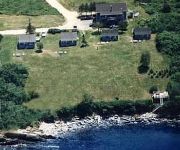
Sea Escape Cottages
Videos from this area
These are videos related to the place based on their proximity to this place.
State Park Series #3 Wolfe's Neck Woods State Park
3 Wolfe's Neck Woods State Park - Freeport, ME This week we travel just north of Portland to the land of L.L. Bean and shopping outlets, Freeport, Maine. Wolfe's Neck Woods State Park, located...
Paul Drinan - Monster In The Woods trailer
Paul Drinan as Jack Killington in a trailer from the indie film "Monster In The Woods" directed by Andy King.
Giant's Stairs on Bailey Island, Maine
Created by www.CreativeMarketingAndLearning.com, this video is part of the "When in Maine, See This" series. These short videos feature free or inexpensive things to do and see in the great...
Lobster trap
Using an ROV (robotic unmanned sub), we took video of animals off of Bailey Island, Maine. In this video, we come upon a lobster trap. The video was taken using Captain James Jone's ROV...
Lobster bait bag
Using an ROV (robotic unmanned sub), we took video of animals off of Bailey Island, Maine. In this video, we come upon a lobster eating from a bait bag. The video was taken using Captain...
on way to Ragged Island, Harpswell, ME
getting near Ragged Island, which is one of the many islands that is part of Harpswell, ME. It was a bit of a rough ride. Looking back to Bailey's Island and Orr's Island, you can see a rain...
Lobster ledge
Using an ROV (robotic unmanned sub), we took video of animals off of Bailey Island, Maine. In this video, we come upon a lobster's den. Notice how the lobster has excavated under the ledge...
Tube anemone
Using an ROV (robotic unmanned sub), we took video of animals off of Bailey Island, Maine. In this video, we come upon a tube anemone. This animal can withdraw below the sand to protect itself...
Wreck
Using an ROV (robotic unmanned sub), we took video of animals off of Bailey Island, Maine. In this video, we come upon a wrecked lobster boat covered with anemones and sponges. The video...
OBYC Time Lapse
Recorded from sunup to sundown on July 4th 2010 from the Orrs Bailey Yacht Club on Orrs Island Maine. One picture was taken every 15 seconds through the entire day. More info about OBYC is...
Videos provided by Youtube are under the copyright of their owners.
Attractions and noteworthy things
Distances are based on the centre of the city/town and sightseeing location. This list contains brief abstracts about monuments, holiday activities, national parcs, museums, organisations and more from the area as well as interesting facts about the region itself. Where available, you'll find the corresponding homepage. Otherwise the related wikipedia article.
Bailey Island (Maine)
Bailey Island is an island in Casco Bay, and a part of the town of Harpswell, in Cumberland County, Maine, in the United States. As of the 2000 census, the island had a year-round population of 400.
Orr's Island (Maine)
Orr's Island is an island in Casco Bay and the Gulf of Maine, part of the Atlantic Ocean. The island is within the town of Harpswell, Maine, U. S. , and forms an archipelago with Sebascodegan Island (also known as Great Island) to its north and Bailey Island (reached by the Bailey Island Bridge) to its south. Orr's Island is connected to Great Island by the Orr's Island/Great Island Bridge, and is connected to the town of Brunswick on the mainland by Route 24 north over the Gurnett Bridge.


