Safety Score: 2,7 of 5.0 based on data from 9 authorites. Meaning we advice caution when travelling to United States.
Travel warnings are updated daily. Source: Travel Warning United States. Last Update: 2024-08-13 08:21:03
Delve into Ferncrest
The district Ferncrest of Little Woods in Orleans Parish (Louisiana) is a subburb in United States about 955 mi south-west of Washington DC, the country's capital town.
If you need a hotel, we compiled a list of available hotels close to the map centre further down the page.
While being here, you might want to pay a visit to some of the following locations: Chalmette, New Orleans, Gretna, Davis (historical) and Covington. To further explore this place, just scroll down and browse the available info.
Local weather forecast
Todays Local Weather Conditions & Forecast: 21°C / 70 °F
| Morning Temperature | 20°C / 67 °F |
| Evening Temperature | 19°C / 67 °F |
| Night Temperature | 19°C / 67 °F |
| Chance of rainfall | 0% |
| Air Humidity | 78% |
| Air Pressure | 1021 hPa |
| Wind Speed | Light breeze with 5 km/h (3 mph) from South |
| Cloud Conditions | Overcast clouds, covering 97% of sky |
| General Conditions | Light rain |
Wednesday, 27th of November 2024
25°C (77 °F)
21°C (70 °F)
Light rain, moderate breeze, clear sky.
Thursday, 28th of November 2024
25°C (77 °F)
15°C (60 °F)
Light rain, moderate breeze, overcast clouds.
Friday, 29th of November 2024
14°C (57 °F)
11°C (51 °F)
Sky is clear, moderate breeze, clear sky.
Hotels and Places to Stay
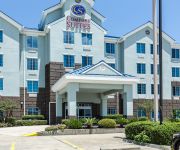
Comfort Suites New Orleans
BAYMONT INN & SUITES NEW ORLEA
Clarion Inn New Orleans
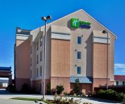
Holiday Inn Express NEW ORLEANS EAST
RED CARPET INN AND SUITES NEW ORLEANS
Royal Inn of New Orleans
New Orleans Inn
MOTEL 6 NEW ORLEANS
Econo Lodge New Orleans
TRAVELODGE NEW ORLEANS
Videos from this area
These are videos related to the place based on their proximity to this place.
VAYLA's End-of-2012 Video {Ft. at our Holiday Festivus}
Take a look back on the accomplishments, successes, and memorable moments at VAYLA. Also, listen to what our staff has in stores for 2013! --- The Vietnamese American Young Leaders Association.
XS MAD's SUMMER CAMP
What is your child doing over summer vacation? Wouldn't it be great if they could use this time to stay active, have fun, learn valuable life skills, and get some quality martial arts training?...
1st *EVER* Youth-Led OPSB Candidates Forum: Promo Video #1
The Vietnamese American Young Leaders Association, in partnership with Kids Rethink New Orleans Schools and Orleans Public Education Network, will be mobilizing youth from all across the city...
NOLA RC Elimination Drag Races (Finals) 20 Feb 2010.wmv
http://www.ultimate5thscale.com/forum/viewtopic.php?f=70&t=237 week 2 New Orleans RC Drag Racing. The Black and Gold City RC Racers present: Round 2 of saturday night eliminiation drag...
NOLA RC Elimination Drag Races (Round 1) 20 Feb 2010.wmv
http://www.ultimate5thscale.com/forum/viewtopic.php?f=70&t=237 week 2 New Orleans RC Drag Racing. The Black and Gold City RC Racers present: Round 1 of eliminiation drag races. these...
NOLA RC Racers (trashtalk) 20 Feb 2010
a lil trashtalk with the fellas before the final race. LIVE form THE BIG EASY. new orleans, LA. black and gold city rc racers spycam.
Movers In New Orleans Call 504-254-2950
Are you planning a big move? No matter where you need to go in the whole world, Lee Moving & Storage is ready to help you get there. Our moving companies in ...
NOLA RC Drag Races- test and tune (pt 1) 27 Feb 2010
Black and Gold City RC Racers UNITE! website: http://www.ultimate5thscale.com/forum/viewtopic.php?f=70&t=237 PT1 TEST and Tune DAY at Black and Gold. Congrats to all racers that showed!...
Moving Company in New Orleans Call 504-254-2950
When you are moving. No matter where you wish to go in the world, Lee Moving & Storage is ready to exceed your expectations and get your valuables to your de...
Videos provided by Youtube are under the copyright of their owners.
Attractions and noteworthy things
Distances are based on the centre of the city/town and sightseeing location. This list contains brief abstracts about monuments, holiday activities, national parcs, museums, organisations and more from the area as well as interesting facts about the region itself. Where available, you'll find the corresponding homepage. Otherwise the related wikipedia article.
Michoud Assembly Facility
The Michoud Assembly Facility (MAF) is an 832-acre (3.4-km²) site owned by NASA in New Orleans East, a district within New Orleans, Louisiana in the United States. Organizationally it is part of NASA's Marshall Space Flight Center, and is currently a multi-tenant complex maintained and operated by Jacobs Technology to allow commercial and government contractors, as well as government agencies, to use the site.
New Orleans Lakefront Airport
Lakefront Airport is a public use airport located four nautical miles (7 km) northeast of the central business district of New Orleans, in Orleans Parish, Louisiana, United States. It is owned by the Louisiana Division of Administration.
WGNO
WGNO is the ABC-affiliated television station serving the New Orleans, Louisiana metropolitan area and coastal areas of southern Mississippi. It broadcasts a high definition digital signal on UHF channel 26 from a transmitter in Chalmette. Owned by Tribune Broadcasting, WGNO is sister to CW affiliate WNOL-TV and both stations maintain studios at The Galleria in Metarie.
WNOL-TV
WNOL-TV is the CW-affiliated television station in New Orleans, Louisiana. It broadcasts a high definition digital signal on UHF channel 15 from a transmitter in Chalmette. Owned by Tribune Broadcasting, WNOL is sister to ABC affiliate WGNO and both stations maintain studios at The Galleria in Metarie. This station can also be seen on Cox Communications and AT&T U-verse channel 13 and in HD on Cox Communications and AT&T U-verse digital channel 1013.
Six Flags New Orleans
Six Flags New Orleans is an amusement park in New Orleans, Louisiana that has been closed since just before Hurricane Katrina struck in 2005 and is currently owned by the city of New Orleans. The park is located in Eastern New Orleans, in the Ninth Ward of the city off Interstate 510. Despite various announced plans to reopen or reuse the site, as of March 2013 it is still an abandoned amusement park in a semi-ruined state.
WRNO-FM
WRNO-FM is an Interactive Talk formatted radio station serving New Orleans, Louisiana. The Clear Channel Communications station broadcasts at 99.5 MHz with an effective radiated power of 100 kilowatts.
WNOE-FM
WNOE-FM is a country music station based in New Orleans, Louisiana. The Clear Channel Communications outlet broadcasts at 101.1 MHz with an ERP of 100 kW. Its current slogan is "Playing the Best Country Music for the Best City in the Country. " The current weekday lineup consists of Big D & Bubba in the Morning, 5–10 am; Mike Tyler, 10 am–2 pm; Eddied Edwards, 2–7 pm; Madison Reeves, 7 pm–midnight; and After MidNite with Blair Garner, midnight-5am.
WLAE-TV
WLAE-TV, virtual channel 32, is a public television station located in New Orleans, Louisiana, serving as a member station of the Public Broadcasting Service. The station is one of two PBS stations serving the market; WYES-TV is the other. It is owned by the Educational Broadcasting Foundation, a partnership between the Willwoods Community, and the Louisiana Educational Television Authority (operators of Louisiana Public Broadcasting, the PBS member for the rest of Louisiana).
Industrial Canal
The Industrial Canal is a 5.5 mile (9 km) waterway in New Orleans, Louisiana, United States. The waterway's proper name, as used by the U.S. Army Corps of Engineers and on NOAA nautical charts, is Inner Harbor Navigation Canal. The more common "Industrial Canal" name is used locally, both by commercial mariners and by landside residents. The canal connects the Mississippi River to Lake Pontchartrain.
TACA Flight 110
TACA Flight 110 was an international scheduled airline flight operated by TACA Airlines, traveling from Belize to New Orleans. On May 24, 1988, the flight lost power in both engines but its pilots made a successful deadstick landing on a grass levee, with no one aboard sustaining more than minor injuries. The captain of the flight, Carlos Dardano of El Salvador, had only one eye due to crossfire on a small flight to El Salvador, which was undergoing a civil war at the time.
Michoud, New Orleans
Michoud [MĒĒ-shū MĒĒ-shū] is an area in Eastern New Orleans, part of the Ninth Ward of New Orleans, Louisiana, located at latitude 30.03N, longitude -89.925W. In the 19th century Michoud was a small rural village in Orleans Parish outside of the city limits on Gentilly Road. Before the American Civil War a sugar plantation and refinery was located here; the old brick smokestacks still remain as an area landmark beside Gentilly Road.
The Jester (roller coaster)
The Jester is a steel roller coaster designed by Vekoma, that is currently Standing But Not Operating (SBNO) at Six Flags New Orleans in New Orleans, Louisiana. The Jester opened to the public on April 13, 2003.
Almonaster Avenue Bridge
The Almonaster Avenue Bridge is a bascule bridge in New Orleans, Louisiana. The bridge has two vehicular lanes of Almonaster Road and two railroad tracks over the Industrial Canal. The bridge is named after Almonaster Avenue on which it is built. It is one of the first four bridges built by the Port of New Orleans and was completed in 1919 in order to provide railroad access across the Inner Harbor-Navigational Canal, locally referred to as the Industrial Canal.
I-10 High Rise Bridge
The I-10 High Rise Bridge, known locally as the High Rise, is a bridge carrying 6 lanes of Interstate 10 over the Industrial Canal in New Orleans, Louisiana.
Danziger Bridge
The Danziger Bridge is a vertical lift bridge named after a New Orleans lawyer and businessman, which carries seven vehicular lanes of U.S. Route 90 (Chef Menteur Highway) across the Industrial Canal in New Orleans, Louisiana. It was built to replace the old Danziger Bridge, a draw bridge constructed in 1931–1932.
Seabrook Bridge
The Seabrook Bridge (officially the Senator Ted Hickey Bridge) is a medium-rise twin bascule, four-lane roadway bridge in New Orleans, Louisiana carrying Lakeshore Drive, connecting Leon C. Simon Drive on the upper side of the bridge with Hayne Boulevard on the lower side. The bridge is operated by the Orleans Levee District. It normally stays in the down position for vehicular traffic, but provides sufficient clearance for most marine traffic
Green Bridge (New Orleans)
The Green Bridge is the unofficial local name of the Paris Road Bridge carrying Louisiana Highway 47 across the Mississippi River Gulf Outlet between St. Bernard Parish and New Orleans, Louisiana. It is sometimes also called Paris Road Bridge. The name "the Green Bridge" came from it originally being painted green. About 1980 it was repainted brown, and more recently grey, but locals continued referring to it as "the green bridge". Interstate 510 ends just to the north of the bridge.
St. Mary's Academy (New Orleans)
St. Mary's Academy is an all-girls Roman Catholic parochial high school in New Orleans, Louisiana. It is located in the Roman Catholic Archdiocese of New Orleans.
KGLA-DT
KGLA-DT serves as the Telemundo affiliate for the New Orleans DMA. http://broadcastingcable. com/article/CA6435890. html The city of license is Hammond, Louisiana.
Mega Zeph
Mega Zeph is a roller coaster found at Six Flags New Orleans, in the Eastern New Orleans area of New Orleans, Louisiana, USA. Originally opening on May 20, 2000, as Jazzland's signature ride, the coaster has been abandoned and left in a state of decay as a result of the park's closure following 2005's Hurricane Katrina.
Danziger Bridge shootings
The Danziger Bridge shootings were police shootings that took place on September 4, 2005, at the Danziger Bridge in New Orleans, Louisiana. Six days after Hurricane Katrina struck New Orleans, members of the city's police department killed two people: 17-year-old James Brissette and 40-year-old Ronald Madison. Four other people were wounded. All victims were unarmed. Madison, a mentally disabled man, was shot in the back.
IHNC Lake Borgne Surge Barrier
The Inner Harbor Navigation Canal Lake Borgne Surge Barrier is a storm surge barrier under construction near the confluence of and across the Gulf Intracoastal Waterway (GIWW) and the Mississippi River Gulf Outlet (MRGO) near New Orleans. The barrier runs generally north-south from a point just east of Michoud Canal on the north bank of the GIWW and just south of the existing Bayou Bienvenue flood control structure.
Muskrat Scrambler
Muskrat Scrambler is a steel roller coaster at Six Flags New Orleans, in the Eastern New Orleans area of New Orleans, Louisiana, USA. Opened on May 20, 2000, as Muskrat Scrambler at Jazzland. Six Flags took over the lease of the park in 2002, changing the park's name to Six Flags New Orleans, but kept the ride name.
Zydeco Scream
Zydeco Scream is a steel roller coaster found at Six Flags New Orleans, in the Eastern New Orleans area of New Orleans, Louisiana, USA. Opened on May 20, 2000, as Zydeco Scream at Jazzland. Six Flags took over the lease of the park in 2002, changing the park's name to Six Flags New Orleans, but kept the ride name.
Seabrook Floodgate
The Inner Harbor Navigation Canal (IHNC) Seabrook Floodgate Structure is a flood barrier in the Industrial Canal in New Orleans, Louisiana. The floodgate is designed to protect the Industrial Canal and the surrounding areas from a storm surge from Lake Ponchartrain. It consists of two 50 ft wide vertical lift gates and a 95 ft wide sector gate.


