Safety Score: 2,7 of 5.0 based on data from 9 authorites. Meaning we advice caution when travelling to United States.
Travel warnings are updated daily. Source: Travel Warning United States. Last Update: 2024-08-13 08:21:03
Delve into Algiers
Algiers in Orleans Parish (Louisiana) is located in United States about 964 mi (or 1,551 km) south-west of Washington DC, the country's capital town.
Current time in Algiers is now 11:16 AM (Tuesday). The local timezone is named America / Chicago with an UTC offset of -6 hours. We know of 8 airports close to Algiers, of which 6 are larger airports. The closest airport in United States is Louis Armstrong New Orleans International Airport in a distance of 13 mi (or 21 km), West. Besides the airports, there are other travel options available (check left side).
Also, if you like playing golf, there are some options within driving distance. If you need a hotel, we compiled a list of available hotels close to the map centre further down the page.
While being here, you might want to pay a visit to some of the following locations: New Orleans, Gretna, Chalmette, Davis (historical) and Hahnville. To further explore this place, just scroll down and browse the available info.
Local weather forecast
Todays Local Weather Conditions & Forecast: 13°C / 55 °F
| Morning Temperature | 10°C / 51 °F |
| Evening Temperature | 13°C / 55 °F |
| Night Temperature | 10°C / 50 °F |
| Chance of rainfall | 0% |
| Air Humidity | 54% |
| Air Pressure | 1034 hPa |
| Wind Speed | Gentle Breeze with 8 km/h (5 mph) from South-West |
| Cloud Conditions | Broken clouds, covering 51% of sky |
| General Conditions | Broken clouds |
Tuesday, 3rd of December 2024
18°C (64 °F)
17°C (62 °F)
Light rain, gentle breeze, overcast clouds.
Wednesday, 4th of December 2024
18°C (64 °F)
13°C (56 °F)
Heavy intensity rain, gentle breeze, overcast clouds.
Thursday, 5th of December 2024
11°C (52 °F)
12°C (53 °F)
Light rain, moderate breeze, overcast clouds.
Hotels and Places to Stay
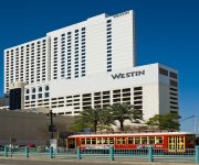
The Westin New Orleans Canal Place
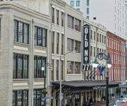
THE OLD NO 77 HOTEL
Embassy Suites by Hilton New Orleans Convention Center
Renaissance New Orleans Arts Warehouse District Hotel
DoubleTree by Hilton New Orleans
Windsor Court Hotel LEGEND
Le Meridien New Orleans
Hilton New Orleans Riverside
Loews New Orleans Hotel
Omni Riverfront Hotel
Videos from this area
These are videos related to the place based on their proximity to this place.
New Orleans Public Belt Railway 2
The return trip of the train seen in the NOPB Railway 1 video. Again several stupid people stand way too close to the train as it passes by.
New Orleans Public Belt Railway 1
A daily CSX manifest train rolls past the New Orleans waterfront. The slow speed of the train causes the crossings to be blocked for some time. Lots of people start walking the tracks in search...
The Idea Village Big Idea Pitch 2012 - New Orleans
Video created with the Socialcam app on iPhone: http://socialcam.com Congrats to Solarchitect for winning the event.
Heliography: Using the Sun to make Art
A guy on the movie set using a type of Heliography to make a picture of Darwin.
KRALYS PROPOSAL
before going back to Iraq for my 2nd tour, i proposed to my girlfriend which ive known for about 9 years..she said yes of course!
Daytime Burglary on 600 Block of Mandeville Street, Faubourg Marigny, New Orleans 3/14/2013
This crime occurred on the afternoon of Thursday March 14, 2013 at 3:09PM on the 600 block of Mandeville Street in the Faubourg Marigny neighborhood of New Orleans. If you have any information...
'tit Rex Parade in the Faubourg-Marigny neighborhood of New Orleans, 2-7-2015
'tit R ex Parade in the Faubourg-Marigny neighborhood of New Orleans, 2-7-2015.
Videos provided by Youtube are under the copyright of their owners.
Attractions and noteworthy things
Distances are based on the centre of the city/town and sightseeing location. This list contains brief abstracts about monuments, holiday activities, national parcs, museums, organisations and more from the area as well as interesting facts about the region itself. Where available, you'll find the corresponding homepage. Otherwise the related wikipedia article.
Algiers, New Orleans
Algiers is a community within the city of New Orleans. It is the portion of Orleans Parish on the West Bank of the Mississippi River. Algiers is also known as the 15th Ward, one of the 17 Wards of New Orleans.
Café du Monde
Café du Monde is a coffee shop on Decatur Street in the French Quarter in New Orleans, Louisiana. It is best known for its café au lait and its French-style beignets. In the New Orleans style, the coffee is blended with chicory. The location at the lower end of the French Market was established in 1862.
Crescent City Connection
The Crescent City Connection (CCC), formerly the Greater New Orleans Bridge (GNO), refers to twin cantilever bridges that carry U.S. Route 90 Business over the Mississippi River in New Orleans, Louisiana, United States. They are tied as the fifth-longest cantilever bridges in the world. Each span carries four general-use automobile lanes; additionally the westbound span has two reversible HOV lanes across the river.
New Orleans Morial Convention Center
The Ernest N. Morial Convention Center is in New Orleans, Louisiana, United States. The lower end of building one is located 1,640 feet upriver from Canal Street on the banks of the Mississippi River. It is named after former Mayor of New Orleans Ernest N. Morial. As of 2006, it has about 1.1 million square feet (102,000 m²) of exhibit space, covering almost 11 blocks, and over 3 million square feet (280,000 m²) of total space. The front of the main building is 1 kilometer long.
Central Grocery
Central Grocery is a small, old-fashioned Italian-American grocery store with a sandwich counter located at 923 Decatur Street, in the French Quarter of New Orleans, Louisiana. It was founded in 1906 by Salvatore Lupo, a Sicilian immigrant. He operated it until 1946 when he retired and his son-in-law Frank Tusa took over the operation. Today it is owned by Salvador T. Tusa, Salvatore's grandson, and two cousins.
Algiers Point
Algiers Point is a location on the Lower Mississippi River in New Orleans, Louisiana. In river pilotage, Algiers Point is simply one of the many points of land around which the river flows—albeit a significant one. Since the 1970s, the name Algiers Point has also referred to the neighborhood in the immediate vicinity of that point.
Port of New Orleans
The Port of New Orleans is a port located in New Orleans, Louisiana. It is the 1st in the United States based on volume of cargo handled, second-largest in the state after the Port of South Louisiana, and 13th largest in the U.S. based on value of cargo. It also has the longest wharf in the world, which is 2.01 miles (3.4 km) long and can accommodate 15 vessels at one time. The Port of New Orleans handles about 62 million short tons of cargo a year.
Mississippi Aerial River Transit
The Mississippi Aerial River Transit, or simply MART, was a gondola lift transport system spanning the Mississippi River in New Orleans, Louisiana, United States. It was constructed for the 1984 Louisiana World Exposition. After the fair, this served as the second urban aerial lift and the first gondola lift commuter system in the United States.
World Trade Center New Orleans
Dating back to its origins more than 50 years ago, the World Trade Center of New Orleans is the founding member of the World Trade Centers Association, an organization of over 300 World Trade Centers in almost 100 countries across the globe.
Natchez (boat)
Natchez has been the name of several steamboats, and four naval vessels, each named after the city of Natchez, Mississippi or the Natchez people. The current one has been in operation since 1975. The previous Natchez were all operated in the nineteenth century, most by Captain Thomas P. Leathers. Each of the steamboats since Leathers' first had as its ensign a cotton bale between its stacks.
Woldenberg Park (New Orleans)
Woldenberg Park is a park in New Orleans, Louisiana. It was created in the late 1980s/early 1990s on land that had been old wharves and warehouses along the Mississippi River front in the upper French Quarter. It is named after philanthropist Malcolm Woldenberg (1896 - 1982) who helped fund the building of it. The upper end of the park is at Canal Street and the Aquarium of the Americas. It continues down river to connect with the riverfront "Moon Walk" across from Jackson Square.
Jackson Brewery
Jackson Brewery, commonly known as Jax Brewery by locals, is a building in the French Quarter of New Orleans, Louisiana, containing shops and restaurants and primarily frequented by tourists. Constructed in 1891, it originally was the central brewery for Jax Beer, and in the 1960s was the 10th-largest brewery in the country. But in the 1970s, the company owning the brewery went bankrupt, and in the 1980s the building was purchased and turned into space for shops and restaurants.


