Safety Score: 2,7 of 5.0 based on data from 9 authorites. Meaning we advice caution when travelling to United States.
Travel warnings are updated daily. Source: Travel Warning United States. Last Update: 2024-08-13 08:21:03
Delve into Standard Heights
The district Standard Heights of Baton Rouge in East Baton Rouge Parish (Louisiana) is a district located in United States about 990 mi south-west of Washington DC, the country's capital town.
In need of a room? We compiled a list of available hotels close to the map centre further down the page.
Since you are here already, you might want to pay a visit to some of the following locations: Port Allen, Plaquemine, New Roads, Saint Francisville and Donaldsonville. To further explore this place, just scroll down and browse the available info.
Local weather forecast
Todays Local Weather Conditions & Forecast: 13°C / 56 °F
| Morning Temperature | 5°C / 41 °F |
| Evening Temperature | 12°C / 54 °F |
| Night Temperature | 8°C / 47 °F |
| Chance of rainfall | 0% |
| Air Humidity | 49% |
| Air Pressure | 1034 hPa |
| Wind Speed | Gentle Breeze with 7 km/h (4 mph) from South-West |
| Cloud Conditions | Clear sky, covering 8% of sky |
| General Conditions | Sky is clear |
Wednesday, 4th of December 2024
16°C (61 °F)
16°C (60 °F)
Moderate rain, gentle breeze, overcast clouds.
Thursday, 5th of December 2024
16°C (62 °F)
12°C (53 °F)
Moderate rain, gentle breeze, overcast clouds.
Friday, 6th of December 2024
9°C (49 °F)
9°C (48 °F)
Light rain, gentle breeze, overcast clouds.
Hotels and Places to Stay
WATERMARK Baton Rouge Autograph Collection
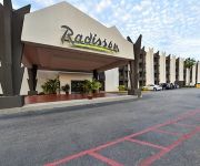
LA Radisson Hotel Baton Rouge
Hilton Baton Rouge Capitol Center
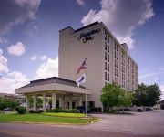
Hampton Inn - Suites Baton Rouge LA
Hampton Inn I-10 - College Drive
Holiday Inn Express & Suites BATON ROUGE -PORT ALLEN
Hampton Inn - Suites Baton Rouge-Port Allen
Courtyard Baton Rouge Acadian Centre/LSU Area
SpringHill Suites Baton Rouge North/Airport
Hilton Garden Inn Baton Rouge Airport
Videos from this area
These are videos related to the place based on their proximity to this place.
big guns nth 15 Baton Rouge Fire Dept.
house fire on north 15th from station 2 baton rouge fire dept.
Baton Rouge Marching Drum Corps and Starette Dancers Warm Up for 2013 Spanish Town Mardi Gras Parade
Baton Rouge Marching Drum Corps and Starette Dancers warm up (1 of 2)http://www.indiegogo.com/the-marching-band-project The group warms up near the Wasted Krewe float before the 2013 ...
Louisiana State Capitol Observation Deck - Baton Rouge
Located in a great city with pictures of the Old Capitol! Also located on the grounds is the grave of Huey Long and the old Barracks!
Spanishtown Mardi Gras Parade February 09 2013
Video Montage of the Baton Rouge, Louisiana Spanishtown Mardi Gras Parade - by far, the biggest Mardi Gras Parade in the Capital City of Louisiana. For the first time in 4 years, the weather...
Merry Christmas from GN Gonzales
Hi Guys. I'm Alicia with GN Gonzales and the holiday season is upon us. We have gifts for everyone of all ages. (http://gngonzales.com) Including ATVs, UTVs, dirt bikes, and street bikes....
080503 View from top of Capitol Building Baton Rouge
View from top of Capitol Building Baton Rouge before the Artcar Parade 5-3-2008.
2009 Way of the Cross
Journey the 14 Stations of the Cross throughout the grounds of the State Capitol in downtown Baton Rouge, Louisiana. Sponsored by Catholic Charities, St. Joseph Cathedral & St. Vincent dePaul.
What Are ATVs, or All Terrain Vehicles?
What are ATVs? We get this question all of the time. Do you know the differences in ATVs, or All-Terrain Vehicles? Different engine sizes, transmission, size of ATV, purpose, storage space,...
Kid's ATVs and Dirt Bike Basics
What types of Off-road vehicles are available for kids? What are the ATV federal regulations for kid's vehicles? We get these question all of the time. When choosing a bike for your child,...
Basics of UTVs, or Side X Sides, You Gotta Know!
What the heck is a UTV? Well, they are also called Side x Sides and it's the answer is quite simple. UTVs are the fastest growing segment in the motorcycle industry. Side x Sides are used...
Videos provided by Youtube are under the copyright of their owners.
Attractions and noteworthy things
Distances are based on the centre of the city/town and sightseeing location. This list contains brief abstracts about monuments, holiday activities, national parcs, museums, organisations and more from the area as well as interesting facts about the region itself. Where available, you'll find the corresponding homepage. Otherwise the related wikipedia article.
Baton Rouge, Louisiana
Baton Rouge is the capital of the U.S. state of Louisiana. Located in East Baton Rouge Parish, the city is the second largest in the state, and has a population of 229,553 people as of the 2010 census. The metropolitan area surrounding the city, known as Greater Baton Rouge, has a population of 802,484 people as of 2010. Baton Rouge is a major industrial, petrochemical, medical, and research center of the American South.
Port Allen, Louisiana
Port Allen is a city in and the parish seat of West Baton Rouge Parish, Louisiana, United States. Port Allen is located between Interstate 10 and US Highway 190 on the West bank of the Mississippi River. The population was 5,180 at the 2010 census. It is part of the Baton Rouge Metropolitan Statistical Area.
CSS Arkansas
The CSS Arkansas was a Confederate Ironclad warship which served during the American Civil War in the Western Theater. Arkansas ran through a U.S. Navy fleet at Vicksburg, Mississippi, on 15 July 1862, in a celebrated action in which she inflicted more damage than she received. She was later destroyed by her crew to prevent capture by Union forces.
BREC Memorial Stadium
BREC Memorial Stadium is a 21,395-seat American football stadium in Baton Rouge, Louisiana. Beyond high school football, it is also used for concerts and other outdoor events, including monster truck rallies. It features concession stands, restrooms, and a modern press box. The stadium was dedicated by BREC, Baton Rouge's parks and recreation commission, in memory of the men and women who fought and served Baton Rouge during the two World Wars and the Korean War.
WPYR
WPYR is an American radio station licensed to serve the community of Baton Rouge, Louisiana. The station currently airs a Catholic programming format.
WPFC (AM)
WPFC is a radio station broadcasting a Christian radio format. Licensed to Baton Rouge, Louisiana, USA. The station is currently owned by Jon Fine Productions, Inc.
WBRH
WBRH is a student-run jazz high school radio station in Baton Rouge, Louisiana. The station, at Baton Rouge Magnet High School, broadcasts with an effective radiated power (ERP) of 21 kW. It is owned by the East Baton Rouge Parish School Board, along with sister station KBRH 1260 AM.
Louisiana State Capitol
The Louisiana State Capitol is the seat of government for the U.S. state of Louisiana and is located in downtown Baton Rouge. The capitol houses the chambers for the Louisiana State Legislature, made up of the House of Representatives and the Senate, as well as the offices for the Governor and Lieutenant Governor. At 450 feet tall and with 34 stories, it is the tallest building in Baton Rouge, the seventh tallest building in Louisiana, and tallest capitol in the United States.
River Center Arena
River Center Arena is an 8,500-seat multi-purpose arena in Baton Rouge, Louisiana, in the United States. The arena opened in 1978. It was home to the Baton Rouge Kingfish ice hockey team.
Baton Rouge River Center
The Baton Rouge River Center (when built in the late 1970s, it was called the Riverside Centroplex) is a municipally owned multi-purpose 200,000 square feet (20,000 m²) entertainment facility located on the Mississippi River in downtown Baton Rouge, the capital city of Louisiana. It is maintained by a private management company, SMG, which presents more than five hundred events a year, including concerts, conventions, sporting events, trade shows and theater productions.
Horace Wilkinson Bridge
The Horace Wilkinson Bridge is a cantilever bridge carrying Interstate 10 in Louisiana across the Mississippi River from Port Allen in West Baton Rouge Parish to Baton Rouge in East Baton Rouge Parish. Around the Baton Rouge Metropolitan Area, the bridge is more commonly known as the "New Bridge" because it is the younger of the two bridges that cross the river in Baton Rouge. The structure begins at the Louisiana Highway 1 (LA 1) exit south of Port Allen.
Huey P. Long Bridge (Baton Rouge)
The Huey P. Long Bridge is a truss cantilever bridge over the Mississippi River carrying US 190 and one rail line between East Baton Rouge Parish, Louisiana and West Baton Rouge Parish, Louisiana. Although the bridge is named after former Louisiana governor Huey P. Long, it is known locally in the Baton Rouge Area as "the old bridge". It is similar in design to the Huey P. Long Bridge in Jefferson Parish, Louisiana.
Baton Rouge Area Foundation
Baton Rouge Area Foundation ("The Foundation") is a community foundation dedicated to enhancing the quality of life in Louisiana's capital region, and is registered with the IRS as a 501(c)(3) tax-deductible nonprofit organization. Over the past 40 years, the Baton Rouge Area Foundation has responded to the wishes of its donors, the concerns of its members, and the community's needs by issuing grants totaling close to $200 million.
Spanish Town, Baton Rouge, Louisiana
Spanish Town is a historic district anchored by Spanish Town Road in Baton Rouge, the capital city of the U.S. state of Louisiana. Spanish Town was commissioned in 1805. Spanish Town holds the title of the oldest neighborhood in Baton Rouge and was added to the National Register of Historic Places in 1978.
One American Place
One American Place is a skyscraper in Downtown Baton Rouge, Louisiana. Its exterior surface is clad entirely in mirrored glass. Completed in 1974, with 24 floors, it stands 94 meters tall. It is currently the second-tallest building in Downtown Baton Rouge.
Catholic High School (Baton Rouge, Louisiana)
Catholic High School is an all-male Catholic college-preparatory school in Baton Rouge, Louisiana, run by the Brothers of the Sacred Heart. It offers grades eight through twelve.
Battle of Baton Rouge (1862)
The Battle of Baton Rouge was a ground and naval battle in the American Civil War fought in East Baton Rouge Parish, Louisiana, on August 5, 1862. The Union victory halted Confederate attempts to recapture the capital city of Louisiana.
WTQT-LP
WTQT-LP (94.9 FM, "Power 94.9") is a low-power FM (LPFM) radio station offering gospel music. The station began on May 8, 2003, and is licensed to Baton Rouge, Louisiana. It broadcasts with an ERP of 71 watts and is available on the Internet.
St. Joseph's Academy (Baton Rouge)
St. Joseph's Academy (SJA) is an all-girls Catholic school established in 1868 by the Sisters of St. Joseph of Medaille. It is located on a live oak shaded campus in Mid-City Baton Rouge, Louisiana, within the Roman Catholic Diocese of Baton Rouge. SJA has been recognized three times as a Blue Ribbon School of Excellence by the U.S. Department of Education. In 2002, the Academy was recognized as a school of technology excellence by the U.S.
Louisiana Governor's Mansion
The Louisiana Governor's Mansion is the official residence of the Governor of Louisiana and his or her family. The Governor’s Mansion was built in 1963 when Jimmie Davis was Governor of Louisiana. The Mansion overlooks Capital Lake near the Louisiana State Capitol in Baton Rouge. Louisiana Governor, Bobby Jindal, and his family currently reside in the mansion. The Mansion was designed by the architectural firm of Annan and Gilmer of Shreveport, Louisiana.
Redemptorist High School
Redemptorist Upper School is a private, Roman Catholic high school in Baton Rouge, Louisiana. It is located in north Baton Rouge, under the remit of the Roman Catholic Diocese of Baton Rouge.
Pentagon Barracks
The Pentagon Barracks is a complex of buildings located at State Capitol Drive at River Road in Baton Rouge, Louisiana, in the grounds of the state capitol. The site has been used by the Spanish, French, British, Confederate States Army, and United States Army and was part of the short-lived Republic of West Florida. During its use as a military post the site has been visited by such notable figures as Lafayette, Robert E. Lee, George Custer, Jefferson Davis and Abraham Lincoln.
Istrouma High School
Istrouma High School is a public school located in Baton Rouge, Louisiana. It was founded in 1917, and is located in East Baton Rouge Parish. Its name is a local Indian word meaning "red stick". Red stick is also the English language translation of the French words baton rouge. The area of north Baton Rouge where the school is located is also known as the Istrouma area.
WHYR-LP
WHYR-LP (sometimes pronounced "wire") is a radio station licensed to Baton Rouge, Louisiana, USA. The LP stands for low power broadcasting. The station began broadcasting on June 24, 2011 in a testing phase. As of July 2011, the station is playing a loop of prerecorded music as planning continues for future programming, including shows covering topics like politics, local music, food and drink, as well as nationally syndicated shows from Pacifica Radio like Democracy Now! and more.
State Library of Louisiana
The State Library of Louisiana is Louisiana's state-operated library, located in Baton Rouge. The state created the Louisiana Library Commission in 1920. In 1925 the commission and the Carnegie Corporation established libraries throughout the state.


