Safety Score: 2,7 of 5.0 based on data from 9 authorites. Meaning we advice caution when travelling to United States.
Travel warnings are updated daily. Source: Travel Warning United States. Last Update: 2024-08-13 08:21:03
Delve into Camp Taylor
Camp Taylor in Jefferson County (Kentucky) is a city located in United States about 471 mi (or 758 km) west of Washington DC, the country's capital town.
Current time in Camp Taylor is now 08:37 AM (Thursday). The local timezone is named America / Kentucky / Louisville with an UTC offset of -5 hours. We know of 8 airports closer to Camp Taylor, of which 4 are larger airports. The closest airport in United States is Louisville International Standiford Field in a distance of 2 mi (or 3 km), South-West. Besides the airports, there are other travel options available (check left side).
There is one Unesco world heritage site nearby. It's Mammoth Cave National Park in a distance of 70 mi (or 113 km), South. Also, if you like playing golf, there are some options within driving distance. In need of a room? We compiled a list of available hotels close to the map centre further down the page.
Since you are here already, you might want to pay a visit to some of the following locations: Louisville, Jeffersonville, New Albany, Shepherdsville and La Grange. To further explore this place, just scroll down and browse the available info.
Local weather forecast
Todays Local Weather Conditions & Forecast: 4°C / 39 °F
| Morning Temperature | 4°C / 39 °F |
| Evening Temperature | 3°C / 37 °F |
| Night Temperature | 3°C / 38 °F |
| Chance of rainfall | 0% |
| Air Humidity | 51% |
| Air Pressure | 1010 hPa |
| Wind Speed | Moderate breeze with 11 km/h (7 mph) from East |
| Cloud Conditions | Overcast clouds, covering 100% of sky |
| General Conditions | Rain and snow |
Thursday, 21st of November 2024
7°C (44 °F)
7°C (45 °F)
Light rain, moderate breeze, broken clouds.
Friday, 22nd of November 2024
12°C (53 °F)
8°C (46 °F)
Scattered clouds, gentle breeze.
Saturday, 23rd of November 2024
14°C (57 °F)
13°C (56 °F)
Overcast clouds, gentle breeze.
Hotels and Places to Stay
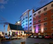
Crowne Plaza LOUISVILLE AIRPORT EXPO CTR
Four Points by Sheraton Louisville Airport
La Quinta Inn and Suites Louisville Airport and Expo
Hampton Inn Louisville-Arpt-Fair-Expo Ctr
Home2 Suites by Hilton Louisville Airport Expo Center
Hilton Garden Inn Louisville Airport
Candlewood Suites LOUISVILLE AIRPORT
Residence Inn Louisville Airport
Comfort Inn & Suites Airport and Expo
SpringHill Suites Louisville Airport
Videos from this area
These are videos related to the place based on their proximity to this place.
Ralf Souquet - 92 Ball Run - Part 3
From the 2008 Derby City Classic Straight Pool Challenge - Ralf Souquet misses two shots in two attempts at the straight pool challenge, and rebounds back to run 92 balls on his 3rd attempt....
KY Stickhorses vs Chicago Outlaws - 2/12/12 - NALL - HD
Highlights from 2/12/12 match up between the KY Stickhorses and Chicago Outlaws played at Freedom Hall in Louisville. The visiting Outlaws jumped out to a 3-0 lead, but the Stickhorses came...
Dead & Deader Warm-Ups LMHS Theater Company '08
Louisville Male High School Theater Company, Louisville, KY, 2008 Warm-Ups for Dead & Deader.
Land of the Pig (The Butcher Is King) left 4 dead 2
Second chapter of my Left 4 Dead 2 videos. In the Land of the Pig (The Butcher is King) by Meat Loaf.
Downburst between Lyndon and Graymoor-Devondale (Louisville) KY
This downburst felled trees near the intersection of Herr and Westport on July 7, 2014. It was taken by Tim Hargis and shared with us by Brian Goode of WAVE. National Weather Service Weather...
Videos provided by Youtube are under the copyright of their owners.
Attractions and noteworthy things
Distances are based on the centre of the city/town and sightseeing location. This list contains brief abstracts about monuments, holiday activities, national parcs, museums, organisations and more from the area as well as interesting facts about the region itself. Where available, you'll find the corresponding homepage. Otherwise the related wikipedia article.
Lynnview, Kentucky
Lynnview is a city in Jefferson County, Kentucky, United States. The population was 965 at the 2000 census. There are plans to move the Louisville Metro Humane Society to Lynnview by 2008.
Louisville Male High School
Louisville Male Traditional High School is a public secondary school serving students in grades 9 through 12 in the southside of Louisville, Kentucky, USA. It is part of the Jefferson County Public School District. A growing 19th century river city needed a place to a new high school, and so in 1861, Male was designated "The University of Public Schools in Louisville".
Louisville Zoo
Founded in 1969, the Louisville Zoo, or the Louisville Zoological Garden, is a 135-acre zoo in Louisville, Kentucky, situated in the city's Poplar Level neighborhood. The "State Zoo of Kentucky" currently exhibits over 1,700 animals in naturalistic and mixed animal settings representing both geographical areas and biomes or habitats. The Louisville Zoo is accredited by the Association of Zoos and Aquariums (AZA) and the American Association of Museums (AAM).
Camp Zachary Taylor
Camp Zachary Taylor was a military training camp in Louisville, Kentucky. It opened in 1917, to train soldiers for U.S. involvement in World War I, and was closed three years later. Its name (and some of its buildings) live on as the Camp Taylor neighborhood of Louisville. It is named for Louisville resident and United States President Zachary Taylor. Not to be confused with Fort Zachary Taylor, a place in Key West Florida used for a military base. The novelist F.
Camp Taylor, Louisville
Camp Taylor is a neighborhood and former military base six miles southeast of downtown Louisville, Kentucky, USA. First announced on June 11, 1917 it was originally a military camp named for former president Zachary Taylor. For a time it was America's largest military training camp, housing 47,500 men at one time, and spurred development in an area that was previously dominated by farmland.
Prestonia, Louisville
Prestonia is a neighborhood five miles southeast of downtown Louisville, Kentucky, U.S. Its boundaries are Preston Highway, Interstate 65, Interstate 264 and the Norfolk Southern Railway tracks. Many of Prestonia's streets are named after Kentucky counties. It was probably named for the local highway (then called Preston Street Road), which was in turn named after early Louisville landowner Col. William Preston.
Standiford, Louisville
Standiford is a defunct neighborhood in Louisville, Kentucky, USA. Its boundaries are Interstate 65 to the east and the Louisville International Airport to the north, west and south. The neighborhood was displaced for expansion of the airport, and is currently the site for Louisville Air National Guard Base, which was relocated to make room for an expansion of the UPS WorldPort.
Louisville Air National Guard Base
See: Louisville International Airport for civil airport information Louisville Air National Guard Base is the home base of the Kentucky Air National Guard 123d Airlift Wing.


