Safety Score: 2,7 of 5.0 based on data from 9 authorites. Meaning we advice caution when travelling to United States.
Travel warnings are updated daily. Source: Travel Warning United States. Last Update: 2024-08-13 08:21:03
Explore Carter Lake
Carter Lake in Pottawattamie County (Iowa) with it's 3,791 inhabitants is a city in United States about 1,010 mi (or 1,625 km) west of Washington DC, the country's capital.
Local time in Carter Lake is now 01:31 PM (Saturday). The local timezone is named America / Chicago with an UTC offset of -5 hours. We know of 8 airports in the vicinity of Carter Lake, of which 3 are larger airports. The closest airport in United States is Eppley Airfield in a distance of 2 mi (or 2 km), North-East. Besides the airports, there are other travel options available (check left side).
Also, if you like golfing, there are multiple options in driving distance. We found 1 points of interest in the vicinity of this place. If you need a place to sleep, we compiled a list of available hotels close to the map centre further down the page.
Depending on your travel schedule, you might want to pay a visit to some of the following locations: Omaha, Council Bluffs, Papillion, Plattsmouth and Glenwood. To further explore this place, just scroll down and browse the available info.
Local weather forecast
Todays Local Weather Conditions & Forecast: 16°C / 60 °F
| Morning Temperature | 7°C / 44 °F |
| Evening Temperature | 12°C / 53 °F |
| Night Temperature | 12°C / 54 °F |
| Chance of rainfall | 0% |
| Air Humidity | 53% |
| Air Pressure | 1019 hPa |
| Wind Speed | Moderate breeze with 11 km/h (7 mph) from North-West |
| Cloud Conditions | Overcast clouds, covering 100% of sky |
| General Conditions | Light rain |
Saturday, 2nd of November 2024
15°C (60 °F)
18°C (65 °F)
Moderate rain, moderate breeze, overcast clouds.
Sunday, 3rd of November 2024
17°C (62 °F)
11°C (52 °F)
Light rain, moderate breeze, broken clouds.
Monday, 4th of November 2024
14°C (56 °F)
9°C (49 °F)
Moderate rain, moderate breeze, scattered clouds.
Hotels and Places to Stay
Omaha Marriott Downtown at the Capitol District
Hotel Deco XV LIFESTYLE
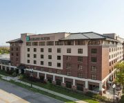
Embassy Suites by Hilton Omaha Downtown Old Market
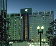
DoubleTree by Hilton Omaha Downtown
Hilton Omaha
Residence Inn Omaha Downtown/Old Market Area
Hilton Garden Inn Omaha Downtown-Old Market Area
Courtyard Omaha Downtown/Old Market Area
Quality Inn & Suites
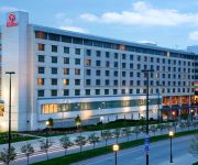
La Quinta Inn and Suites Omaha Airport Downtown
Videos from this area
These are videos related to the place based on their proximity to this place.
Old Market - Omaha, Nebraska, United States
http://tripwow.tripadvisor.com/tripwow/ta-00a0-b9c0-7ca5?ytv2=1 - Created at TripWow by TravelPod Attractions (a TripAdvisor™ company) Old Market Omaha Omaha preserves its historic place...
The Mastercraft Building 1111 N 13th St Omaha, NE
For more details click here: http://www.visualtour.com/showvt.asp?t=2506324 1111 N 13th St Omaha 68102 The Mastercraft is: Unique/Creative/Urban/Artistic/Eclectic. Professional environment...
2014 Omaha Metro Red Dress Dash
Highlights from Omaha's first Red Dress Dash, in support of the American Heart Association, hosted at Union Pacific Center Feb. 6.
Driving around Omaha and Northeastern Nebraska 2011 | 1 of 2 | Back View (Front view lost)
This is the real time version of my "Driving around Omaha, Council Bluffs, Bellevue, Fremont, and Oakland, NE in time lapse" video that can be seen here: http://youtu.be/93pxKnC7DlI It should...
Ride Omaha Metro route Green (1994 Flxible Metro)
A ride on the Omaha Metro Green line downtown circulator. This footage covers most of the route. The Green is designed primarily to connect the downtown core with the outer parking areas. Filmed...
Mobile Digital Billboard for Camping World RV Show at Centurylink Omaha
The Legion Digital Outdoor Mobile Digital Billboard truck was hired to promote the Camping World of Council Bluffs RV Show at Horseshoe Casino on Feb 19-22. Our LED advertising truck circled...
Hot Shops Open House - Omaha Nebraska Wegener Images Panasonic AG-HMC 40/41 Mark Wegener
Hot Shops Open House 2010 - Artist collective Painting Metalworking Sculpture Photography Weaving Glassworks Omaha Nebraska Wegenerimages.com Mark Wegener Panasonic AG-HMC40/41.
Videos provided by Youtube are under the copyright of their owners.
Attractions and noteworthy things
Distances are based on the centre of the city/town and sightseeing location. This list contains brief abstracts about monuments, holiday activities, national parcs, museums, organisations and more from the area as well as interesting facts about the region itself. Where available, you'll find the corresponding homepage. Otherwise the related wikipedia article.
Carter Lake, Iowa
Carter Lake is a city in Pottawattamie County, Iowa, United States. The population was 3,785 at the 2010 census.
USS Marlin (SST-2)
USS Marlin (SST-2), originally USS T-2 (SST-2), was a T-1-class training submarine in commission from 1953 to 1973. She was the second submarine of the United States Navy to be named for the marlin, a large game fish. She was one of the smallest operational submarines ever built for the U.S. Navy.
USS Hazard (AM-240)
USS Hazard (AM-240) was an Admirable-class minesweeper which served in the United States Navy during World War II. Hazard was launched on 1 October 1944 and was commissioned on 30 December 1944. The vessel was built by the Winslow Marine Railway and Shipbuilding Corporation of Winslow, Washington. Hazard was fitted for both wire and acoustic sweeping and could double as an anti-submarine warfare platform. The Admirable class of minesweepers were also used for patrol and escort duties.
Carter Lake (Iowa–Nebraska)
Carter Lake is a shallow oxbow lake in Nebraska and Iowa, located next to Omaha and Carter Lake. Soon after its formation the lake was called the East Omaha Lake, and then Lake Nakoma.
Culture of Omaha, Nebraska
The culture of Omaha, Nebraska has been partially defined by music and college sports, as well as local cuisine and community theatre. The city has a long history of improving and expanding on its cultural offerings. In the 1920s, the Omaha Bee newspaper wrote, "The cultural future of Omaha seems as certain of greatness as the commercial future...
Levi Carter Park
Levi Carter Park is located at 3100 Abbott Drive in East Omaha, Nebraska. It was named after one of Omaha's original industrialists, Levi Carter, who ran a white lead smelter in the area.
Port of Omaha
The Port of Omaha is a port of entry in the United States with facilities on the west side of the Missouri River in Omaha, Nebraska. The official address is located at 5229 Boeing Court in East Omaha. The Port was formally sanctioned by the U.S. Congress in 1888.
Squatter's Row
Squatter's Row was a historic neighborhood in the downtown area of Omaha, Nebraska. It was an area between North 11th and North 13th Streets, from Nicholas to Locust Streets, behind the Storz Brewery. For more than 75 years this area was inhabited solely by squatters. A village of shacks built of materials salvaged from the Omaha city dump, the neighborhood included different enclaves such as Vinegar Flats, Blind Pig Alley, among others.


