Safety Score: 2,7 of 5.0 based on data from 9 authorites. Meaning we advice caution when travelling to United States.
Travel warnings are updated daily. Source: Travel Warning United States. Last Update: 2024-08-13 08:21:03
Touring Egralharve
Egralharve in Dickinson County (Iowa) is a town located in United States about 991 mi (or 1,595 km) west of Washington DC, the country's capital place.
Time in Egralharve is now 12:03 PM (Tuesday). The local timezone is named America / Chicago with an UTC offset of -6 hours. We know of 10 airports nearby Egralharve, of which 3 are larger airports. The closest airport in United States is Fairmont Municipal Airport in a distance of 41 mi (or 67 km), North-East. Besides the airports, there are other travel options available (check left side).
Also, if you like the game of golf, there are several options within driving distance. Need some hints on where to stay? We compiled a list of available hotels close to the map centre further down the page.
Being here already, you might want to pay a visit to some of the following locations: Spirit Lake, Spencer, Jackson, Estherville and Windom. To further explore this place, just scroll down and browse the available info.
Local weather forecast
Todays Local Weather Conditions & Forecast: -4°C / 25 °F
| Morning Temperature | -11°C / 12 °F |
| Evening Temperature | -4°C / 24 °F |
| Night Temperature | -3°C / 26 °F |
| Chance of rainfall | 0% |
| Air Humidity | 60% |
| Air Pressure | 1025 hPa |
| Wind Speed | Moderate breeze with 13 km/h (8 mph) from North |
| Cloud Conditions | Broken clouds, covering 84% of sky |
| General Conditions | Broken clouds |
Tuesday, 3rd of December 2024
1°C (34 °F)
-12°C (11 °F)
Overcast clouds, fresh breeze.
Wednesday, 4th of December 2024
-9°C (17 °F)
-7°C (19 °F)
Scattered clouds, moderate breeze.
Thursday, 5th of December 2024
-1°C (31 °F)
-3°C (27 °F)
Sky is clear, gentle breeze, clear sky.
Hotels and Places to Stay
West Oaks Resort
The Oakwood Inn
Village West Resort & Hotel
Northland Inn Motel
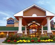
AmericInn Lodge & Suites Okoboji
Vintage Block Inn & Suites
Boulders Inn and Suites Okoboji
THE INN AT OKOBOJI
Ramada Spirit Lake/Okoboji
ARROWWOOD RESORT OKOBOJI
Videos from this area
These are videos related to the place based on their proximity to this place.
Wooden Roller Coaster at Arnolds Park on West Lake Okoboji, Iowa
Discover the scenic side of life at http://Ydstoti.com. Wooden Roller Coaster at Arnolds Park on West Lake Okoboji, Iowa. In 1927, the park's wooden roller coaster began thrilling passengers....
Lake Okoboji Walleyes
Shots of walleye under a swim raft near Pikes Point West Okoboji. No scuba stuff just me, my goggles and the camera.
Lake Okoboji Seaplane Takeoff - Grumman HU-16 Albatross - July 6, 2014
A Grumman HU-16 Albatross seaplane departing lake Okoboji on Sunday, July 6, 2014.
Lake Okoboji over the 4th of July 2014
Lake Okoboji over the 4th of July 2014. This is the boat traffic between East and West I shot off the deck at Fisherman's Wharf.
Lake Okoboji, Iowa - WaveRunner with Sony Action Cam
Lake Okoboji, Iowa. WaveRunner with the Sony Action Cam. Mixed filming speeds: 1080p 60fps and 720p 120fps.
Videos provided by Youtube are under the copyright of their owners.
Attractions and noteworthy things
Distances are based on the centre of the city/town and sightseeing location. This list contains brief abstracts about monuments, holiday activities, national parcs, museums, organisations and more from the area as well as interesting facts about the region itself. Where available, you'll find the corresponding homepage. Otherwise the related wikipedia article.
Dickinson County, Iowa
Dickinson County is a county located in the U.S. state of Iowa. The population was 16,667 in the 2010 census, an increase from 16,424 in the 2000 census. The county seat is Spirit Lake. The county was organized in 1857 and is named in honor of Daniel S. Dickinson, a U.S. Senator for New York.
Okoboji, Iowa
Okoboji is a city in Dickinson County, Iowa, United States, along the eastern shore of West Okoboji Lake in the Iowa Great Lakes region. The population was 807 at the 2010 census. Pikes Point State Park is located within the city limits. Okoboji is served by KUOO-FM and KUQQ-FM.
Wahpeton, Iowa
Wahpeton is a city in Dickinson County, Iowa, United States. The population was 341 at the 2010 census. Wahpeton is part of the Iowa Great Lakes region of northwestern Iowa, which is a regional vacation and recreation destination.
West Okoboji Lake
West Okoboji Lake is a natural body of water, approximately 3,847 acres in area, in Dickinson County in northwest Iowa in the United States. It is part of the chain of lakes known as the Iowa Great Lakes. The area was long inhabited by the Santee or Dakota Sioux. The Dakota-language name for the lake was Minnetonka, meaning "great waters". The cities of Arnolds Park, Okoboji, West Okoboji, and Wahpeton sit on its shore.
Diamond Lake Township, Dickinson County, Iowa
Diamond Lake Township is one of twelve townships in Dickinson County, Iowa, USA. As of the 2000 census, its population was 296.
Montgomery, Iowa
Montgomery is an unincorporated community in Diamond Lake Township, Dickinson County, Iowa, United States.


