Safety Score: 2,7 of 5.0 based on data from 9 authorites. Meaning we advice caution when travelling to United States.
Travel warnings are updated daily. Source: Travel Warning United States. Last Update: 2024-08-13 08:21:03
Delve into Shady Side
Shady Side in Porter County (Indiana) is a city located in United States about 565 mi (or 909 km) west of Washington DC, the country's capital town.
Current time in Shady Side is now 04:59 AM (Tuesday). The local timezone is named America / Chicago with an UTC offset of -6 hours. We know of 8 airports closer to Shady Side, of which 4 are larger airports. The closest airport in United States is Gary Chicago International Airport in a distance of 14 mi (or 22 km), West. Besides the airports, there are other travel options available (check left side).
Also, if you like playing golf, there are some options within driving distance. We saw 1 points of interest near this location. In need of a room? We compiled a list of available hotels close to the map centre further down the page.
Since you are here already, you might want to pay a visit to some of the following locations: Valparaiso, Crown Point, Chicago, Knox and Rensselaer. To further explore this place, just scroll down and browse the available info.
Local weather forecast
Todays Local Weather Conditions & Forecast: 20°C / 68 °F
| Morning Temperature | 19°C / 66 °F |
| Evening Temperature | 18°C / 64 °F |
| Night Temperature | 14°C / 57 °F |
| Chance of rainfall | 2% |
| Air Humidity | 73% |
| Air Pressure | 1005 hPa |
| Wind Speed | Strong breeze with 21 km/h (13 mph) from North |
| Cloud Conditions | Overcast clouds, covering 100% of sky |
| General Conditions | Light rain |
Tuesday, 5th of November 2024
12°C (53 °F)
9°C (48 °F)
Sky is clear, moderate breeze, clear sky.
Wednesday, 6th of November 2024
13°C (56 °F)
10°C (51 °F)
Sky is clear, light breeze, clear sky.
Thursday, 7th of November 2024
14°C (57 °F)
11°C (51 °F)
Broken clouds, gentle breeze.
Hotels and Places to Stay
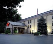
Hampton Inn Portage
TRAVEL INN PORTAGE
AFFORDABLE SUITES PORTAGE
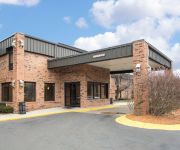
Quality Inn & Suites Portage
SPRING HOUSE INN
IN Country Inn and Suites by Radisson; Portage
Holiday Inn Express & Suites PORTAGE
BW PLUS PORTAGE HOTEL SUITES
Comfort Inn & Suites Porter
Rodeway Inn Portage
Videos from this area
These are videos related to the place based on their proximity to this place.
1969 Pleasant Meadows St. Portage, IN 46368
http://www.1stteamrealseate.net Call 219-309-9930 to schedule an appointment to see this property.
CR England Hotel stay First Night Burns Harbor Indiana hotel
Follow My journey from trucking School to driving Semi Truck over the Road, will post often so please subscribe to see the latest. This was my first night at Hotel of CR england in Burns...
CR England lobby & bus ride burns harbor
Follow My journey from trucking School to driving Semi Truck over the Road, will post often so please subscribe to see the latest. wanted to show everyone the lobby and how it was on school bus.
Golden Tee Replay on Desert Valley.
Dirty Shank took this shot while playing at THE MILL, BURNS HARBOR, IN!
Golden Tee Replay on Celtic Shores.
Dirty Shank took this shot while playing at THE MILL, BURNS HARBOR, IN!
Golden Tee Great Shot on Sparkling Waters!
liquor good hit an amazing shot at THE MILL, BURNS HARBOR, IN!
Golden Tee Great Shot on Rocky Hollow!
The Animal hits an amazing shot at THE MILL, BURNS HARBOR, IN!
Golden Tee Great Shot on Celtic Shores!
Shanked it hit an amazing shot at THE MILL, BURNS HARBOR, IN!
Golden Tee Replay on Pearl Lagoon
chipper took this shot while playing at THE MILL, BURNS HARBOR, IN.
Golden Tee Replay on Celtic Shores
Mr. Staples took this shot while playing at THE MILL, BURNS HARBOR, IN.
Videos provided by Youtube are under the copyright of their owners.
Attractions and noteworthy things
Distances are based on the centre of the city/town and sightseeing location. This list contains brief abstracts about monuments, holiday activities, national parcs, museums, organisations and more from the area as well as interesting facts about the region itself. Where available, you'll find the corresponding homepage. Otherwise the related wikipedia article.
Burns Harbor, Indiana
Burns Harbor is a town in Westchester Township, Porter County, Indiana, United States on the shores of Lake Michigan in Northwest Indiana and is part of the Chicago metropolitan area. The population was 1,156 at the 2010 census. Burns Harbor is located adjacent to the Indiana Dunes, an area that conservationists have fought hard to preserve.
USCGC Acacia (WLB-406)
The USCGC Acacia (WLB 406) was second to the last of a fleet of 39 similar 180-foot seagoing buoy tenders completed during World War II. The Acacia was named after the United States Lighthouse Service ship Acacia, the only Lighthouse Service vessel sunk during World War II. The Acacia is a multi-purpose vessel, nominally a buoy tender, but with equipment and capabilities for ice breaking, search and rescue, fire fighting, logistics, and other tasks as well.
Port of Indiana
The Port of Indiana-Burns Harbor is an industrial area, founded in 1965 and located on the Lake Michigan shore of Indiana at the intersection of U.S. Highway 12 and Indiana 249. The primary work done in the area is the manufacturing of steel, and the port area is dominated by steel mills. The port is divided between the municipalities of Burns Harbor and Portage.
Mammals of the Indiana Dunes
Mammals of the Indiana Dunes species of mammals have been identified at the Indiana Dunes National Lakeshore.
Invertebrates of the Indiana Dunes
The Indiana Dunes National Lakeshore is a National Park Service unit on the shore of Lake Michigan in Indiana, USA. A BioBlitz took place there on May 15 and 16, 2009. During that time, a list of organisms was compiled which included invertebrates.
Lost communities of Porter County, Indiana
The lost towns are a group of places that are still commonly used by county residents. Each was at one time a post office, a store the served a part of the county, a grain elevator used by farmers to shipping their crops, or a development that was or may still remain a unique designation. There may be a residential association or some other legal body for the area. More often, these communities are communities of people, who still refer to their homes by these geographic designations.
Bailly Generating Station
The Bailly Generating Station is a coal-fired electric generating plant located on the shore of Lake Michigan adjacent to the Port of Indiana. The plant, which began operation in 1962 and tripled its capacity in 1968, is owned and operated by the Northern Indiana Public Service Company (NIPSCO), an electric-utility operating division of the energy holding company NiSource. Since 1968, this plant has had a nameplate capacity of 604 megawatts.
Bailly Nuclear Power Plant
The Bailly Nuclear Power Plant was a nuclear power plant project to be located near the Indiana Dunes National Lakeshore in Porter County, Indiana, United States. The project was proposed by the Northern Indiana Public Service Company (NIPSCO) in 1967; however, it was cancelled in 1981. It was to have capacity one 644 MW boiling water reactor and it was expected to cost $1.8 billion. Construction started on January 1, 1974.


