Safety Score: 2,7 of 5.0 based on data from 9 authorites. Meaning we advice caution when travelling to United States.
Travel warnings are updated daily. Source: Travel Warning United States. Last Update: 2024-08-13 08:21:03
Explore Crows Nest
Crows Nest in Marion County (Indiana) with it's 76 inhabitants is located in United States about 492 mi (or 792 km) west of Washington DC, the country's capital.
Local time in Crows Nest is now 05:57 AM (Thursday). The local timezone is named America / Indiana / Indianapolis with an UTC offset of -5 hours. We know of 11 airports in the wider vicinity of Crows Nest, of which 5 are larger airports. The closest airport in United States is Indianapolis International Airport in a distance of 12 mi (or 19 km), South-West. Besides the airports, there are other travel options available (check left side).
Also, if you like golfing, there are multiple options in driving distance. We found 1 points of interest in the vicinity of this place. If you need a place to sleep, we compiled a list of available hotels close to the map centre further down the page.
Depending on your travel schedule, you might want to pay a visit to some of the following locations: Indianapolis, Noblesville, Lebanon, Danville and Franklin. To further explore this place, just scroll down and browse the available info.
Local weather forecast
Todays Local Weather Conditions & Forecast: 2°C / 35 °F
| Morning Temperature | 1°C / 33 °F |
| Evening Temperature | 1°C / 34 °F |
| Night Temperature | 2°C / 36 °F |
| Chance of rainfall | 0% |
| Air Humidity | 57% |
| Air Pressure | 1007 hPa |
| Wind Speed | Moderate breeze with 11 km/h (7 mph) from East |
| Cloud Conditions | Overcast clouds, covering 100% of sky |
| General Conditions | Rain and snow |
Thursday, 21st of November 2024
5°C (41 °F)
7°C (44 °F)
Broken clouds, moderate breeze.
Friday, 22nd of November 2024
10°C (49 °F)
7°C (45 °F)
Broken clouds, gentle breeze.
Saturday, 23rd of November 2024
12°C (53 °F)
12°C (54 °F)
Overcast clouds, gentle breeze.
Hotels and Places to Stay
UNIVERSITY PLACE CONFERENCE CENTER AND H
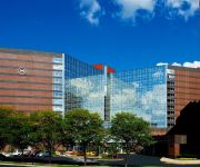
Sheraton Indianapolis Hotel at Keystone Crossing
Embassy Suites by Hilton Indianapolis North
Hyatt Place Indianapolis Keystone
Courtyard Indianapolis Carmel
THE VILLA INN
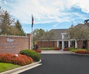
Homewood Suites by Hilton Indianapolis Keystone Crossing
Old Northside Bed & Breakfast
Holiday Inn INDIANAPOLIS CARMEL
Looking Glass Inn
Videos from this area
These are videos related to the place based on their proximity to this place.
Indianapolis Contractor Cliffs Construction builds Room Addition
Room Addition project completed in the Meridian Hills area of Indianapolis.
JDRF Ride to Cure Diabetes - Support TeamAlex!
Hello! This year, I'll be taking part in JDRF's Ride to Cure Diabetes, along with hundreds of other riders across the country to improve the lives of all people affected by type 1 diabetes...
Nike and Gable--Cute, Cozy and Lazy Dogs (Whippets)
Nike and Gable doing their thing...being cute and cozy!
2008.09.11 - Red Bull Motocross Stunts - Broad Ripple
After attending a book reading and author signing at Big Hat Books in the Broad Ripple area of Indianapolis, we noticed that a big chunk of Broad Ripple Avenue was blocked off and hundreds...
HopCat Broad Ripple Construction/Opening Time Lapse
HopCat Broad Ripple opened in Indianapolis, Indiana on Aug. 16, 2014 thanks to the tireless work of hundreds of men and women. This time-lapse captures the process of building HopCat beginning...
Union Jack Pub App - Broad Ripple, IN
Get the Union Jack Bar App. 924 Broad Ripple Ave. Indianapolis, Indiana 46220 http://www.unionjackpub-broadripple.com.
Lazer Party
Lazer Party at the Red Room in Broad Ripple presented by Nick Ford Party Dates: 11/26/14 12/6/14 12/13/14 Don't Miss this!
Candlebox - Indianapolis, IN - Far Behind.mp4
Filmed in Indianapolis, IN on February 4, 2012 at Broad Ripple Super Fest on the night before the Super Bowl.
Videos provided by Youtube are under the copyright of their owners.
Attractions and noteworthy things
Distances are based on the centre of the city/town and sightseeing location. This list contains brief abstracts about monuments, holiday activities, national parcs, museums, organisations and more from the area as well as interesting facts about the region itself. Where available, you'll find the corresponding homepage. Otherwise the related wikipedia article.
North Crows Nest, Indiana
North Crows Nest is an affluent town in Washington Township, Marion County, Indiana. The town is approximately 7 miles northwest of downtown Indianapolis. The town is adjacent to the neighboring community of Crows Nest. The population was 45 at the 2010 census. It has existed as an "included town" since 1970, when it was incorporated into Indianapolis as part of Unigov. It is part of Indianapolis, but retains town governmental powers under IC 36-3-1-11.
Rocky Ripple, Indiana
Rocky Ripple is a town in Marion County, Indiana. The population was 606 at the 2010 census. It has existed as an "included town" since 1970, when it was incorporated into Indianapolis as part of Unigov. It is part of Indianapolis, but retains a functioning town government under IC 36-3-1-11.
Crows Nest, Indiana
The Town of Crows Nest is located in Washington Township, Marion County, Indiana, approximately 7 miles northwest of downtown Indianapolis. The town is adjacent to the neighboring community of North Crows Nest. It includes two streets: Sunset Lane south of Kessler Boulevard and Questover Circle. The population was 73 at the 2010 census. It has existed as an "included town" since 1970, when it was incorporated into Indianapolis as part of Unigov.
Butler Bowl
Butler Stadium is a multi-purpose stadium in Indianapolis, Indiana, United States. It opened in 1928 and is home to the Butler University Bulldogs football and soccer teams. The original seating in the Butler Bowl was 36,000. It held games against the likes of the Four Horsemen of Notre Dame and Red Grange of Illinois. In 1955, the seating was reduced to 20,000 with the addition of the Hilton U. Brown Theater, and later renovations dropped seating capacity to below 6,000.
Hinkle Fieldhouse
Hinkle Fieldhouse is a basketball arena located on the campus of Butler University in Indianapolis, Indiana. When it was built in 1928, it was the largest basketball arena in the United States, and it retained that distinction until 1950. It is the sixth-oldest college basketball arena still in use, and it is a U.S. National Historic Landmark.
Holcomb Observatory and Planetarium
Holcomb Observatory and Planetarium is a part of Butler University in Indianapolis, Indiana. A small observatory was built on the Butler campus on the east side of Indianapolis. The campus moved to the north side of Indianapolis in 1928 and the old observatory was torn down. The telescope was reconditioned in the 1930s and remounted on the new campus, but sat unused until 1945. In 1953, benefactor James Irving Holcomb and his wife gave $325,000 for the construction of an observatory.
Butler–Tarkington, Indianapolis
Butler–Tarkington is a neighborhood on the north side of Indianapolis with the following borders: 38th Street and Crown Hill Cemetery to the south, the Central Canal and Westfield Boulevard to the north, Michigan Road to the west, and Meridian Street to the east. The neighborhood began as a farming settlement in the 1840s near what is now the intersection of 38th Street and Illinois Street. The settlement was called Mapleton due to the large number of maple trees in the area.
Meridian-Kessler, Indianapolis
Meridian-Kessler is a residential neighborhood located about 4 miles north of downtown Indianapolis. It is bounded on the north by Kessler Boulevard, on the east by the Monon Trail greenway corridor, on the south by 38th Street and to the west by Meridian Street. Meridian Street forms a shared boundary with the adjacent Butler-Tarkington neighborhood.


