Safety Score: 2,7 of 5.0 based on data from 9 authorites. Meaning we advice caution when travelling to United States.
Travel warnings are updated daily. Source: Travel Warning United States. Last Update: 2024-08-13 08:21:03
Touring Oakenwald
The district Oakenwald of Chicago in Cook County (Illinois) is a subburb located in United States about 592 mi west of Washington DC, the country's capital place.
Need some hints on where to stay? We compiled a list of available hotels close to the map centre further down the page.
Being here already, you might want to pay a visit to some of the following locations: Crown Point, Wheaton, Joliet, Waukegan and Valparaiso. To further explore this place, just scroll down and browse the available info.
Local weather forecast
Todays Local Weather Conditions & Forecast: -2°C / 28 °F
| Morning Temperature | -7°C / 20 °F |
| Evening Temperature | -2°C / 28 °F |
| Night Temperature | -3°C / 26 °F |
| Chance of rainfall | 0% |
| Air Humidity | 58% |
| Air Pressure | 1033 hPa |
| Wind Speed | Moderate breeze with 9 km/h (6 mph) from North-East |
| Cloud Conditions | Broken clouds, covering 67% of sky |
| General Conditions | Broken clouds |
Wednesday, 4th of December 2024
1°C (34 °F)
-6°C (21 °F)
Overcast clouds, fresh breeze.
Thursday, 5th of December 2024
-6°C (22 °F)
-5°C (23 °F)
Broken clouds, fresh breeze.
Friday, 6th of December 2024
-3°C (27 °F)
-3°C (27 °F)
Broken clouds, gentle breeze.
Hotels and Places to Stay
The Blackstone Autograph Collection
Palmer House a Hilton Hotel
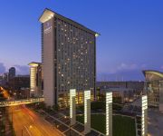
Hyatt Regency Mccormick Place
Marriott Marquis Chicago
The Wheeler Mansion
Hilton Chicago
The Buckingham Hotel
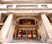
Chicago Old Colony
Ginosi Basics Loop Apartel
an Ascend Hotel Collection Member Hotel Blake
Videos from this area
These are videos related to the place based on their proximity to this place.
Robots at Automate, 2013, Chicago
A Stäuble pick and place robot moves at blinding speeds, even when filmed at 240 fps and a Apps engineer, Mark from Adept is one of the few who, with practice, can beat his robot. Very few...
Alvin Ellis can score: 6'4 SG Chicago De La Salle HS 2013 / Meanstreets basketball highlights
Alvin Ellis basketball highlights. Under the radar 6'4 Alvin Ellis plays for Chicago's De La Salle Meteors alongside fellow 2013 standouts Alex Foster and Gavin Schilling. He plays summer/AAU...
IIT Armour Institute - As Seen On Source Code
The Armour Institute Illinois Institute of Technology http://www.harboearch.com/getProject.php?projname=iitmainbuilding The Main Building, designed by Chicago architects Patton & Fisher,...
Chicago IIT Crown Hall by Mies van der Rohe
Chicago IIT Crown Hall by Mies van der Rohe, and a trip through the roof tube of Rem Koolhaas' student amenities building... the green line goes right through it!
Crown Hall (1956) - Ludwig Mies van der Rohe
S.R.Crown Hall Illinois Institute of Technology Campus Designed by Mies in 1956, Crown Hall cohesively represents his architectural concepts and theories in their most complete and mature...
Soundgarden - The Day I Tried To Live UIC Pavilion Chicago, IL July 16, 2011
"The Day I Tried To Live"
2014 Dodge Journey, Mopar and Jeep Walk-Thru at Chicago Auto Show 2014 #fuelCAS
VIP tour of the 2014 Dodge Journey display, Mopar '14 and Jeep Cherokee with key executives and engineers. Chicago Auto Show 2014 - #fuelCAS #CAS14.
Chicago, The windy City - Summer 2009
Este video presenta a la ciudad de los vientos, a Chicago, durante un recorrido en el centro de Chicago en verano del 2009. Aqui se puede apreciar una bella ciudad, con sus playas, sus calles,...
Videos provided by Youtube are under the copyright of their owners.
Attractions and noteworthy things
Distances are based on the centre of the city/town and sightseeing location. This list contains brief abstracts about monuments, holiday activities, national parcs, museums, organisations and more from the area as well as interesting facts about the region itself. Where available, you'll find the corresponding homepage. Otherwise the related wikipedia article.
Illinois Institute of Technology
Illinois Institute of Technology, commonly called Illinois Tech or IIT, is a private Ph.D. -granting university located in Chicago, in the U.S. state of Illinois, with programs in engineering, science, psychology, architecture, business, communications, industrial technology, information technology, design and law.
Shimer College
Shimer College is a very small, private, undergraduate liberal arts college in Chicago, Illinois, in the United States. Founded by Frances Wood Shimer in 1853 in the frontier town of Mt. Carroll, Illinois, it was a women's school for most of its first century. It joined with the University of Chicago (U. of C. ) in 1896, and became one of the first junior colleges in the country in 1907.
McCormick Tribune Campus Center
The McCormick Tribune Campus Center (MTCC) is a building on the main campus of the Illinois Institute of Technology, in the Bronzeville neighborhood on the south side of Chicago.
Camp Douglas (Chicago)
Camp Douglas, in Chicago, Illinois, was a Union Army prisoner-of-war camp for Confederate soldiers taken prisoner during the American Civil War. It was also a training and detention camp for Union soldiers. The Union Army first used the camp in 1861 as an organizational and training camp for volunteer regiments. It became a prisoner-of-war camp in early 1862. Later in 1862 the Union Army again used Camp Douglas as a training camp.
Old University of Chicago
The University of Chicago, now known as the Old University of Chicago (also called Chicago University), was a school founded by Baptists in Chicago in 1857. It eventually failed in 1886, and was succeeded by the present University of Chicago; its small number of alumni were later recognized by the current University of Chicago.
Michael Reese Hospital
Michael Reese Hospital and Medical Center was an American hospital founded in 1881. In its heyday, it was a major research and teaching hospital and one of the oldest and largest hospitals in Chicago, Illinois. It was located on the near south side of Chicago, next to Lake Shore Drive which lies along Lake Michigan.
De La Salle Institute
De La Salle Institute is a Catholic, Lasallian, secondary school located in the Bronzeville neighborhood on the South Side of Chicago, Illinois, United States. The school is currently housed on two separate campuses. The original school, now called the Institute Campus (Institute or Young Men's Campus) is for men. The newer Lourdes Hall Campus (Lourdes or Young Women's Campus) for women is located at 1040 W. 32nd Place. The school is considered a historic institution on Chicago's South Side.
35th–Bronzeville–IIT (CTA station)
35th–Bronzeville–IIT (formerly Tech–35th) is a station on the Chicago Transit Authority's 'L' system, located in the Chicago, Illinois neighborhood of Douglas and serving the Green Line. It is situated at 16 E 35th Street, just east of State Street. It opened on June 6, 1892. Currently, the station serves the historic neighborhood of Bronzeville as well as the Illinois Institute of Technology, and also U.S. Cellular Field, though the Red Line station of Sox–35th is closer.
Indiana (CTA station)
Indiana is a station on the Chicago Transit Authority's 'L' system, located in Chicago, Illinois and serving the Green Line. It is situated at 4003 S Indiana Avenue, two blocks east of State Street. It opened on August 15, 1892. Before the two lines closed, Indiana was a transfer station from the Englewood-Jackson Park Line to the Stock Yards and Kenwood branches of the CTA. Indiana is one of two stations on the 'L' that is built on an S-curve, with Sheridan on the Red Line being the other.
43rd (CTA station)
43rd is a station on the Chicago Transit Authority's 'L' system, located in Chicago, Illinois and serving the Green Line. It is situated at 314 E 43rd Street, three blocks east of State Street. It opened on August 15, 1892.
Burnham Park (Chicago)
Burnham Park is a public park in Chicago in Cook County, Illinois, United States. The park, which lines along six miles (9.66 km) of Lake Michigan shoreline, connects Grant Park at 14th Street to Jackson Park at 56th Street. The 598 acres of parkland is owned and managed by Chicago Park District. It was named for urban planner and architect Daniel Burnham in 1927. Burnham was one of the designers of the 1893 World's Columbian Exposition.
27th Street (Metra)
The 27th Street Station is a commuter rail station within the city of Chicago that serves the Metra Electric Line north to Millennium Station and south to University Park, Blue Island, and South Chicago. The station was originally built by the Illinois Central railroad (ICRR). It directly served Michael Reese Hospital until it closed in 2008. In 1972 it was the site of Chicago's worst rail disaster, the Illinois Central commuter rail crash.
Chicago Defender Building
The Chicago Defender Building is the former Jewish synagogue building that housed the Chicago Defender from 1920 until 1960. It was designated a Chicago Landmark on September 9, 1998. It is located in the Black Metropolis-Bronzeville District in the Douglas community area of Chicago, Illinois at 3435 S. Indiana Ave.
Wendell Phillips Academy High School
Wendell Phillips Academy High School (commonly known as Phillips) is a public 4-year high school located in the Bronzeville neighborhood on the southside of Chicago, Illinois, USA. It is part of the Chicago Public Schools and is managed by the Academy for Urban School Leadership. It is named for the noted American abolitionist Wendell Phillips. It was the first predominantly black high school in Chicago.
1972 Chicago commuter rail crash
The 1972 Chicago commuter rail crash, the worst in Chicago's history, occurred during the cloudy morning rush hour on October 30, 1972. Illinois Central Gulf train 416, made up of newly purchased Highliners, overshot the 27th Street Station on what is now the Metra Electric Line, and the engineer asked and received permission from the train's conductor to back the train to the platform. This move was then made without the flag protection required by the railroad's rules.
Calumet/Giles Prairie District
The Calumet/Giles Prairie District is a historic district in the South Side, Chicago community area of Chicago, Illinois, USA. The district was built between 1870 to 1910 by various architects. It was designated a Chicago Landmark on July 13, 1988.
Eliel House
The Eliel House is a house at 4122 South Ellis Avenue in Chicago, Illinois, United States. The house was built in 1886 by Adler & Sullivan for Mathilde Eliel. It was designated a Chicago Landmark on October 2, 1991.
Sunset Cafe
The Sunset Cafe, also known as The Grand Terrace Cafe, was a jazz club in Chicago, Illinois operating during the 1920s, 1930s and 1940s. It was one of the most important jazz clubs in America, especially during the period between 1917 and 1928 when Chicago became a creative capital of jazz innovation and again during the emergence of bebop in the early 1940s.
Soldiers' Home
The Soldiers' Home is an Italianate style house in Chicago, Illinois, United States. The Soldiers' House is located at 739 E. 35th St. The house was built in a series of phases from 1864 to 1923 by William W. Boyington and other various architects. It was designated a Chicago Landmark on April 16, 1996. The Soldiers' Home is the last surviving building with exact association to the Civil War. During the war the home served as a hospital for injured soldiers.
WIIT
WIIT is a radio station located at the Illinois Institute of Technology. Licensed to Chicago, Illinois, USA, it serves the Chicago area. The station is currently owned by Illinois Institute of Technology. The station has previously had its call letters forced to WOUI by a similar sounding radio station. The station eventually returned to its original call letters, WIIT, on February 23, 2001.
First Church of Christ, Scientist (Chicago, Illinois)
The former First Church of Christ, Scientist, built in 1897, is an historic Neo-Classical style church located at 4017 S. Drexel Boulevard in Chicago, Illinois. It was designed by noted Chicago-based architect Solon Spencer Beman, who was renowned for the churches and other buildings that he designed in the United States. In 1923 an Aeolian-Skinner organ was installed in the church. On May 7, 1950, Grant Memorial AME Church bought the building and is its present owner.
Dunbar Park (Chicago)
Dunbar Park is a park located at 300 East 31st Street in the south side of Chicago. The 20-acre site was acquired in 1962, and transformed into Dunbar Park between 1964 and 1966. It was named for poet Paul Laurence Dunbar.
Chicago Military Academy
Chicago Military Academy-Bronzeville is a public 4-year military high school located in the Bronzeville neighborhood located on the South Side of Chicago, Illinois, USA. The Academy includes a mandatory Junior Reserve Officers' Training Corps (JROTC) instructional component in addition to a four-year college preparatory curriculum.
Dunbar Vocational High School
Dunbar Vocational High School Address 3000 S. King Drive.
Ida B. Wells Homes
Ida B. Wells Homes was a Chicago Housing Authority (CHA) public housing project located in the Bronzeville neighborhood on the South Side of Chicago, Illinois, USA. It was bordered by Dr. Martin Luther King Drive on the west, Cottage Grove Avenue to the east, 37th Street to the north, and 39th Street (Pershing Road) to the south. The Ida B. Wells Homes consisted of rowhouses and mid- and high-rise apartment buildings and were constructed for African Americans in 1939–41.


