Safety Score: 2,7 of 5.0 based on data from 9 authorites. Meaning we advice caution when travelling to United States.
Travel warnings are updated daily. Source: Travel Warning United States. Last Update: 2024-08-13 08:21:03
Explore Grand Boulevard
The district Grand Boulevard of Chicago in Cook County (Illinois) is located in United States about 592 mi west of Washington DC, the country's capital.
If you need a place to sleep, we compiled a list of available hotels close to the map centre further down the page.
Depending on your travel schedule, you might want to pay a visit to some of the following locations: Crown Point, Wheaton, Joliet, Waukegan and Valparaiso. To further explore this place, just scroll down and browse the available info.
Local weather forecast
Todays Local Weather Conditions & Forecast: 7°C / 44 °F
| Morning Temperature | 6°C / 42 °F |
| Evening Temperature | 8°C / 46 °F |
| Night Temperature | 6°C / 43 °F |
| Chance of rainfall | 0% |
| Air Humidity | 60% |
| Air Pressure | 1017 hPa |
| Wind Speed | Gentle Breeze with 8 km/h (5 mph) from South-East |
| Cloud Conditions | Overcast clouds, covering 100% of sky |
| General Conditions | Overcast clouds |
Sunday, 24th of November 2024
9°C (47 °F)
10°C (51 °F)
Overcast clouds, light breeze.
Monday, 25th of November 2024
10°C (50 °F)
7°C (45 °F)
Light rain, moderate breeze, overcast clouds.
Tuesday, 26th of November 2024
3°C (37 °F)
2°C (35 °F)
Sky is clear, moderate breeze, few clouds.
Hotels and Places to Stay
The Blackstone Autograph Collection
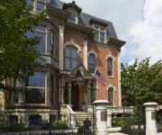
The Wheeler Mansion
Hilton Chicago
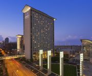
Hyatt Regency Mccormick Place
Marriott Marquis Chicago
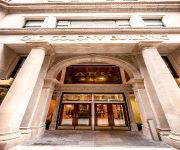
Chicago Old Colony
an Ascend Hotel Collection Member Hotel Blake
CONGRESS PLAZA HOTEL
BEST WESTERN GRANT PARK HOTEL
Welcome Inn Manor
Videos from this area
These are videos related to the place based on their proximity to this place.
Chicago Children's Museum
Take a tour of Chicago Children's Museum! Copyright 2010 Chicago Children's Museum.
Alvin Ellis can score: 6'4 SG Chicago De La Salle HS 2013 / Meanstreets basketball highlights
Alvin Ellis basketball highlights. Under the radar 6'4 Alvin Ellis plays for Chicago's De La Salle Meteors alongside fellow 2013 standouts Alex Foster and Gavin Schilling. He plays summer/AAU...
Chicago IIT Crown Hall by Mies van der Rohe
Chicago IIT Crown Hall by Mies van der Rohe, and a trip through the roof tube of Rem Koolhaas' student amenities building... the green line goes right through it!
WB Garden Update Early Spring 2015 Back Yard
Well it is finally warm, sort of! Most of the snow is gone except for a few patches here and there and things are emerging from the ground. The spring flowers have started to emerge and a few...
All Hallows Eve, All Souls Day Ritual Of Remembrance and Gratitude.
Here is the Remembrance and Gratitude Project I was working on. It's done. It was inspired from a ritual of making prayer ties when one has a vision quest or special ceremony to do like a sweat...
Chicago Gay Pride Parade 2013 - Slide Show
Well, another Pride Month has come and gone in Chicago and so much has happened Nationally regarding same sex marriage. Although we are grateful for the progress made regarding Same Sex ...
A condo garden grows in a Bronzeville food desert
I recently met with members of Rosenwald for All, a group of residents concerned that the local infrastructure is inadequate to support the redevelopment of the Rosenwald Apartments, 47th and...
Americas Beauty Show 2013-Demonstration (Part Two)
Jill Glaser of Make Up First ® School of Makeup Artistry demonstrates some of the current makeup trends for Spring/Summer 2013 at Americas Beauty Show.
WB Garden Early Summer 2 July 2nd Part 2
This focuses mostly on the Back Vegetable Herb Flower Community, it's a companion garden where many plants grow together, provide each other protection, attract pollinators and shade the soil...
Water Meter Installation: Chicago's New World Order
The City of Chicago's method to get property owners to install water meters is: Keep jacking up the non-metered flat rate until they cry "uncle", as I just did. The water meter was installed...
Videos provided by Youtube are under the copyright of their owners.
Attractions and noteworthy things
Distances are based on the centre of the city/town and sightseeing location. This list contains brief abstracts about monuments, holiday activities, national parcs, museums, organisations and more from the area as well as interesting facts about the region itself. Where available, you'll find the corresponding homepage. Otherwise the related wikipedia article.
Robert Taylor Homes
The Robert Taylor Homes was a Chicago Housing Authority (CHA) public housing project located in the Bronzeville neighborhood on the South Side of Chicago, on State Street between Pershing Road (39th Street) and 54th Street alongside the Dan Ryan Expressway.
Camp Douglas (Chicago)
Camp Douglas, in Chicago, Illinois, was a Union Army prisoner-of-war camp for Confederate soldiers taken prisoner during the American Civil War. It was also a training and detention camp for Union soldiers. The Union Army first used the camp in 1861 as an organizational and training camp for volunteer regiments. It became a prisoner-of-war camp in early 1862. Later in 1862 the Union Army again used Camp Douglas as a training camp.
DuSable High School
DuSable High School was a public 4-year high school located in the Bronzeville neighborhood on the south side of Chicago, Illinois USA. It was operated by Chicago Public Schools. The school was named after Chicago's first permanent non-native settler, Jean Baptiste Point du Sable. DuSable was built to accommodate the growing Phillips High School in the 1930s. The campus was renamed. DuSable's initial fame was in its music program.
Indiana (CTA station)
Indiana is a station on the Chicago Transit Authority's 'L' system, located in Chicago, Illinois and serving the Green Line. It is situated at 4003 S Indiana Avenue, two blocks east of State Street. It opened on August 15, 1892. Before the two lines closed, Indiana was a transfer station from the Englewood-Jackson Park Line to the Stock Yards and Kenwood branches of the CTA. Indiana is one of two stations on the 'L' that is built on an S-curve, with Sheridan on the Red Line being the other.
43rd (CTA station)
43rd is a station on the Chicago Transit Authority's 'L' system, located in Chicago, Illinois and serving the Green Line. It is situated at 314 E 43rd Street, three blocks east of State Street. It opened on August 15, 1892.
47th (CTA Green Line station)
47th is a station on the Chicago Transit Authority's 'L' system, located in Chicago, Illinois and serving the Green Line. It is situated at 314 E 47th Street, three blocks east of State Street. It opened on August 15, 1892.
51st (CTA station)
51st is a station on the Chicago Transit Authority's 'L' system, located in Chicago, Illinois and serving the Green Line. It is situated at 319 E 51st Street, three blocks east of State Street. It opened on August 28, 1892.
47th (CTA Red Line station)
47th is a station on the Chicago Transit Authority's 'L' system, serving the Red Line. The station is located in the median of the Dan Ryan Expressway north of the West 47th Street overpass in the Fuller Park neighborhood. Access to the station is available from a staircase from the middle of the north side of the overpass, where an open canopy crosswalk with traffic signals leads to a bus stop on the south side.
Savoy Ballroom (Chicago)
The Savoy Ballroom in Chicago, United States was opened on Thanksgiving Eve, November 23, 1927 at 4733 South Parkway. Originally featuring primarily Jazz artists, including Louis Armstrong, Count Basie, Duke Ellington, Earl Hines, Stan Kenton, Dizzy Gillespie, Ella Fitzgerald, Gene Krupa, Woody Herman, the Savoy also hosted other activities, such as boxing, figure skating, and basketball exhibitions featuring the Savoy Big Five, who would later change their name to the Harlem Globetrotters.
Al-Sadiq Mosque
The Al Sadiq Mosque (Wabash Mosque) was commissioned in 1922 in the Bronzeville neighborhood in city of Chicago. This mosque was funded with the money donated by African-American converts and Ahmadis in India.
Legends South
Legends South is proposed mixed-income housing development located in the Bronzeville neighborhood of the South Side of Chicago. It will include nearly 2,400 new mixed-income rental and home ownership units. In 1996 HOPE VI funds were granted specifically for Legends South to replace the infamous Robert Taylor Homes.
Wendell Phillips Academy High School
Wendell Phillips Academy High School (commonly known as Phillips) is a public 4-year high school located in the Bronzeville neighborhood on the southside of Chicago, Illinois, USA. It is part of the Chicago Public Schools and is managed by the Academy for Urban School Leadership. It is named for the noted American abolitionist Wendell Phillips. It was the first predominantly black high school in Chicago.
Hales Franciscan High School
Hales Franciscan High School is a private, Roman Catholic high school in Chicago, Illinois, USA. It is located in the Roman Catholic Archdiocese of Chicago.
North Kenwood District
The North Kenwood District is a historic district in the Kenwood community area of Chicago, Illinois. It includes the 4500-block of South Berkeley, as well as surrounding historic structures in an area bounded by 43rd Street, 47th Street, Cottage Grove, and the Illinois Central Railroad tracks. The area was designated a Chicago Landmark district on June 9, 1993. The Kenwood Evangelical Church, which is listed on the National Register of Historic Places is in this neighborhood.
Harold Washington Cultural Center
Harold Washington Cultural Center is a performance facility located in the Grand Boulevard community area of Chicago in Cook County, Illinois, United States. It was named after Chicago's first African-American Mayor Harold Washington and opened August 17, 2004 ten years after initial groundbreaking. In addition to the 1000 seat Com-Ed Theatre, the center offers a Digital Media Resource Center.
Eliel House
The Eliel House is a house at 4122 South Ellis Avenue in Chicago, Illinois, United States. The house was built in 1886 by Adler & Sullivan for Mathilde Eliel. It was designated a Chicago Landmark on October 2, 1991.
Kenwood Astrophysical Observatory
The Kenwood Astrophysical Observatory was the personal observatory of George Ellery Hale, constructed by his father, William E. Hale, in 1890 at the family home in the Kenwood section of Chicago. It was here that the spectroheliograph, which Hale had invented while attending MIT, was first put to practical use; and it was here that Hale established the Astrophysical Journal.
First Church of Christ, Scientist (Chicago, Illinois)
The former First Church of Christ, Scientist, built in 1897, is an historic Neo-Classical style church located at 4017 S. Drexel Boulevard in Chicago, Illinois. It was designed by noted Chicago-based architect Solon Spencer Beman, who was renowned for the churches and other buildings that he designed in the United States. In 1923 an Aeolian-Skinner organ was installed in the church. On May 7, 1950, Grant Memorial AME Church bought the building and is its present owner.
Provident Hospital (Chicago)
Provident Hospital, the first Black-owned and operated hospital in America, was established in Chicago in 1891 by Dr. Daniel Hale Williams an African American surgeon during the time in American history where few public or private medical facilities were open to Black citizens.
King College Prep High School
Dr. Martin Luther King, Jr. College Preparatory High School (commonly known as King College Prep) is a public 4-year selective enrollment magnet high school located in the Kenwood neighborhood on the south side of Chicago, Illinois, USA. King is one of the Chicago Public School System's eight selective enrollment schools, which means that its approximately 900 students must apply for acceptance, based on academic achievement and test scores.
Bronzeville Scholastic Institute
Bronzeville Scholastic Institute is a public 4-year high school in the Bronzeville neighborhood on the south side of Chicago, Illinois. It is located on the DuSable Campus, and shares a building with Daniel Hale Williams Preparatory School of Medicine and DuSable Leadership Academy.
Regal Theater, South Side (Chicago)
The Regal Theater, located in the heart of Bronzeville on Chicago's south side, was an important night club and music venue in Chicago. Part of the Balaban and Katz chain, the lavishly decorated venue, with plush carpeting and velvet drapes featured some of the most celebrated black entertainers in America. The Regal also featured motion pictures and live stage shows.
Chicago Military Academy
Chicago Military Academy-Bronzeville is a public 4-year military high school located in the Bronzeville neighborhood located on the South Side of Chicago, Illinois, USA. The Academy includes a mandatory Junior Reserve Officers' Training Corps (JROTC) instructional component in addition to a four-year college preparatory curriculum.
Dyett Academic Center
Dyett Academic Center (commonly known as Dyett High School) is a public 4-year high school located in the Bronzeville neighborhood on the south side of Chicago, Illinois, USA. It is part of the Chicago Public Schools. It's named for American violinist and music educator Walter Henri Dyett. The school opened as an elementary school in 1972 before becoming a neighborhood high school in 1999.
Ida B. Wells Homes
Ida B. Wells Homes was a Chicago Housing Authority (CHA) public housing project located in the Bronzeville neighborhood on the South Side of Chicago, Illinois, USA. It was bordered by Dr. Martin Luther King Drive on the west, Cottage Grove Avenue to the east, 37th Street to the north, and 39th Street (Pershing Road) to the south. The Ida B. Wells Homes consisted of rowhouses and mid- and high-rise apartment buildings and were constructed for African Americans in 1939–41.


