Safety Score: 2,7 of 5.0 based on data from 9 authorites. Meaning we advice caution when travelling to United States.
Travel warnings are updated daily. Source: Travel Warning United States. Last Update: 2024-08-13 08:21:03
Delve into Chinatown
The district Chinatown of Chicago in Cook County (Illinois) is a district located in United States about 593 mi west of Washington DC, the country's capital town.
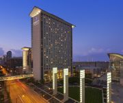
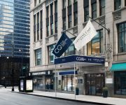
In need of a room? We compiled a list of available hotels close to the map centre further down the page.
Since you are here already, you might want to pay a visit to some of the following locations: Wheaton, Crown Point, Waukegan, Joliet and Geneva. To further explore this place, just scroll down and browse the available info.
Local weather forecast
Todays Local Weather Conditions & Forecast: -2°C / 28 °F
| Morning Temperature | -7°C / 20 °F |
| Evening Temperature | -2°C / 28 °F |
| Night Temperature | -3°C / 26 °F |
| Chance of rainfall | 0% |
| Air Humidity | 58% |
| Air Pressure | 1033 hPa |
| Wind Speed | Moderate breeze with 9 km/h (6 mph) from North-East |
| Cloud Conditions | Broken clouds, covering 67% of sky |
| General Conditions | Broken clouds |
Wednesday, 4th of December 2024
1°C (34 °F)
-6°C (21 °F)
Overcast clouds, fresh breeze.
Thursday, 5th of December 2024
-6°C (22 °F)
-5°C (23 °F)
Broken clouds, fresh breeze.
Friday, 6th of December 2024
-3°C (27 °F)
-3°C (27 °F)
Broken clouds, gentle breeze.
Hotels and Places to Stay
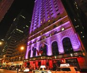
The Blackstone Autograph Collection
W Chicago City Center
JW Marriott Chicago
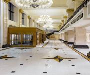
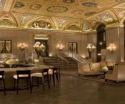
Palmer House a Hilton Hotel
Marriott Marquis Chicago
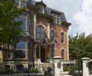
The Wheeler Mansion
Hyatt Regency Mccormick Place
Hilton Chicago
Central Loop Club Quarters
Holiday Inn & Suites CHICAGO-DOWNTOWN
Videos from this area
These are videos related to the place based on their proximity to this place.
One Day in Chicago
Discover the windy city with exploratory timelapse of Chicago. There's a quote hiding in the video that says "Make Life One Long Weekend" and we totally agree-- one long weekend, one long ...
Chinatown, Chicago
Ryan and Kelly do some exploring in Chicago's Chinatown! We visit a bulk goods store, a couple gift shops, MingHin Cuisine and Chinatown Square.
Railfanning Metra and Amtrak on Chicago's Near South Side
Descriptions of each train are in the captions in the video. Got some pretty good action today in and around Amtrak and Metra's Canal St Yard and shop complex, mostly from above on the 18th...
Chicago Machine Pro Lacrosse Highlights
Come see Chicago machine professional lacrosse (Major League Lacrosse) at Toyota Park 15 minutes southwest of downtown Chicago. Tix and info www.chicagomachine.com. Home opener is May ...
Chicago Coffee Review E3: Overflow Coffee Bar
VISIT US! www.chicagocoffeereview.com INSTAGRAM @chicagocoffeereview TWITTER @chicoffeereview Please SUBSCRIBE! Overflow Coffee Bar is situated in the South Loop with convenient ...
Navy Pier Carousel
Very short little video of the carousel at Navy Pier in Chicago. Taken on July 14th, 2010.
Chicago skyline, the view from East Pilsen
View Chicago's skyline from several unusual vantage points along the Chicago River in East Pilsen's industrial corridor.
Crossing the Canal St. Bridge and Entering the Yard
Crossing the Canal St. Bridge and Entering the Yard.
Amtrak Train crossing Canal Street Railroad Bridge from canoe.
Saturday, July 18, 2009, paddling our canoe through downtown Chicago we crossed under a rare vertical lift bridge. This bridge was originally built for the Pennsylvania Railroad in 1915 by...
Videos provided by Youtube are under the copyright of their owners.
Attractions and noteworthy things
Distances are based on the centre of the city/town and sightseeing location. This list contains brief abstracts about monuments, holiday activities, national parcs, museums, organisations and more from the area as well as interesting facts about the region itself. Where available, you'll find the corresponding homepage. Otherwise the related wikipedia article.
Battle of Fort Dearborn
The Battle of Fort Dearborn (also known as the Fort Dearborn Massacre) was an engagement between United States troops and Potawatomi Indians that occurred on August 15, 1812, near Fort Dearborn in what is now Chicago, Illinois, but was then part of the Illinois Territory. The battle, which occurred during the War of 1812, followed the evacuation of the fort as ordered by William Hull, commander of the United States Army of the Northwest.
Everleigh Club
The Everleigh Club was a high-class brothel which operated in Chicago, Illinois from February 1900 until October 1911. It was owned and operated by Ada and Minna Everleigh.
Chinatown, Chicago
The Chinatown neighborhood in Chicago, Illinois, is on the South Side (located in the Armour Square community area), centered on Cermak and Wentworth Avenues, and is an example of an American Chinatown, or ethnic-Chinese neighborhood. By the 2000 Census, Chicago Primary Metropolitan Statistical Areas has 68,021 Chinese. Chicago is the second oldest settlement of Chinese in America after the Chinese fled persecution in California.
Chicago Coliseum
The Chicago Coliseum was the name applied to three large indoor arenas in Chicago, Illinois, which stood successively from the 1860s to 1982; they served as venues for sports events, large (national-class) conventions and as exhibition halls. The first Coliseum stood at State and Washington streets in Chicago’s downtown in the late 1860s. The second, at 63rd Street near Stony Island Avenue in the south side's Woodlawn community, hosted the 1896 Democratic National Convention.
Pacific Garden Mission
Pacific Garden Mission is a homeless shelter in the South Loop section of Chicago, Illinois, founded in 1877, by Colonel George Clarke and his wife, Sarah. It has been nicknamed, "The Old Lighthouse. " It is the oldest such shelter in Chicago. According to the PGM website, "Pacific Garden Mission is the oldest, continuously operating rescue mission in the country. " Among the converts to Christ from PGM's efforts are the famous evangelists Billy Sunday and Mel Trotter.
23rd Street Grounds
23rd Street Grounds, also known as State Street Grounds and 23rd Street Park, and sometimes spelled out as Twenty-third Street Grounds, was a ballpark in Chicago, Illinois. In it, the Chicago White Stockings played baseball from 1874 to 1877, the first two years in the National Association and the latter two in the National League.
Pui Tak Center
The Pui Tak Center, formerly known as the On Leong Merchants Association Building, is a building located in Chicago's Chinatown. Designed by architects Christian S. Michaelsen and Sigurd A. Rognstad, the building was built for the On Leong Merchants Association and opened in 1928. The Association used it as an immigrant assistance center, and the building was informally referred to as Chinatown's "city hall".
McCormick Place (Metra)
The McCormick Place Station is a commuter rail station in Chicago underneath McCormick Place, Chicago's main convention center, that serves the Metra Electric Line north to the Millennium Station and south to University Park, Blue Island, and South Chicago; and the South Shore Line to Gary and South Bend, Indiana. The South Shore Line stops here on weekends only.
Cermak–Chinatown (CTA station)
Cermak–Chinatown is a station on the Chicago Transit Authority's 'L' system, serving the Red Line. The station is adjacent to Chicago's Chinatown neighborhood and contains many elements of Chinese culture in its architecture.
Central Station, Chicago
Currently, Central Station refers to a neighborhood within the Near South Side, Chicago community area (neighborhood) in Chicago, Illinois, USA. Once 69 acres, and later 72 acres, the City of Chicago planned development is now 80 acres . It encompasses the former rail yards and air space rights east of Indiana Avenue between Roosevelt Road and 18th Street. It also now encompasses the strip between Michigan and Indiana Avenues.
2003 E2 nightclub stampede
The E2 nightclub stampede occurred on February 17, 2003, at the E2 nightclub located above the Epitome Chicago restaurant in Chicago, Illinois, in which 21 people died and more than 50 were injured when panic ensued from the use of pepper spray by security guards to break up a fight. The club's owners, Dwain Kyles and Calvin Hollins, were later convicted of criminal contempt for their persistent failure to keep the facility up to code, and sentenced to two years in prison.
Ping Tom Memorial Park
Ping Tom Memorial Park is a 17.24-acre public urban park in Chicago's Chinatown, owned and operated by the Chicago Park District (CPD). Located on the south bank of the Chicago River, the park is divided into three sections by a Santa Fe rail track and 18th Street. Currently, only development in the area south of 18th Street has been completed. It was designed by Ernest C. Wong of Site Design Group and features a pagoda-style pavilion, bamboo gardens, and a playground.
18th Street (Metra)
The 18th Street Station is a commuter rail station within the city of Chicago that serves the Metra Electric Line north to Millennium Station and south to University Park, Blue Island, and South Chicago. The station is occasionally served by trains of the South Shore Line to Gary and South Bend, Indiana, on an exceptional basis for Chicago Bears home games during football season. The station was originally built by the Illinois Central railroad (ICRR).
27th Street (Metra)
The 27th Street Station is a commuter rail station within the city of Chicago that serves the Metra Electric Line north to Millennium Station and south to University Park, Blue Island, and South Chicago. The station was originally built by the Illinois Central railroad (ICRR). It directly served Michael Reese Hospital until it closed in 2008. In 1972 it was the site of Chicago's worst rail disaster, the Illinois Central commuter rail crash.
Henry B. Clarke House
The Henry B. Clarke House is a Greek Revival style house in Chicago, Illinois, United States. Henry Brown Clarke was a native of New York State who had come to Chicago in 1833 with his wife, Caroline Palmer Clarke, and his family. He entered into the hardware business with William Jones and Byram King, establishing King, Jones and Company, and provided building materials to the growing Chicago populace.
Schoenhofen Brewery Historic District
The Schoenhofen Brewery Historic District is centered around the former site of the Peter Schoenhofen Brewing Company at 18th and Canalport Avenue in the Pilsen neighborhood of Chicago, Illinois. Beginning in the mid-1880s, Peter Schoenhofen was among a group of brewers in Chicago who transformed production methods and utilized expanding transportation options. By 1900, there were sixty Chicago breweries that collectively produced over 100 million gallons of beer per year.
Chinatown Square
Chinatown Square is a two-story outdoor mall located in Chinatown, Chicago, a mile (1.6 km) from the center of Chicago just north of the main Wentworth Avenue District (the main Chinatown Street). Chinatown Square, on 45 acres of reclaimed land from a former railroad yard, houses mostly restaurants, retail space, boutiques, banks, clinics, beauty shops, and a handful of offices. This outdoor mall is the largest Chinese mall in the US east of San Francisco and west of New York City.
St. Charles Air Line Bridge
The St. Charles Air Line Bridge is a Strauss Trunnion bascule bridge which spans the Chicago River in Chicago, Illinois. Built as part of the St. Charles Air Line Railroad by the American Bridge Company in 1919, the bridge originally had a span of 260 feet . This bridge held the world record for longest bascule-type span until 1930, when it was shortened to 220 feet during a relocation as a result of straightening the river channel.
Arie Crown Theater
The Arie Crown Theater was named after Lithuanian immigrant Arie Crown, who was the father of Henry Crown, the American industrialist and philanthropist. The theater is situated on Lake Shore Drive, Chicago. It opened in 1960, with seating for 5,000 people, one of the largest seating capacities in Chicago. The theater is part of the McCormick Place convention facility, owned by the Metropolitan Pier and Exposition Authority. The theatre was damaged by a fire in 1967 and was closed until 1971.
Canal Street railroad bridge
The Canal Street railroad bridge (or Pennsylvania Railroad bridge) is a vertical-lift bridge across the south branch of the Chicago River in Chicago, Illinois. When it was constructed in 1914, its 1500-ton main span was the heaviest of any vertical lift bridge in the United States. It is the only vertical-lift bridge across the Chicago River, and it was designated a Chicago Landmark on December 12, 2007.
Dunbar Park (Chicago)
Dunbar Park is a park located at 300 East 31st Street in the south side of Chicago. The 20-acre site was acquired in 1962, and transformed into Dunbar Park between 1964 and 1966. It was named for poet Paul Laurence Dunbar.
Dunbar Vocational High School
Dunbar Vocational High School Address 3000 S. King Drive.
Dearborn Homes
Dearborn Homes is a Chicago Housing Authority (CHA) public housing project located in the Bronzeville neighborhood on the South Side of Chicago, Illinois. It is located on State Street between 27th and 30th Streets.
Harold Ickes Homes
Harold Ickes Homes was a Chicago Housing Authority (CHA) public housing project in the Bronzeville neighborhood of the South Side of Chicago, Illinois. It is bordered between State Street and Federal Avenue and Cermak Road and 25th Street.
Roosevelt (CTA station)
Roosevelt is a station on the Chicago Transit Authority's 'L' system, located in between the Chicago Loop and the Near South Side in Chicago, Illinois. It is situated at 1167 S State Street, just north of Roosevelt Road, and serves the Red, Green and Orange lines. The station is also the closest 'L' station to the Museum Campus of Chicago and Soldier Field, which are about ½ mile to the east. The Museum Campus/11th Street Metra station is also about ⅓ miles to the east.


