Safety Score: 2,7 of 5.0 based on data from 9 authorites. Meaning we advice caution when travelling to United States.
Travel warnings are updated daily. Source: Travel Warning United States. Last Update: 2024-08-13 08:21:03
Touring Punahou
Punahou in Honolulu County (Hawaii) is a town located in United States about 4,828 mi (or 7,769 km) west of Washington DC, the country's capital place.
Time in Punahou is now 10:24 PM (Wednesday). The local timezone is named Pacific / Honolulu with an UTC offset of -10 hours. We know of 8 airports nearby Punahou, of which one is a larger airport. The closest airport in United States is Honolulu International Airport in a distance of 6 mi (or 9 km), West. Besides the airports, there are other travel options available (check left side).
Also, if you like the game of golf, there are several options within driving distance. We collected 2 points of interest near this location. Need some hints on where to stay? We compiled a list of available hotels close to the map centre further down the page.
Being here already, you might want to pay a visit to some of the following locations: Honolulu, Waimanalo, Wailuku, Lihue and Hilo. To further explore this place, just scroll down and browse the available info.
Local weather forecast
Todays Local Weather Conditions & Forecast: 26°C / 78 °F
| Morning Temperature | 25°C / 76 °F |
| Evening Temperature | 25°C / 77 °F |
| Night Temperature | 25°C / 77 °F |
| Chance of rainfall | 0% |
| Air Humidity | 77% |
| Air Pressure | 1019 hPa |
| Wind Speed | Strong breeze with 19 km/h (12 mph) from South-West |
| Cloud Conditions | Few clouds, covering 22% of sky |
| General Conditions | Light rain |
Thursday, 31st of October 2024
26°C (78 °F)
25°C (76 °F)
Scattered clouds, fresh breeze.
Friday, 1st of November 2024
26°C (79 °F)
25°C (77 °F)
Light rain, moderate breeze, broken clouds.
Saturday, 2nd of November 2024
26°C (78 °F)
25°C (77 °F)
Light rain, moderate breeze, overcast clouds.
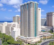
Hotels and Places to Stay
PRINCE WAIKIKI
DoubleTree by Hilton Alana - Waikiki Beach
WAIKIKI MARINA RESORT
The Grand Islander by Hilton Grand Vacations
Grand Waikikian by Hilton Grand Vacations
Hilton Grand Vacations at Hilton Hawaiian Village
ALA MOANA HOTEL
OAKWOOD AT WAIKIKI
Oakwood at Waikiki
ExecuStay at Ilikai
Videos from this area
These are videos related to the place based on their proximity to this place.
MISSAO HAWAII 2011- Rodolpho nos altos montes de Honolulu
Lugar perfeito para contemplar a criacao e adorar a Jesus !!! Que visual incrivel, presenca Dele.
Bus tour of Honolulu Oahu Hawaii on the way to Pearl Harbor
http://ourvideosite.com/View/V2980 Bus tour of Oahu, Hawaii. It's not all a tropical paradise.
Waiola Shave Ice Honolulu Hawaii by Discover808.com
Waiola Shave Ice Honolulu Hawaii by Discover808.com. We found this place off of McCully in Kaimuki in 1985 when we lived on Algaroba street. It was our first Hawaiian Shave ice and while we...
Thunderbolt Ala Wai Park, Honolulu 3/1/07
HONOLULU- Thunderbolt at Ala Wai Park recorded Thu 3/1/07 at 11:45 AM. Temperature High 83 Low 71 Partly cloudy Wind NE 18.4 mph.
Funky bicycle ride through Moiliili neighborhood streets in Honolulu Hawaii 2014
Riding pedaling bike through Moiliili district in Honolulu. Cycling on Date street and Citron st. City life clear sunny weather late morning. Relaxing laid back Hawaii.
Stacie Caires & Muzik Makerz Superstar 02-20-2013
Awesome live performance of Stacie & her band at King's Korner in Mo'ili'ili-Honolulu, HI with a gifted female keyboardist sitting in. I'm not sure, but I think she plays for the Society Of...
Brug Bakery 1year Anniversary! ブルクベーカリー1周年記念イベント
アラモアナセンター、シロキヤのブルベーカリー1周年記念イベントが行われました。 Brug Bakery, the Hokkaido-origin popular bakery shop in Shirokiya, Ala Moana...
Relson Gracie Jiu-Jitsu Team HK: Todd's Paper Cutter Chokes
Relson Gracie Jiu-Jitsu Black Belt Todd Tanaka demonstrates the traditional and modern ways to execute the Paper Cutter Choke as taught to him by Relson Gracie and Saulo Ribeiro. http://www.
Only Hope ~ Punahou Class of 2005
Only Hope Performed by the Punahou Class of 2005 [repost] Jonathan Foreman; Arranged by David Kauahikaua.
Videos provided by Youtube are under the copyright of their owners.
Attractions and noteworthy things
Distances are based on the centre of the city/town and sightseeing location. This list contains brief abstracts about monuments, holiday activities, national parcs, museums, organisations and more from the area as well as interesting facts about the region itself. Where available, you'll find the corresponding homepage. Otherwise the related wikipedia article.
Honolulu Stadium
Honolulu Stadium was a stadium located in the Moʻiliʻili district of Honolulu, Hawai'i, at the corner of King and Isenberg Streets. It was opened in 1926 and demolished in 1976. It was the primary sports venue in Hawai'i preceding Aloha Stadium. Famous athletes who competed in Honolulu Stadium include Babe Ruth, Joe DiMaggio (hit a home run out of the park in 1944) and Jesse Owens. Irving Berlin performed at Honolulu Stadium in 1945.
Hawaii Convention Center
The Hawai‘i Convention Center (HCC) is a premier convention and exhibition center in Hawaii, located in Honolulu on the island of Oahu. The Hawaii Convention Center is the largest exhibition center of its type in the state. It is located directly to the west of the Waikiki district of Honolulu.
Maryknoll School
Maryknoll School is a private, coeducational Catholic Christian school serving children in pre-kindergarten through twelfth grade in Honolulu, Hawaiʻi. The school is located on the island of Oʻahu and is administered by the Diocese of Honolulu in association with its original founders, the Maryknoll Society of brothers and priests and the Maryknoll Congregation, also called the Maryknoll Sisters. The school started out as a one-story wood frame building containing four classrooms.
Makiki
Makiki is an area of Honolulu, Hawaiʻi located northeast of downtown Honolulu generally stretching east to west from Punahou Street to Pensacola Street and north to south from Round Top Drive/Makiki Heights Drive to Lunalilo Freeway. Punchbowl, an extinct tuff cone, and Tantalus, tower over the Makiki neighborhood. The geographic layout of this area is primarily older houses, smaller apartment buildings, and side streets.
KHON-TV
KHON-TV is a Fox-affiliated television station in Honolulu, Hawaii owned by the LIN TV Corporation. The station broadcasts on virtual channel 2. In addition to its Honolulu broadcast facilities, KHON has relays on all the major Hawaiian Islands to rebroadcast programs outside of metropolitan Honolulu: KHAW-TV channel 11 in Hilo; KAII-TV channel 7 in Wailuku; and low-power K55DZ channel 55 in Lihue. KHON can also be seen statewide on Oceanic Time Warner Cable analog channel 3.
President Theodore Roosevelt High School
President Theodore Roosevelt High School is a public, co-educational college preparatory high school of the Hawaiʻi State Department of Education and serves grades nine through twelve. Roosevelt High School is accredited by the Western Association of Schools and Colleges.
Hawaii Medical Service Association
Hawaii Medical Service Association (HMSA) is a nonprofit health insurer in the state of Hawaii. HMSA was founded in 1938, is an independent licensee of the Blue Cross Blue Shield Association, and is the largest insurer in the state of Hawaii serving more than 700,000 people.
George Mavrothalassitis
George Mavrothalassitis is a chef and restaurateur known as one of the cofounders of Hawaii Regional Cuisine in the early 1990s. Mavrothalassitis is particularly known for individual pairings of wines with each dish in a multicourse meal.
Punahou Circle apartments
Punahou Circle apartments is a 10-story apartment building at 1617 S. Beretania Street in the Makiki neighborhood of Honolulu, Hawaii. The building was one of the childhood homes of Barack Obama, who is currently the President of the United States. Obama lived in the building from 1971 to 1979 when he graduated high school. It was built in 1965. The building is being considered for landmark status.
John Mott-Smith
John Mott-Smith (1824–1895) was the first dentist to set up a permanent practice in the Kingdom of Hawaii. He was also a politician, newspaper editor, and diplomat.
William Patterson Alexander
William Patterson Alexander (1805–1884) was an American missionary to the Kingdom of Hawaii. His family continued to influence the history of Hawaii.
Samuel Gardner Wilder
Samuel Gardner Wilder (1831–1888) was an American shipping magnate and politician who developed a major transportation company in the Kingdom of Hawaii.


