Safety Score: 2,7 of 5.0 based on data from 9 authorites. Meaning we advice caution when travelling to United States.
Travel warnings are updated daily. Source: Travel Warning United States. Last Update: 2024-08-13 08:21:03
Explore Manoa
Manoa in Honolulu County (Hawaii) is a city in United States about 4,826 mi (or 7,766 km) west of Washington DC, the country's capital.
Local time in Manoa is now 10:23 PM (Wednesday). The local timezone is named Pacific / Honolulu with an UTC offset of -10 hours. We know of 8 airports in the vicinity of Manoa, of which one is a larger airport. The closest airport in United States is Honolulu International Airport in a distance of 8 mi (or 12 km), West. Besides the airports, there are other travel options available (check left side).
Also, if you like golfing, there are multiple options in driving distance. We found 2 points of interest in the vicinity of this place. If you need a place to sleep, we compiled a list of available hotels close to the map centre further down the page.
Depending on your travel schedule, you might want to pay a visit to some of the following locations: Honolulu, Waimanalo, Wailuku, Lihue and Hilo. To further explore this place, just scroll down and browse the available info.
Local weather forecast
Todays Local Weather Conditions & Forecast: 26°C / 78 °F
| Morning Temperature | 25°C / 76 °F |
| Evening Temperature | 25°C / 77 °F |
| Night Temperature | 25°C / 77 °F |
| Chance of rainfall | 0% |
| Air Humidity | 77% |
| Air Pressure | 1019 hPa |
| Wind Speed | Strong breeze with 19 km/h (12 mph) from South-West |
| Cloud Conditions | Few clouds, covering 22% of sky |
| General Conditions | Light rain |
Thursday, 31st of October 2024
26°C (78 °F)
25°C (76 °F)
Scattered clouds, fresh breeze.
Friday, 1st of November 2024
26°C (79 °F)
25°C (77 °F)
Light rain, moderate breeze, broken clouds.
Saturday, 2nd of November 2024
26°C (78 °F)
25°C (77 °F)
Light rain, moderate breeze, overcast clouds.
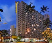
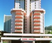
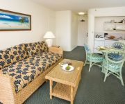
Hotels and Places to Stay
The Ritz-Carlton Residences Waikiki Beach
DoubleTree by Hilton Alana - Waikiki Beach
WAIKIKI SAND VILLA HOTEL
Hilton Garden Inn Waikiki Beach
Ambassador Hotel Waikiki
COCONUT WAIKIKI HOTEL
Wyndham Royal Garden at Waikiki
ILIMA HOTEL
THE SURFJACK HOTEL
PRIORITY SUITES OF HAWAII
Videos from this area
These are videos related to the place based on their proximity to this place.
MISSAO HAWAII 2011- Rodolpho nos altos montes de Honolulu
Lugar perfeito para contemplar a criacao e adorar a Jesus !!! Que visual incrivel, presenca Dele.
DSA siren test Palolo Valley Field 5/29/07
HONOLULU- DSA siren test at Palolo Valley Field recorded Tuesday 5/29/07 at about 9:50 a.m. http://www.yelp.com/biz/palolo-valley-district-park-honolulu Temperature High 88 Low 72 Temperature...
[FULL HD] View at the overlook Pu'u Ualaka'a State Wayside Park Tantalus Round Top Drive
http://yesnomads.com/ The scenic overlook inside the park is located along the Round Top and Tantalus Drive. From Honolulu you can reach the overlook within a 20min car journey. Just head to...
[FULL HD] Aussicht Pu'u Ualaka'a State Wayside Park Tantalus Round Top Drive
http://yesnomads.com/de/ Dieser Aussichtspunkt befindet sich im Park entlang des Tantalus & Round Top Drives. Von Honolulu aus erreicht Ihr den Aussichtspunkt mit dem Auto in ca. 20 Minuten....
Building KIPO Honolulu, Part One
This shows the mid-stage of construction of the new KIPO-FM transmitter facility, atop Pu`u O`hi`a (Tantalus), 2000 feet above Honolulu. And a short hike to the summit, and a view of Honolulu...
volcanoes vs paniolos 2014 game 2
Hawaii Gridiron League Honolulu Volcanoes vs Pearl City Paniolos in the second match up of the season.
Hawaii sightseeing up Tantalus Mountain with Mini Cooper
A scenic drive up to the top of the beautiful Tantalus, overlooking Honolulu and Waikiki beach.
Tantalus on Yamaha WR250X with go pro hd
Trying out my go pro hd for the first time. Not bad in the rain either.
Legendary status conferred to Chuck Gee
Chuck Gee Chuck Yim Gee, the former longtime dean of the University of Hawaiʻi at Mānoa School of Travel Industry Management, is now a member of a very small and distinguished group—the...
Videos provided by Youtube are under the copyright of their owners.
Attractions and noteworthy things
Distances are based on the centre of the city/town and sightseeing location. This list contains brief abstracts about monuments, holiday activities, national parcs, museums, organisations and more from the area as well as interesting facts about the region itself. Where available, you'll find the corresponding homepage. Otherwise the related wikipedia article.
Hawaii
Hawaii is the most recent of the 50 U.S. states (joined the Union on August 21, 1959), and is the only U.S. state made up entirely of islands. It is the northernmost island group in Polynesia, occupying most of an archipelago in the central Pacific Ocean. Hawaii’s diverse natural scenery, warm tropical climate, abundance of public beaches, oceanic surroundings, and active volcanoes make it a popular destination for tourists, surfers, biologists, and volcanologists alike.
Republic of Hawaii
The Republic of Hawaii was the formal name of the government that controlled Hawaii from 1894 to 1898 when it was run as a republic. The republic period occurred between the administration of the Provisional Government of Hawaii which ended on July 4, 1894, and the adoption of the Newlands Resolution in the United States Congress in which the Republic was annexed to the United States and became the Territory of Hawaii on July 7, 1898.
Institute for Astronomy
Not to be confused with the Institute for Astronomy of the University of Edinburgh School of Physics and Astronomy. The Institute for Astronomy (IfA) is a research unit within the University of Hawaii system, led by Günther Hasinger as Director. IfA main headquarters are located at 2680 Woodlawn Drive in Honolulu, Hawaii, {{#invoke:Coordinates|coord}}{{#coordinates:21|18|27|N|157|48|41|W|type:landmark_region:US-HI |primary |name= }}, on the University of Hawaii at Mānoa campus.
Manoa
Mānoa /mɑːˈnoʊ. ə/ is a valley and a residential neighborhood of Honolulu, Hawaiʻi. The neighborhood is approximately three miles east and inland from downtown Honolulu and less than a mile from Ala Moana and Waikīkī at {{#invoke:Coordinates|coord}}{{#coordinates:21|18.87916|N|157|48.4846|W||| |primary |name= }}. Similar to many Honolulu neighborhoods, Mānoa consists of an entire valley, running from Mānoa Falls at the mauka (inland-most) end to King Street.
Lyon Arboretum
The Harold L. Lyon Arboretum is a 200-acre arboretum and botanical garden managed by the University of Hawaiʻi at Mānoa located at the upper end of Mānoa Valley in Hawaiʻi. Much of the Arboretum's botanical collection consists of an artificial lowland tropical rainforest with numerous trails and small water features.
Saint Francis School
Saint Francis School Address 2707 Pamoa Road Honolulu, Hawaii, 96822 22x20px United States Coordinates coord}}{{#coordinates:21.304778|-157.813400|type:edu_region:US-HI primary name= }} Information Type Private, Coeducational Motto Quality Catholic Education in a Spirit of Joy. Religious affiliation(s) Catholic Church (Franciscan Patron saint Saint Francis of Assisi Established 1924 Founder Sisters of Saint Francis Asst. Principal Mrs.
Mid-Pacific Institute
Mid-Pacific Institute is a private, co-educational college preparatory school for grades Pre-K and K-12, offering programs of study in the International Baccalaureate Diploma Programme and the Mid-Pacific School of the Arts (MPSA). Mid-Pacific Institute is located on 34 acres in Manoa, near the University of Hawaiʻi, close to downtown Honolulu. The college was established through the 1908 merger of Kawaiahaʻo Seminary for Girls, founded in 1864, and Mills Institute for Boys, founded in 1892.
Henry E. Cooper
Henry Ernest Cooper (1857–1929) was a lawyer who became prominent in Hawaiian politics in the 1890s.
Noelani Elementary School
Noelani Elementary School is a public elementary school located in Honolulu, Hawaiʻi.
Palolo, Hawaii
Pālolo is a valley, stream, and residential neighborhood of Honolulu, Hawaii, United States. It lies approximately four miles east and inland from downtown Honolulu, and less than a mile from Diamond Head. Like many of Hawaii's neighborhoods, Pālolo consists of an entire valley. The mauka (mountain-side) of the valley is agricultural in nature. The makai (ocean-side) of the valley ends approximately at Waialae Avenue and is densely settled, mostly with single-family homes.
Hamilton Library (Hawaii)
The Hamilton Library is the largest research library in the state of Hawaii. It was designed by George Hogan who designed numerous houses on the island including Plantation Estate which is used by Barack Obama as his Winter White House.
Samuel Northrup Castle
Samuel Northrup Castle (1808–1894) was a businessman and politician in the Kingdom of Hawaii.


!['[FULL HD] View at the overlook Pu'u Ualaka'a State Wayside Park Tantalus Round Top Drive' preview picture of video '[FULL HD] View at the overlook Pu'u Ualaka'a State Wayside Park Tantalus Round Top Drive'](https://img.youtube.com/vi/km1msinDtcE/mqdefault.jpg)
!['[FULL HD] Aussicht Pu'u Ualaka'a State Wayside Park Tantalus Round Top Drive' preview picture of video '[FULL HD] Aussicht Pu'u Ualaka'a State Wayside Park Tantalus Round Top Drive'](https://img.youtube.com/vi/8VYKZiuaVxw/mqdefault.jpg)


