Safety Score: 2,7 of 5.0 based on data from 9 authorites. Meaning we advice caution when travelling to United States.
Travel warnings are updated daily. Source: Travel Warning United States. Last Update: 2024-08-13 08:21:03
Delve into Indrio
Indrio in Saint Lucie County (Florida) is a city located in United States about 809 mi (or 1,302 km) south of Washington DC, the country's capital town.
Current time in Indrio is now 02:41 AM (Sunday). The local timezone is named America / New York with an UTC offset of -5 hours. We know of 8 airports closer to Indrio, of which 4 are larger airports. The closest airport in United States is St Lucie County International Airport in a distance of 2 mi (or 3 km), South-West. Besides the airports, there are other travel options available (check left side).
Also, if you like playing golf, there are some options within driving distance. We saw 1 points of interest near this location. In need of a room? We compiled a list of available hotels close to the map centre further down the page.
Since you are here already, you might want to pay a visit to some of the following locations: Ft Pierce, Vero Beach, Stuart, Okeechobee and West Palm Beach. To further explore this place, just scroll down and browse the available info.
Local weather forecast
Todays Local Weather Conditions & Forecast: 21°C / 71 °F
| Morning Temperature | 14°C / 57 °F |
| Evening Temperature | 19°C / 66 °F |
| Night Temperature | 18°C / 65 °F |
| Chance of rainfall | 0% |
| Air Humidity | 54% |
| Air Pressure | 1022 hPa |
| Wind Speed | Light breeze with 5 km/h (3 mph) from West |
| Cloud Conditions | Clear sky, covering 0% of sky |
| General Conditions | Sky is clear |
Sunday, 24th of November 2024
23°C (74 °F)
20°C (68 °F)
Sky is clear, gentle breeze, clear sky.
Monday, 25th of November 2024
23°C (74 °F)
20°C (68 °F)
Sky is clear, gentle breeze, clear sky.
Tuesday, 26th of November 2024
23°C (74 °F)
21°C (69 °F)
Sky is clear, gentle breeze, clear sky.
Hotels and Places to Stay
Beachfront Inn
ROYAL INN BEACH HUTCHINSON ISLAND
Dockside Inn & Resort
Hutchinson Island Plaza Hotel and Suites
FOUNTAIN RESORT
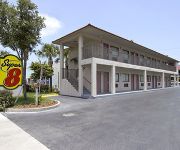
SUPER 8 FT. PIERCE
Rendezvous Resort
Videos from this area
These are videos related to the place based on their proximity to this place.
Manatees in Crisis, Oceanography Presentation (2013)
A brief video that illustrates how the loss of sea grass in Indian River Lagoon is taking a toll on the Florida manatee population. A chart in the video, provided by St. Johns River Water Managemen...
King Air 300 Ft. Pierce landing
Landing at Ft. Pierce to clear customs returning from Marsh Harbour, Abao, Bahamas, May 2009.
1996 Lincoln Town Car Used Cars Ft. Pierce FL
http://www.megscarsllc.com This 1996 Lincoln Town Car is available from Megs Cars LLC. For details, call us at 772-409-4321.
The Trip of a Lifetime
After months of flight training from the Aviator College, Giuseppe and Ruben decided to fly themselves all the way from Florida to California and back. This is their adventure while building...
KFPR Full Stop Taxibacks on RWY28R with PA28
Shortly before takeoff from RWY14 we were advised of wind changes and cleared to join a left base for RWY28R. We then kept performing right traffic full stop taxibacks on RWY28R with a final...
Videos provided by Youtube are under the copyright of their owners.
Attractions and noteworthy things
Distances are based on the centre of the city/town and sightseeing location. This list contains brief abstracts about monuments, holiday activities, national parcs, museums, organisations and more from the area as well as interesting facts about the region itself. Where available, you'll find the corresponding homepage. Otherwise the related wikipedia article.
St. Lucie, Florida
St. Lucie is a village in St. Lucie County, Florida, United States. The population was 604 at the 2000 census. As of 2004, the population recorded by the U.S. Census Bureau is 597 http://www. census. gov/popest/cities/tables/SUB-EST2004-04-12. xls. It is part of the Port St. Lucie Metropolitan Statistical Area.
WPHR-FM
WPHR-FM (94.7 FM, "Rush Radio 94.7") is an American radio station licensed in Gifford, Florida, serving the Vero Beach / Fort Pierce market. The station, owned and operated by the Aloha Stations Trust, airs talk shows. On January 25, 2008, it was announced that the station, then licensed as WSYR-FM, was one of several Clear Channel radio stations to be sold, in order to remain under the ownership caps following the sale of Clear Channel to private investors.
St. Lucie County International Airport
St. Lucie County International Airport is a public airport located three miles (5 km) northwest of the central business district of Fort Pierce, a city in St. Lucie County, Florida, United States. It is owned by the St. Lucie Board of County Commissioners. The airport sees frequent use by various aviation flight schools in south Florida, including three based at the airport, for general aviation flight training traffic.
North Hutchinson Island
North Hutchinson Island, Florida is an Atlantic coastal barrier island, lying north of the Fort Pierce Inlet in St. Lucie County, Florida. It is separated from the mainland by the Indian River Lagoon. North of the county line between St Lucie and Indian River counties, it is known as Orchid Island. In order to avoid confusion, this article deals only with North Hutchinson Island in St. Lucie County.
Spanish River (Florida)
The Spanish River is a former fresh-water stream which once flowed through Boca Raton, Florida. It was originally known as "Boca Raton's Lagoon" but settlers renamed it the "Old Spanish River. " It has since been channeled into the Intracoastal Waterway. People joke that "no one in town can find it" but in fact the stream bed is still visible in Spanish River Park.


