Safety Score: 2,7 of 5.0 based on data from 9 authorites. Meaning we advice caution when travelling to United States.
Travel warnings are updated daily. Source: Travel Warning United States. Last Update: 2024-08-13 08:21:03
Delve into Lamond Riggs
Lamond Riggs in Washington County (District of Columbia) is a city located in United States a little north of Washington DC, the country's capital town.
Current time in Lamond Riggs is now 06:35 AM (Thursday). The local timezone is named America / New York with an UTC offset of -5 hours. We know of 8 airports closer to Lamond Riggs, of which 4 are larger airports. The closest airport in United States is Ronald Reagan Washington National Airport in a distance of 8 mi (or 13 km), South. Besides the airports, there are other travel options available (check left side).
There is one Unesco world heritage site nearby. It's Monticello and the University of Virginia in Charlottesville in a distance of 70 mi (or 112 km), South. Also, if you like playing golf, there are some options within driving distance. We saw 10 points of interest near this location. In need of a room? We compiled a list of available hotels close to the map centre further down the page.
Since you are here already, you might want to pay a visit to some of the following locations: Washington DC, Arlington, Alexandria, Falls Church and Rockville. To further explore this place, just scroll down and browse the available info.
Local weather forecast
Todays Local Weather Conditions & Forecast: 9°C / 48 °F
| Morning Temperature | 5°C / 41 °F |
| Evening Temperature | 7°C / 45 °F |
| Night Temperature | 3°C / 38 °F |
| Chance of rainfall | 2% |
| Air Humidity | 48% |
| Air Pressure | 1002 hPa |
| Wind Speed | Moderate breeze with 12 km/h (7 mph) from South-East |
| Cloud Conditions | Clear sky, covering 3% of sky |
| General Conditions | Moderate rain |
Thursday, 21st of November 2024
4°C (40 °F)
5°C (42 °F)
Rain and snow, moderate breeze, overcast clouds.
Friday, 22nd of November 2024
8°C (46 °F)
9°C (49 °F)
Scattered clouds, moderate breeze.
Saturday, 23rd of November 2024
10°C (49 °F)
9°C (48 °F)
Overcast clouds, gentle breeze.
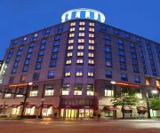
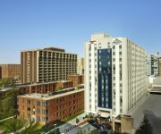
Hotels and Places to Stay
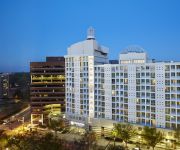
DoubleTree by Hilton Washington DC - Silver Spring
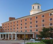
College Park Marriott Hotel & Conference Center
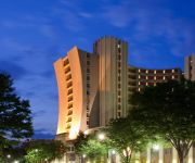
Sheraton Silver Spring Hotel
Eden Park Guest House
Birdhouse Bed and Breakfast
Homewood Suites by Hilton Washington DC NoMa Union Station
Hampton Inn Washington DC NoMa Union Station
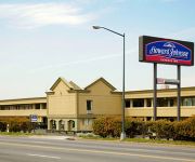
HOWARD JOHNSON INN WASHINGTON
Courtyard Silver Spring Downtown
Hampton Inn Silver Spring
Videos from this area
These are videos related to the place based on their proximity to this place.
Takoma Park MD Real Estate : 5 Secret Ways to Finance Your Home in Maryland
Takoma Park Homes For Sale Here : http://www.reallynicehomes.com/takoma-park-homes-sale-5-secret-ways-buy-home-and-save-money/ Secret Ways to Finance Your Home with The Neighborhood ...
Food Truck Fridays in Takoma Park
Short documentary produced as part of Docs In Progress Intro to Documentary Production class by Lisa Fanning and John Filson. Topic is the food truck revolution in Takoma Park, MD.
Brand New Technology at Takoma Park Dentist Office
http://www.takomaparkdentist.com - Dr. Hines is constantly updating the technology in his office. His new inter oral camera enables him to provide the highest quality of oral health! Takoma...
What are tooth colored fillings? Takoma Park Dentist
http://www.takomaparkdentist.com - Dr. Hines a dentist in Takoma Park - talks about tooth colored fillings or white fillings. Takoma Dentist Practice Premier Dental Care Daniel S. Hines, D.D.S....
Are Silver Fillings Safe? Takoma Park Dentist
http://www.takomaparkdentist.com - Dr. Hines a dentist in Takoma Park - talks about silver fillings, their safety and alternatives. Takoma Dentist Practice Premier Dental Care Daniel S. Hines,...
Oral Cancer Takoma Park Dentist
http://www.takomaparkdentist.com - Dr. Hines a dentist in Takoma Park answers the questions - Do you scan for oral cancer? How? Takoma Dentist Practice Premier Dental Care Daniel S. Hines,...
Fear of Dentist - Takoma Park Dentist 202-723-2400
http://www.takomaparkdentist.com - Dr. Hines a dentist in Takoma Park - talks about fear of the dentist. Takoma Dentist Practice Premier Dental Care Daniel S. Hines, D.D.S. 405 Butternut Street,...
Dental X-rays, are they safe? Takoma Park Dentist
http://www.takomaparkdentist.com - Dr. Hines a dentist in Takoma Park - talks about the safety of dental x-rays. Takoma Dentist Practice Premier Dental Care Daniel S. Hines, D.D.S. 405 Butternut...
Missing Teeth - Takoma Park Dentist 202-723-2400
http://www.takomaparkdentist.com - Takoma Park Dentist Dr. Hines, discusses whether or not missing a tooth will have a negative impact on your oral health. Takoma Dentist Practice Premier...
Takoma Park 4th of July Parade 2014 (In One Minute)
The Takoma Park 4th of July Parade in Takoma Park, Maryland on July 4, 2014 viewed in one single minute.
Videos provided by Youtube are under the copyright of their owners.
Attractions and noteworthy things
Distances are based on the centre of the city/town and sightseeing location. This list contains brief abstracts about monuments, holiday activities, national parcs, museums, organisations and more from the area as well as interesting facts about the region itself. Where available, you'll find the corresponding homepage. Otherwise the related wikipedia article.
Takoma (WMATA station)
Takoma is a Washington Metro station in Washington, D.C. on the Red Line. It is the last station within the District of Columbia on the eastern end of the line.
Northeast, Washington, D.C
Northeast (NE or N.E. ) is the northeastern quadrant of Washington, D.C. , the capital of the United States, and is located north of East Capitol Street and east of North Capitol Street. Northeast neighborhoods include Brentwood, Brookland, Ivy City, Marshall Heights, Pleasant Hill, Stanton Park, Trinidad, Michigan Park, Riggs Park, Fort Totten, Fort Lincoln, Edgewood, Deanwood, Kenilworth, and Woodridge, as well as much of Capitol Hill.
Queens Chapel
Queens Chapel is a residential neighborhood on the northeastern edge of Washington, D.C. , United States, bounded by Galloway Street NE to the south, Eastern Avenue to the east, South Dakota Avenue to the west, and Riggs Road to the north. It was named for early landowner Mr. Queen. The neighborhood is close to The Catholic University of America.
New Hampshire Avenue
New Hampshire Avenue is a diagonal street in Washington, D.C. , beginning at the Kennedy Center and extending northeast for about 5 miles (8 km) and then continuing into Maryland where it is designatedMaryland Route 650. New Hampshire Avenue, however, is not contiguous. It stops at 15th and W Streets NW and resumes again on the other side of Columbia Heights at Park Road NW, a few blocks from Georgia Avenue.
Manor Park, Washington, D.C
Manor Park is a neighborhood in northwest Washington, D.C.. The National Capital Planning Commission 1967 "District Communities" map indicates this neighborhood is roughly bounded by Fifth Street NW on the west, North Capitol Street and Blair Road on the east, Aspen Street to the north, and Missouri Avenue NW to the south. In 1940, the Manor Park Citizens Association deemed the boundaries to be Eighth Street, Whittier Street, North Capitol Street, and Concord Street (now Missouri Avenue).
Washington Theological Union
Washington Theological Union (WTU) is a Roman Catholic graduate school of theology and ministry in Washington, D.C. in the United States, with a mission of educating and forming candidates for the priesthood and other church ministries. WTU is accredited by the Association of Theological Schools in the United States and Canada (ATS). WTU is a member of the Washington Theological Consortium.
Fort Stevens Ridge
Fort Stevens Ridge is a neighborhood in Northwest Washington, D.C. built during the 1920s. The neighborhood comprises about 50 acres and is very roughly bounded by Peabody Street, Fifth Street, Underwood Street, and Ninth Street. As of the 2010 census, the neighborhood had 2,597 residents. It was named for nearby Fort Stevens, a Civil War-era fort used to defend the nation's capital from invasion by Confederate soldiers.
Takoma Park Police Department
The Takoma Park Police Department (TPPD) is the primary law enforcement agency servicing a population of 17,229 within 2.5 square miles of the municipality of Takoma Park, Maryland. Until July 1, 1997, the TPPD was aided by both the Prince George's County Police and the Montgomery County Police as the city was divided within the two counties. After that date, the municipality was moved to become contained entirely within Montgomery County by a move of the Maryland General Assembly.
Eastern Avenue (Washington, D.C.)
Eastern Avenue is one of three boundary streets between Washington, D.C. , and the state of Maryland. It follows a northwest-to-southeast line, beginning at the intersection of 16th Street NW (a north-south street in the District of Columbia) and Colesville Road (a street in Montgomery County in the state of Maryland). It intersects with Blair Road NW, and ceases to exist for about 1,000 feet (305 metres). Another interruption occurs at Cedar Street NW.
June 2009 Washington Metro train collision
The June 2009 Washington Metro train collision was a subway train-on-train collision between two southbound Red Line Washington Metro trains during the afternoon rush hour of June 22, 2009, in Northeast, Washington, D.C. , United States. A moving train collided with a train stopped ahead of it; the train operator and eight passengers were killed, making it the deadliest crash in the history of the Washington Metro. Several survivors were trapped for hours, and approximately 80 were injured.
Coolidge Senior High School (Washington, DC)
Calvin Coolidge High School is a public high school located in the Northwest quadrant of the District of Columbia.
Whittier Education Campus
J.G. Whittier Education Campus is a public school located in the Northwest quadrant of the District of Columbia.


