Safety Score: 2,7 of 5.0 based on data from 9 authorites. Meaning we advice caution when travelling to United States.
Travel warnings are updated daily. Source: Travel Warning United States. Last Update: 2024-08-13 08:21:03
Explore Brightwood
Brightwood in Washington County (District of Columbia) is located in United States a little north of Washington DC, the country's capital.
Local time in Brightwood is now 04:29 PM (Saturday). The local timezone is named America / New York with an UTC offset of -4 hours. We know of 8 airports in the wider vicinity of Brightwood, of which 4 are larger airports. The closest airport in United States is Ronald Reagan Washington National Airport in a distance of 8 mi (or 12 km), South. Besides the airports, there are other travel options available (check left side).
There is one Unesco world heritage site nearby. It's Monticello and the University of Virginia in Charlottesville in a distance of 69 mi (or 111 km), South. Also, if you like golfing, there are multiple options in driving distance. We found 10 points of interest in the vicinity of this place. If you need a place to sleep, we compiled a list of available hotels close to the map centre further down the page.
Depending on your travel schedule, you might want to pay a visit to some of the following locations: Washington DC, Arlington, Alexandria, Falls Church and Rockville. To further explore this place, just scroll down and browse the available info.
Local weather forecast
Todays Local Weather Conditions & Forecast: 14°C / 57 °F
| Morning Temperature | 9°C / 48 °F |
| Evening Temperature | 15°C / 59 °F |
| Night Temperature | 12°C / 53 °F |
| Chance of rainfall | 0% |
| Air Humidity | 40% |
| Air Pressure | 1028 hPa |
| Wind Speed | Gentle Breeze with 8 km/h (5 mph) from South |
| Cloud Conditions | Overcast clouds, covering 100% of sky |
| General Conditions | Overcast clouds |
Saturday, 2nd of November 2024
14°C (58 °F)
10°C (50 °F)
Overcast clouds, light breeze.
Sunday, 3rd of November 2024
15°C (60 °F)
14°C (57 °F)
Overcast clouds, gentle breeze.
Monday, 4th of November 2024
19°C (65 °F)
18°C (64 °F)
Overcast clouds, gentle breeze.
Hotels and Places to Stay
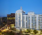
DoubleTree by Hilton Washington DC - Silver Spring
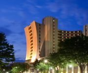
Sheraton Silver Spring Hotel
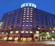
Washington Marriott Wardman Park
Omni Shoreham Hotel
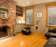
Birdhouse Bed and Breakfast
Courtyard Silver Spring Downtown
Central Townhouse Apartments
Hampton Inn Silver Spring
Homewood Suites by Hilton Silver Spring
Eden Park Guest House
Videos from this area
These are videos related to the place based on their proximity to this place.
Brand New Technology at Takoma Park Dentist Office
http://www.takomaparkdentist.com - Dr. Hines is constantly updating the technology in his office. His new inter oral camera enables him to provide the highest quality of oral health! Takoma...
What are tooth colored fillings? Takoma Park Dentist
http://www.takomaparkdentist.com - Dr. Hines a dentist in Takoma Park - talks about tooth colored fillings or white fillings. Takoma Dentist Practice Premier Dental Care Daniel S. Hines, D.D.S....
Are Silver Fillings Safe? Takoma Park Dentist
http://www.takomaparkdentist.com - Dr. Hines a dentist in Takoma Park - talks about silver fillings, their safety and alternatives. Takoma Dentist Practice Premier Dental Care Daniel S. Hines,...
Oral Cancer Takoma Park Dentist
http://www.takomaparkdentist.com - Dr. Hines a dentist in Takoma Park answers the questions - Do you scan for oral cancer? How? Takoma Dentist Practice Premier Dental Care Daniel S. Hines,...
Fear of Dentist - Takoma Park Dentist 202-723-2400
http://www.takomaparkdentist.com - Dr. Hines a dentist in Takoma Park - talks about fear of the dentist. Takoma Dentist Practice Premier Dental Care Daniel S. Hines, D.D.S. 405 Butternut Street,...
Dental X-rays, are they safe? Takoma Park Dentist
http://www.takomaparkdentist.com - Dr. Hines a dentist in Takoma Park - talks about the safety of dental x-rays. Takoma Dentist Practice Premier Dental Care Daniel S. Hines, D.D.S. 405 Butternut...
Missing Teeth - Takoma Park Dentist 202-723-2400
http://www.takomaparkdentist.com - Takoma Park Dentist Dr. Hines, discusses whether or not missing a tooth will have a negative impact on your oral health. Takoma Dentist Practice Premier...
Dr. Hines, DDS - Takoma Park Dentist
http://www.takomaparkdentist.com/ Dr. Daniel Hines welcomes Martha (a new patient) to the Takoma Park neighborhood. Takoma Park Dentist Office: Premier Denta...
Takoma Park, DC - Patient Testimonial
http://www.takomaparkdentist.com - Patient Testimonial for Dr. Hines, a dentist in Takoma Park. Takoma Dentist Practice Premier Dental Care Daniel S. Hines, ...
Takoma Park Dentist New iTero Technology
http://www.takomaparkdentist.com - Dr. Hines, a Takoma dentist now has new itero technology. itero enables the doctor to take a 3D digital scan of the patien...
Videos provided by Youtube are under the copyright of their owners.
Attractions and noteworthy things
Distances are based on the centre of the city/town and sightseeing location. This list contains brief abstracts about monuments, holiday activities, national parcs, museums, organisations and more from the area as well as interesting facts about the region itself. Where available, you'll find the corresponding homepage. Otherwise the related wikipedia article.
Battle of Fort Stevens
The Battle of Fort Stevens was an American Civil War battle fought July 11–12, 1864, in Northwest Washington, D.C. , as part of the Valley Campaigns of 1864 between forces under Confederate Lt. Gen. Jubal A. Early and Union Maj. Gen. Alexander McD. McCook. Although Early caused consternation in the Union government, reinforcements under Maj. Gen. Horatio G.
Paul Public Charter School
Paul Public Charter School is a charter school in northwest Washington, D.C.. It is located at 5800 Eighth Street NW, at the intersection of Eighth and Olglethorpe Streets. The school opened its doors as a public charter junior high school in 2000. It has students from sixth through ninth grade and is named in honor of Edward Paul.
WDCW
WDCW is the CW-affiliated television station for Washington, D.C. It broadcasts a high definition digital signal on UHF channel 50 from a transmitter atop the Hughes Memorial Tower in the city's Brightwood section. Owned by the Tribune Company, the station maintains studios on Wisconsin Avenue Northwest in the Glover Park section of Washington D.C.
WCSP-FM
WCSP-FM, also known as C-SPAN Radio, is a radio station licensed to the Cable-Satellite Public Affairs Network (C-SPAN) in Washington, D.C. The station broadcasts on 90.1 MHz and is on-air 24 hours a day. Its studios are located near Capitol Hill in C-SPAN’s headquarters. In addition to WCSP-FM, C-SPAN Radio programming is also available online at c-span. org and via satellite radio on XM 119 (previously 132).
Brightwood (Washington, D.C.)
Brightwood is a neighborhood located in the northwestern quadrant of Washington, D.C. Brightwood and the rest of Ward 4 are represented in the Council of the District of Columbia by Muriel Bowser.
Fort Stevens (Washington, D.C.)
Fort Stevens was part of the extensive fortifications built around Washington, D.C. , during the American Civil War. It was constructed in 1861 as "Fort Massachusetts" and later enlarged by the Union Army and renamed "Fort Stevens" after Brig. Gen. Isaac Ingalls Stevens, who was killed at the Battle of Chantilly, Virginia, on September 1, 1862. The fort came under direct Confederate attack by troops led by Maj. Gen. Jubal Early in the Battle of Fort Stevens on July 11 and July 12, 1864.
Hughes Memorial Tower
The Hughes Memorial Tower is a radio tower located in Washington, D.C. at 6001 Georgia Avenue, near the intersection of 9th Street, NW, and Peabody Street, NW. Built on January 15, 1989, the tower is positioned at {{#invoke:Coordinates|coord}}{{#coordinates:38|57|47|N|77|1|36|W|scale:10000 |primary |name= }} and at an elevation of 87.7 m above mean sea level. The tower is owned by the District of Columbia Office of Property Management.
Brightwood Park
Brightwood Park is a small neighborhood in Northwest Washington, D.C. in the USA. The neighborhood is bounded by Georgia Avenue NW to the west, Missouri Avenue NW to the northeast and Emerson Street NW to the south. It is located in Ward 4, which is represented in the Council of the District of Columbia by Muriel Bowser. Brightwood Park is largely characterized by rowhouses, detached and semi-detached houses, and small neighborhood businesses.
Fort Stevens Ridge
Fort Stevens Ridge is a neighborhood in Northwest Washington, D.C. built during the 1920s. The neighborhood comprises about 50 acres and is very roughly bounded by Peabody Street, Fifth Street, Underwood Street, and Ninth Street. As of the 2010 census, the neighborhood had 2,597 residents. It was named for nearby Fort Stevens, a Civil War-era fort used to defend the nation's capital from invasion by Confederate soldiers.
Coolidge Senior High School (Washington, DC)
Calvin Coolidge High School is a public high school located in the Northwest quadrant of the District of Columbia.
Whittier Education Campus
J.G. Whittier Education Campus is a public school located in the Northwest quadrant of the District of Columbia.
Brightwood Education Campus
Brightwood Education Campus is a public school located in the Northwest quadrant of the District of Columbia.


