Safety Score: 2,7 of 5.0 based on data from 9 authorites. Meaning we advice caution when travelling to United States.
Travel warnings are updated daily. Source: Travel Warning United States. Last Update: 2024-08-13 08:21:03
Delve into Orchard Manor
Orchard Manor in Sussex County (Delaware) is located in United States about 102 mi (or 164 km) east of Washington DC, the country's capital town.
Current time in Orchard Manor is now 09:05 AM (Thursday). The local timezone is named America / New York with an UTC offset of -5 hours. We know of 10 airports close to Orchard Manor, of which 5 are larger airports. The closest airport in United States is Salisbury Ocean City Wicomico Regional Airport in a distance of 25 mi (or 41 km), South-West. Besides the airports, there are other travel options available (check left side).
There is one Unesco world heritage site nearby. It's Independence Hall in a distance of 95 mi (or 153 km), North. Also, if you like playing golf, there are some options within driving distance. We encountered 6 points of interest near this location. If you need a hotel, we compiled a list of available hotels close to the map centre further down the page.
While being here, you might want to pay a visit to some of the following locations: Georgetown, Snow Hill, Salisbury, Cape May Court House and Princess Anne. To further explore this place, just scroll down and browse the available info.
Local weather forecast
Todays Local Weather Conditions & Forecast: 10°C / 50 °F
| Morning Temperature | 6°C / 43 °F |
| Evening Temperature | 8°C / 46 °F |
| Night Temperature | 5°C / 40 °F |
| Chance of rainfall | 11% |
| Air Humidity | 39% |
| Air Pressure | 1001 hPa |
| Wind Speed | Strong breeze with 18 km/h (11 mph) from South-East |
| Cloud Conditions | Clear sky, covering 2% of sky |
| General Conditions | Heavy intensity rain |
Thursday, 21st of November 2024
7°C (44 °F)
5°C (42 °F)
Light rain, moderate breeze, scattered clouds.
Friday, 22nd of November 2024
8°C (47 °F)
10°C (50 °F)
Sky is clear, fresh breeze, clear sky.
Saturday, 23rd of November 2024
11°C (52 °F)
7°C (45 °F)
Scattered clouds, moderate breeze.
Hotels and Places to Stay
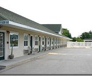
SEA ESTA MOTEL 2
Videos from this area
These are videos related to the place based on their proximity to this place.
White Marlin Fishing,
Fishing Ocean City Maryland, aboard the "Marli" . Hunting and Fishing Maryland.com Hosted by Jay Schline.
Elevated Subway In HO Scale (2D or 3D)
This is an elevated subway line that I added to my 14' X 9' H.O.Train layout. I added 2 scratch-built station platforms on the extreme right side about 2 weeks after this was uploaded, and...
Bad Boys of Bowling
This is footage from in early October. Pleasant Hill Lanes Newport, DE. Just now getting around to putting it together...Enjoy!
NFL Season Pickem Challenge II: Week 12 Predictions
After a bad 8-8 week. Total: (104-56) Here's Week 12.
Indian River Inlet Catching false albacore 1992.
Catching false albacore about 10 miles out Indian River Inlet.
2012 Summer Vacation - Boat Jumping in Indian River Bay
Pop-Pop, Dad and 3 boys find a cool spot off the shore of Holt's Landing in Indian River Bay, Delaware, and do some boat jumping on a 100-degree-plus summer day in July 2012.
Dynamic Physical Therapy Long Neck, Georgetown.mpg
Dynamic Physical Therapy , Sussex County , Delaware. Serving all of Lower Delaware for all physical therapy needs.
Sandy-Outer Bands Before the Storm.m4v
Hurricane Sandy is approaching the Delaware Coast. These clips were taken in Pot-Nets Bayside on Long Neck, DE.
Videos provided by Youtube are under the copyright of their owners.
Attractions and noteworthy things
Distances are based on the centre of the city/town and sightseeing location. This list contains brief abstracts about monuments, holiday activities, national parcs, museums, organisations and more from the area as well as interesting facts about the region itself. Where available, you'll find the corresponding homepage. Otherwise the related wikipedia article.
Long Neck, Delaware
Long Neck is a census-designated place (CDP) in Sussex County, Delaware, United States. The population was 1,980 at the 2010 census. Long Neck is the only census-designated place in Sussex County. It is part of the Seaford, Delaware Micropolitan Statistical Area.
Pepper Creek (Delaware)
Pepper Creek is a river, approximately 8 mi (13 km) long, in southern Delaware in the United States. It rises in Cypress Swamp in southern Sussex County, approximately 3 mi (5 km) north of the Maryland state line. It flows generally ENE, past Dagsboro and into Indian River Bay, an inlet of the Atlantic Ocean, approximately 2 mi (3 km) northwest of Millville. The upper course of the creek is connected by channelized ditches through Cypress Swamp to the headwaters of the Pocomoke River.
Baywood Greens
Baywood Greens is a public golf club located in Long Neck, Delaware that is consistently rated as one of the very best in the state. The front nine holes are nicknamed the "Woods Nine", while the back nine holes carry the "Water Nine" nickname. A third 9-hole grouping is planned on the north side of Delaware Route 24, which is supposed to be the "Sand Nine". The course is noted for having over 200,000 flowers, plants, shrubs, and trees that decorate the playing area.
Lingo Creek
Lingo Creek is a 1.7-mile-long stream flowing southeast to Indian River Bay, 7.5 miles northeast of Frankford in Sussex County, Delaware.
Lingo Cove
Lingo Cove, Delaware is a 0.2 mile wide cove in Rehoboth Bay at the mouth of Herring Creek in Sussex County, Delaware.
Lingo Point
Lingo Point, Delaware is a point of land at the mouth of Lingo Creek at the western limit of Indian River Bay, 7.5 miles northeast of Frankford in Sussex County, Delaware; a variant of the name is Lingos Point.


