Safety Score: 2,7 of 5.0 based on data from 9 authorites. Meaning we advice caution when travelling to United States.
Travel warnings are updated daily. Source: Travel Warning United States. Last Update: 2024-08-13 08:21:03
Discover Palmertown
Palmertown in New London County (Connecticut) is a city in United States about 313 mi (or 504 km) north-east of Washington DC, the country's capital city.
Local time in Palmertown is now 12:06 AM (Saturday). The local timezone is named America / New York with an UTC offset of -5 hours. We know of 12 airports in the vicinity of Palmertown, of which 5 are larger airports. The closest airport in United States is Groton New London Airport in a distance of 9 mi (or 15 km), South-East. Besides the airports, there are other travel options available (check left side).
Also, if you like golfing, there are a few options in driving distance. We discovered 4 points of interest in the vicinity of this place. Looking for a place to stay? we compiled a list of available hotels close to the map centre further down the page.
When in this area, you might want to pay a visit to some of the following locations: Hartford, Johnston, Riverhead, Cranston and North Providence. To further explore this place, just scroll down and browse the available info.
Local weather forecast
Todays Local Weather Conditions & Forecast: 13°C / 55 °F
| Morning Temperature | 4°C / 39 °F |
| Evening Temperature | 10°C / 51 °F |
| Night Temperature | 6°C / 43 °F |
| Chance of rainfall | 0% |
| Air Humidity | 31% |
| Air Pressure | 1009 hPa |
| Wind Speed | Moderate breeze with 10 km/h (6 mph) from South-East |
| Cloud Conditions | Clear sky, covering 0% of sky |
| General Conditions | Sky is clear |
Saturday, 16th of November 2024
13°C (56 °F)
7°C (45 °F)
Sky is clear, gentle breeze, clear sky.
Sunday, 17th of November 2024
9°C (48 °F)
8°C (46 °F)
Light rain, moderate breeze, overcast clouds.
Monday, 18th of November 2024
10°C (50 °F)
5°C (41 °F)
Sky is clear, moderate breeze, clear sky.
Hotels and Places to Stay
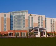
Hyatt Place Mohegan Sun
Hilton Garden Inn Mystic-Groton
Fairfield Inn & Suites Uncasville
Econo Lodge Inn & Suites
Hampton Inn Norwich CT
SpringHill Suites Mystic Waterford
Holiday Inn NORWICH
Flagship Inn And Suites
Clarion Inn Groton
RED CARPET INN SUITES NEW LONDON
Videos from this area
These are videos related to the place based on their proximity to this place.
Flooding near Horton Cove (Uncasville, CT)- March 30, 2010
A massive torrent of water pouring down the hillside into Horton Cove & the Thames River.
Videos provided by Youtube are under the copyright of their owners.
Attractions and noteworthy things
Distances are based on the centre of the city/town and sightseeing location. This list contains brief abstracts about monuments, holiday activities, national parcs, museums, organisations and more from the area as well as interesting facts about the region itself. Where available, you'll find the corresponding homepage. Otherwise the related wikipedia article.
New London County, Connecticut
New London County is a county located in the southeastern corner of the U.S. state of Connecticut bordering Long Island Sound. As of 2010 the population was 274,055. The total area of the county is 772 square miles, including inland and coastal waters. As is the case with all eight of Connecticut's counties, there is no county government and no county seat. In Connecticut, Towns are responsible for all local government activities, including fire and rescue, snow removal and schools.
Oxoboxo River, Connecticut
For the river, see Oxoboxo River. Oxoboxo River, Connecticut is located in ConnecticutOxoboxo River, Connecticut Location of Oxoboxo River Oxoboxo River is a census-designated place (CDP) in the town of Montville in New London County, Connecticut, United States. The population was 2,938 at the 2000 census and 3,165 at the 2010 census. The statistical area encompasses the town center of Montville, as well as the adjacent villages of Palmertown and Uncasville.
Uncasville, Connecticut
Uncasville is an area in the town of Montville, Connecticut, United States. It is a village in southeastern Montville, at the mouth of the Oxoboxo River. The name is now applied more generally to all of the east end of Montville, which is the area served by the Uncasville ZIP code. In 1994 the federal government officially recognized the Mohegan Indian Tribe of Connecticut, which had historically occupied this area.
Saint Bernard School
This article is about the school in Connecticut. For the school in Saskatoon, see St. Bernard School. 50x40pxThis article needs additional citations for verification. Please help improve this article by adding citations to reliable sources. Unsourced material may be challenged and removed.
WCTY
WCTY is a radio station with studios in Norwich, Connecticut. Its transmitter is located on Cook Drive in Montville, Connecticut. WCTY broadcasts a country music format, and is owned by WICH, Inc. , a subsidiary of Hall Communications.
WKNL
WKNL (100.9 FM, "Roxy FM") is a radio station licensed to serve New London, Connecticut. The station is owned by Hall Communications, Inc. , which owns a number of stations in medium-sized markets along the eastern seaboard from Vermont to Florida. It airs a hot adult contemporary music format.
Palmertown, Connecticut
Palmertown, also known as Palmer Town, is village in the town of Montville, Connecticut.
Montville High School (Connecticut)
Montville High School is located in Oakdale, Connecticut and serves all communities belonging to the Montville School District. The student population comprises grades 9–12 and is typically about 800 students.


