Safety Score: 2,7 of 5.0 based on data from 9 authorites. Meaning we advice caution when travelling to United States.
Travel warnings are updated daily. Source: Travel Warning United States. Last Update: 2024-08-13 08:21:03
Explore Hoskins
Hoskins in Hartford County (Connecticut) is located in United States about 305 mi (or 491 km) north-east of Washington DC, the country's capital.
Local time in Hoskins is now 08:19 PM (Friday). The local timezone is named America / New York with an UTC offset of -5 hours. We know of 10 airports in the wider vicinity of Hoskins, of which 3 are larger airports. The closest airport in United States is Bradley International Airport in a distance of 6 mi (or 10 km), North-East. Besides the airports, there are other travel options available (check left side).
There is one Unesco world heritage site nearby. It's Statue of Liberty in a distance of 103 mi (or 166 km), South-West. Also, if you like golfing, there are multiple options in driving distance. If you need a place to sleep, we compiled a list of available hotels close to the map centre further down the page.
Depending on your travel schedule, you might want to pay a visit to some of the following locations: Hartford, Riverhead, Carmel, Worcester and Hudson. To further explore this place, just scroll down and browse the available info.
Local weather forecast
Todays Local Weather Conditions & Forecast: 12°C / 53 °F
| Morning Temperature | 5°C / 42 °F |
| Evening Temperature | 10°C / 50 °F |
| Night Temperature | 7°C / 44 °F |
| Chance of rainfall | 0% |
| Air Humidity | 29% |
| Air Pressure | 1010 hPa |
| Wind Speed | Moderate breeze with 9 km/h (6 mph) from South-East |
| Cloud Conditions | Clear sky, covering 1% of sky |
| General Conditions | Sky is clear |
Saturday, 16th of November 2024
14°C (57 °F)
8°C (46 °F)
Sky is clear, gentle breeze, clear sky.
Sunday, 17th of November 2024
9°C (47 °F)
8°C (46 °F)
Light rain, gentle breeze, overcast clouds.
Monday, 18th of November 2024
10°C (50 °F)
7°C (44 °F)
Few clouds, gentle breeze.
Hotels and Places to Stay
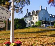
Simsbury 1820 House
SIMSBURY INN
Truman Gillet House Bed & Breakfast
Iron Horse Inn
Videos from this area
These are videos related to the place based on their proximity to this place.
Sanseiryu Kata
Sanseiryu kata performed by Bill Antonitis, Head Karate Instructor at Gracie Farmington Valley in Tariffville, CT. See more at http://moaimartialarts.com and http://graciefv.com.
Jet Black | Driveway Sealing & Sealcoating Avon Windsor West Hartford CT
Jet Black | Driveway Sealing & Sealcoating Avon Windsor West Hartford CT http://jet-black.com/asphalt-driveway-parking-lot-sealcoating-avon-windsor-west-hartford-ct Jet Black of Avon, Windsor...
Like us on Facebook!
https://www.facebook.com/eastpointatdoresetcrossing Eastpointe at Dorset Crossing Apartments 55 Dorset Crossing Drive Sismbury, CT 06070 (888) 281-6692 www.e...
12_08 Clinic - Battle Drill 2
Jaclyn Hawkins of the CT Northern Lights and Boston Blades led a clinic for 50 young girls with the help from the UConn Women's Hockey Team - thanks ladies!!
12_08 Clinic - Power Skating 1
Jaclyn Hawkins of the CT Northern Lights and Boston Blades led a clinic for 50 young girls with the help from the UConn Women's Hockey Team - thanks ladies!!
Videos provided by Youtube are under the copyright of their owners.
Attractions and noteworthy things
Distances are based on the centre of the city/town and sightseeing location. This list contains brief abstracts about monuments, holiday activities, national parcs, museums, organisations and more from the area as well as interesting facts about the region itself. Where available, you'll find the corresponding homepage. Otherwise the related wikipedia article.
Tariffville, Connecticut
Tariffville is a neighborhood and census-designated place (CDP) in the town of Simsbury in Hartford County, Connecticut, United States. The population was 1,324 at the 2010 census. It is a popular location for whitewater paddlers who use the Farmington River. Part of the original mill village area is included in the Tariffville Historic District, listed on the National Register of Historic Places.
Ensign-Bickford Company
The Ensign-Bickford Aerospace & Defense Company (formerly The Ensign-Bickford Company) was started in 1836 in Simsbury, Connecticut as a manufacturer of William Bickford's safety fuse for use in mining. Safety fuse was a great advance in mining technology over the practice of filling holes with black powder. The next step in mining technology was detonating cord. Ensign-Bickford and other companies developed different versions of detonating cord.
Simsbury High School
Simsbury High School is a public school located in Simsbury, Connecticut. The school was ranked number 3 in Connecticut Magazine's list of Top Connecticut Public High Schools. It was also included in list of Newsweek magazine's 2009 top 1500 public schools, as well as earning the top and second place (which varies every year between the two spots) in the Farmington Valley School systems. SHS is in the top 6% of all schools nationally.
Westminster School (Connecticut)
Westminster School is a small, private, boarding school located in Simsbury, Connecticut.
Simsbury Airport
Simsbury Airport is a public use airport located in Simsbury and East Granby, both towns in Hartford County, Connecticut, United States. It is privately owned by the Airport Realty Association, LLC. The airport is operated by the Simsbury Flying Club, a not-for-profit group that operates an FBO at the airport.
Barn Door Hills
The Barn Door Hills of north-central Connecticut are a pair of prominent rocky trap rock knobs separated by a steep sided gap. They are located in Granby, Connecticut. The hills are an outlying section of the narrow, linear Metacomet Ridge that extends from Long Island Sound near New Haven, north through the Connecticut River Valley of Massachusetts to the Vermont border. The crest of the Metacomet Ridge is located 3.75 miles east at Hatchet Hill.
Amos Eno House
The Amos Eno House is a historic home in Simsbury, Connecticut. It is also known as the 1820 House.
St. Mary's School (Connecticut)
St. Mary's School is Catholic elementary school located in Simsbury, Connecticut, USA. It is the only Catholic school for grades k-8 and Preschool in the Farmington Valley. St. Mary's School is accredited by the New England Association of Schools and Colleges (the last reaccreditation was in 2008) and the Connecticut State Department of Education.


