Safety Score: 2,7 of 5.0 based on data from 9 authorites. Meaning we advice caution when travelling to United States.
Travel warnings are updated daily. Source: Travel Warning United States. Last Update: 2024-08-13 08:21:03
Discover East Portal
East Portal in Gilpin County (Colorado) is a place in United States about 1,522 mi (or 2,450 km) west of Washington DC, the country's capital city.
Current time in East Portal is now 08:55 PM (Monday). The local timezone is named America / Denver with an UTC offset of -7 hours. We know of 8 airports near East Portal, of which two are larger airports. The closest airport in United States is Denver International Airport in a distance of 52 mi (or 83 km), East. Besides the airports, there are other travel options available (check left side).
Also, if you like playing golf, there are a few options in driving distance. We encountered 1 points of interest in the vicinity of this place. If you need a hotel, we compiled a list of available hotels close to the map centre further down the page.
While being here, you might want to pay a visit to some of the following locations: Central City, Georgetown, Boulder, Golden and Hot Sulphur Springs. To further explore this place, just scroll down and browse the available info.
Local weather forecast
Todays Local Weather Conditions & Forecast: -0°C / 31 °F
| Morning Temperature | -7°C / 19 °F |
| Evening Temperature | -5°C / 22 °F |
| Night Temperature | -8°C / 18 °F |
| Chance of rainfall | 2% |
| Air Humidity | 71% |
| Air Pressure | 1004 hPa |
| Wind Speed | Moderate breeze with 10 km/h (6 mph) from East |
| Cloud Conditions | Scattered clouds, covering 28% of sky |
| General Conditions | Snow |
Tuesday, 5th of November 2024
-7°C (19 °F)
-12°C (10 °F)
Snow, gentle breeze, overcast clouds.
Wednesday, 6th of November 2024
-6°C (21 °F)
-11°C (12 °F)
Scattered clouds, gentle breeze.
Thursday, 7th of November 2024
-3°C (26 °F)
-5°C (24 °F)
Light snow, gentle breeze, overcast clouds.
Hotels and Places to Stay
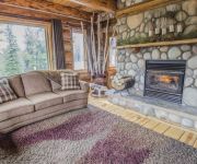
The Silver Lake Lodge
Videos from this area
These are videos related to the place based on their proximity to this place.
Amtrak California Zephyr with UP Heritage D&RGW 1989 SD70ACe pt2
On a lucky trip aboard the California Zephyr this past August, one locomotive began giving us some problems. The replacement just happened to be the one and only UP Heritage D&RGW 1989 ...
Descending Rollins Pass in a Jeep
Descending from the top of Rollins Pass towards Winter Park in a Jeep.
Rollins Pass East
Rollins Pass East Gilpin County, Colorado Roosevelt National Forest Boulder Ranger District.
Rollins Pass in the Colorado Rockies
Video of Rollins Pass shot during the summer of 2010. The railroad west of Denver used Rollins Pass to cross the continental divide prior to the construction of the Moffat tunnel.
Lost Lake outside Nederland, Colorado
A quick, but somewhat steep, 3-mile hike from the Hessie Trailhead to a small lake in the Roosevelt National Forest just outside Eldora, Colorado.
Tumbling Water - Middle Boulder Creek, South Fork
Along the trail to Lost Lake, Skyscraper Reservoir, King Lake, Jasper Lake, and Devil's Thumb Lake (among many others). Just south and east of the Jasper Creek feed into Middle Boulder Creek....
TR-01 CDS Intro & Kingston Peak Trail - Part 1
My first Moto Vlog. A quick explanation of what my videos will be about and the first section of the Kingston Peak Trail heading to a nice overlook of St. Mary's Glacier. Part 2 to follow shortly....
Colorado 4 Wheeling Kingston Peak 2012
From Rollinsville to Empire www.facebook.com/colorado4wheeling.
TR-01 Kingston Peak Trail - Part 3 (Final)
The third and final part of my first Moto Vlog. We search for a nonexistent hidden lake, make a dirt biker friend who joins us for a bit and a Random Act of Coolness! Enjoy! The second part...
Videos provided by Youtube are under the copyright of their owners.
Attractions and noteworthy things
Distances are based on the centre of the city/town and sightseeing location. This list contains brief abstracts about monuments, holiday activities, national parcs, museums, organisations and more from the area as well as interesting facts about the region itself. Where available, you'll find the corresponding homepage. Otherwise the related wikipedia article.
Rollins Pass
Rollins Pass (el. 11,660 ft) is a high mountain pass in the Rocky Mountains of north-central Colorado in the United States. The pass is located on the continental divide at the crest of the Front Range southwest of Boulder, at the boundary of Grand and Boulder counties.
Moffat Tunnel
The Moffat Tunnel is a railroad and water tunnel that cuts through the Continental Divide in north-central Colorado. Named after Colorado railroad pioneer David Moffat, the tunnel's first railroad traffic passed through in February 1928. Fifty miles (80 km) west of Denver, Colorado is the East Portal in the Front Range, about 10 miles west of the town of Rollinsville, Colorado at {{#invoke:Coordinates|coord}}{{#coordinates:39.90235|-105.6461|type:railwaystation|||||| |primary |name= }}.


