Safety Score: 2,7 of 5.0 based on data from 9 authorites. Meaning we advice caution when travelling to United States.
Travel warnings are updated daily. Source: Travel Warning United States. Last Update: 2024-08-13 08:21:03
Touring Aspen Meadows
Aspen Meadows in Boulder County (Colorado) is a town located in United States about 1,510 mi (or 2,430 km) west of Washington DC, the country's capital place.
Time in Aspen Meadows is now 09:07 AM (Thursday). The local timezone is named America / Denver with an UTC offset of -7 hours. We know of 8 airports nearby Aspen Meadows, of which two are larger airports. The closest airport in United States is Denver International Airport in a distance of 40 mi (or 64 km), East. Besides the airports, there are other travel options available (check left side).
Also, if you like the game of golf, there are several options within driving distance. We collected 2 points of interest near this location. Need some hints on where to stay? We compiled a list of available hotels close to the map centre further down the page.
Being here already, you might want to pay a visit to some of the following locations: Boulder, Central City, Golden, Broomfield and Georgetown. To further explore this place, just scroll down and browse the available info.
Local weather forecast
Todays Local Weather Conditions & Forecast: 6°C / 43 °F
| Morning Temperature | -2°C / 28 °F |
| Evening Temperature | 2°C / 35 °F |
| Night Temperature | 1°C / 34 °F |
| Chance of rainfall | 0% |
| Air Humidity | 28% |
| Air Pressure | 1021 hPa |
| Wind Speed | Moderate breeze with 9 km/h (6 mph) from East |
| Cloud Conditions | Overcast clouds, covering 100% of sky |
| General Conditions | Overcast clouds |
Thursday, 21st of November 2024
10°C (49 °F)
2°C (36 °F)
Overcast clouds, gentle breeze.
Friday, 22nd of November 2024
10°C (50 °F)
2°C (35 °F)
Overcast clouds, gentle breeze.
Saturday, 23rd of November 2024
4°C (40 °F)
-1°C (30 °F)
Broken clouds, gentle breeze.
Hotels and Places to Stay
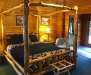
Eldora Lodge at Wondervu
Videos from this area
These are videos related to the place based on their proximity to this place.
Level 2 balancing vinyasa and movements of the hip
Stabilize and awaken the hips with this uncommon approach to vinyasa. Learn anatomical movements of the hip joint and how to access in yoga. Instructed by Shakti and demonstrated by Gayatri...
Seen on the (former) D&RGW, 04/12/08
Just bought a JVC Everio GZ-MG330 HD camcorder for the school library, and thought I had better get acquainted with it. As luck would have it, I found myself parked along side the UP (former...
What just fell? The rental car keys
"I think my phone just dropped. It maybe the keys. I'm not kidding. I heard it."
Explore Grand County Snowmobiling Feature
Grand County Television short feature on snowmobiling in Winter Park, Fraser, Grand Lake and Kremmling Colorado. Snowmobile Capitol of Colorado.
Sahel Desertification (School Project)
Educational Video For Schools and Children looking for help on Assignments.
Pinecliffe - Peak to Peak
A ride west of Coal Creek Canyon on Colorado 72, from Pinecliffe to the Peak to Peak Scenic Byway.
Videos provided by Youtube are under the copyright of their owners.
Attractions and noteworthy things
Distances are based on the centre of the city/town and sightseeing location. This list contains brief abstracts about monuments, holiday activities, national parcs, museums, organisations and more from the area as well as interesting facts about the region itself. Where available, you'll find the corresponding homepage. Otherwise the related wikipedia article.
Boulder Creek (Colorado)
Boulder Creek is a 31.4-mile-long creek draining the Rocky Mountains to the west of Boulder, Colorado, as well as the city itself and surrounding plains.
Sugarloaf, Colorado
Sugarloaf is a census-designated place (CDP) in Boulder County, Colorado, United States. The population as of the 2010 Census was 261.
St. Ann Highlands, Colorado
St. Ann Highlands is a census-designated place (CDP) in Boulder County, Colorado, United States. The population as of the 2010 Census was 288.


