Safety Score: 2,7 of 5.0 based on data from 9 authorites. Meaning we advice caution when travelling to United States.
Travel warnings are updated daily. Source: Travel Warning United States. Last Update: 2024-08-13 08:21:03
Delve into West Linda
West Linda in Yuba County (California) is a city located in United States about 2,367 mi (or 3,809 km) west of Washington DC, the country's capital town.
Current time in West Linda is now 02:26 AM (Friday). The local timezone is named America / Los Angeles with an UTC offset of -8 hours. We know of 11 airports closer to West Linda, of which 5 are larger airports. The closest airport in United States is Sacramento International Airport in a distance of 29 mi (or 47 km), South. Besides the airports, there are other travel options available (check left side).
Also, if you like playing golf, there are some options within driving distance. In need of a room? We compiled a list of available hotels close to the map centre further down the page.
Since you are here already, you might want to pay a visit to some of the following locations: Marysville, Yuba City, Oroville, Colusa and Woodland. To further explore this place, just scroll down and browse the available info.
Local weather forecast
Todays Local Weather Conditions & Forecast: 13°C / 55 °F
| Morning Temperature | 12°C / 54 °F |
| Evening Temperature | 13°C / 55 °F |
| Night Temperature | 13°C / 55 °F |
| Chance of rainfall | 28% |
| Air Humidity | 86% |
| Air Pressure | 1014 hPa |
| Wind Speed | Fresh Breeze with 13 km/h (8 mph) from North-West |
| Cloud Conditions | Overcast clouds, covering 100% of sky |
| General Conditions | Heavy intensity rain |
Friday, 22nd of November 2024
14°C (58 °F)
9°C (48 °F)
Light rain, gentle breeze, scattered clouds.
Saturday, 23rd of November 2024
9°C (49 °F)
9°C (47 °F)
Moderate rain, light breeze, overcast clouds.
Sunday, 24th of November 2024
10°C (50 °F)
11°C (51 °F)
Light rain, moderate breeze, overcast clouds.
Hotels and Places to Stay
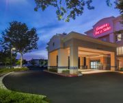
Hampton Inn - Suites Yuba City
MAGNUSON GRAND BONANZA INN
RIO INN AND SUITES-MA
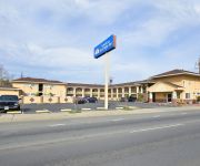
AMERICAS BEST VALUE INN
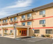
Econo Lodge Inn & Suites Yuba City - Marysville
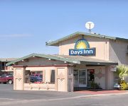
DAYS INN YUBA CITY
Comfort Suites Beale Air Force Base Area
S8 MARYSVILLE-YUBA CITY AREA
MOTEL 6 MARYSVILLE SOUTH
MOTEL 6 MARYSVILLE CA
Videos from this area
These are videos related to the place based on their proximity to this place.
Extreme Bomber Trailer Race Marysville Raceway - Last Man Standing
Bomber Trailer Race Final October 24th, 2009 Marysville Raceway Park The Colusa Casino Extreme Bomber 100 lap Recreational Vehicle and Boat Trailer Race was won by Crazy Ray Fernandez.
GoPro Marysville MMX Motocross Helmet Cam | Summer 2014
Footage from Matt & Mike Morgan riding the motocross tracks at MMX. I combined footage from both our helmet cameras to show two point of views on the sand track. I felt pretty good on the...
Northbound BNSF Freight Train, Marysville, CA, 1/24/09.
Northbound BNSF Freight Train, running through Marysville, CA on 1/24/09.
UP 1996 SP Heritage Southbound through Marysville, CA.
UP 1996 SP Heritage Southbound coasting past the former Western Pacific Depot in Marysville, CA. 1/24/09.
Home for Rent Edgewater 4BR/3BA by Edgewater Property Management
Get Professional, Courteous, and Fast Response Time from http://www.rentalpropertyprofessionals.com ! We are a Full Service "Edgewater Property Management" company always ready to help! Give...
Edgewater House for Rent 5BR/3BA by Edgewater Property Management
Get Professional, Courteous, and Fast Response Time from http://www.rentalpropertyprofessionals.com ! We are a Full Service "Edgewater Property Management" company always ready to help! Give...
E Street Racing RD2 Spring 2010 01.flv
Madminis Film Production - on loaction E street MX Park RD2 spring series. This movie for dailup users.
2008 Lexus IS F Used Cars Marysville CA
http://www.yubacitydodge.com This 2008 Lexus IS F is available from John L. Sullivan Chrysler Dodge Jeep. For details, call us at 530-742-6406.
Videos provided by Youtube are under the copyright of their owners.
Attractions and noteworthy things
Distances are based on the centre of the city/town and sightseeing location. This list contains brief abstracts about monuments, holiday activities, national parcs, museums, organisations and more from the area as well as interesting facts about the region itself. Where available, you'll find the corresponding homepage. Otherwise the related wikipedia article.
Linda, California
Linda is a census-designated place (CDP) in Yuba County, California, United States. The population was 17,773 at the 2010 census, up from 13,474 at the 2000 census. Linda is located 2 miles north-northwest of Olivehurst.
Marysville, California
Marysville is the county seat of Yuba County, California, United States. The population was 12,072 at the 2010 census, down from 12,268 at the 2000 census. It is included in the Yuba City Metropolitan Statistical Area, often referred to as the Yuba-Sutter Area after the two counties, Yuba and Sutter. The metropolitan statistical area is part of the Greater Sacramento area.
Sutter County Airport
Sutter County Airport is a public airport located one mile (1.6 km) south of Yuba City, serving Sutter County, California, USA. This general aviation airport covers 170 acres and has one runway.
Alicia, California
Alicia is an unincorporated community in Yuba County, California. It is located 1.5 miles west-northwest of Olivehurst, at an elevation of 59 feet (18 m).
South Yuba, California
South Yuba is an unincorporated community in Yuba County, California. It is located on the Sacramento Northern Railroad 1.5 miles south of Marysville, at an elevation of 66 feet (20 m).
West Linda, California
West Linda is an unincorporated community in Yuba County, California. It lies at an elevation of 62 feet (19 m).
Oliver, California
Oliver is a former settlement in Yuba County, California, USA. It was on the Western Pacific Railroad 1 mile (1.6 km) south of Marysville, at an elevation of 52 feet (16 m). It still appeared on maps in 1952.
Yuba, California
Yuba (also, Rupert Siding and Rupert) is a former settlement in Yuba County, California. It was located on the Southern Pacific Railroad 1.5 miles north-northwest of Olivehurst, at an elevation of 62 feet (19 m). It still appeared on maps as of 1895.


