Safety Score: 2,7 of 5.0 based on data from 9 authorites. Meaning we advice caution when travelling to United States.
Travel warnings are updated daily. Source: Travel Warning United States. Last Update: 2024-08-13 08:21:03
Delve into Beatrice
Beatrice in Yolo County (California) is a city located in United States about 2,376 mi (or 3,824 km) west of Washington DC, the country's capital town.
Current time in Beatrice is now 09:39 AM (Friday). The local timezone is named America / Los Angeles with an UTC offset of -8 hours. We know of 8 airports closer to Beatrice, of which 4 are larger airports. The closest airport in United States is Sacramento International Airport in a distance of 4 mi (or 6 km), North. Besides the airports, there are other travel options available (check left side).
Also, if you like playing golf, there are some options within driving distance. We saw 2 points of interest near this location. In need of a room? We compiled a list of available hotels close to the map centre further down the page.
Since you are here already, you might want to pay a visit to some of the following locations: Sacramento, Woodland, Yuba City, Marysville and Auburn. To further explore this place, just scroll down and browse the available info.
Local weather forecast
Todays Local Weather Conditions & Forecast: 13°C / 55 °F
| Morning Temperature | 14°C / 58 °F |
| Evening Temperature | 13°C / 56 °F |
| Night Temperature | 13°C / 55 °F |
| Chance of rainfall | 45% |
| Air Humidity | 78% |
| Air Pressure | 1015 hPa |
| Wind Speed | Moderate breeze with 11 km/h (7 mph) from North-West |
| Cloud Conditions | Overcast clouds, covering 100% of sky |
| General Conditions | Heavy intensity rain |
Friday, 22nd of November 2024
15°C (59 °F)
9°C (48 °F)
Heavy intensity rain, moderate breeze, broken clouds.
Saturday, 23rd of November 2024
13°C (56 °F)
12°C (53 °F)
Broken clouds, gentle breeze.
Sunday, 24th of November 2024
12°C (54 °F)
12°C (54 °F)
Light rain, gentle breeze, overcast clouds.
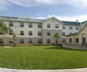
Hotels and Places to Stay
Four Points by Sheraton Sacramento International Airport
Residence Inn Sacramento Airport Natomas
Fairfield Inn & Suites Sacramento Airport Natomas
Hampton Inn - Suites West Sacramento
Hampton Inn - Suites Sacramento-Airport-Natomas
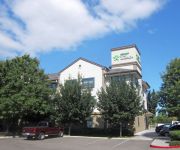
Extended Stay America Sacramento West Sacramento
Homewood Suites by Hilton Sacramento Airport-Natomas
Holiday Inn Express & Suites SACRAMENTO AIRPORT NATOMAS
Hilton Garden Inn Sacramento-So Natomas
Holiday Inn Express WEST SACRAMENTO - CAPITOL AREA
Videos from this area
These are videos related to the place based on their proximity to this place.
Cheap Passenger Van Rentals in Sacramento!
Call Toll-Free 877-826-4680 http://www.airportvanrental.com Los Angeles • San Francisco • San Jose • Oakland Ontario • Long Beach • Orange County • Las Vegas...
Southwest 737 landing in Sacramento (SMF).
Landing in Sacramento on a Southwest 737 from San Diego. September 2007.
Take off from Sacremento to LA
Aboard Southwest airlines, taking off from Sacremento (SMF) to Los Angeles (LAX) Aug. 2007.
Retirement Salute
FedEx feeder pilot gets the firemen's salute after twenty one and a half years of flying the Cessna 208 Caravan.
ILS Approach into Sacramento International Airport (KSMF)
Cirrus SR-22TN performing a practice ILS approach runway 16R into Sac International.
I-5 At Airport Blvd Crash
Video of a major injury traffic collision that sent three people to the hospital on southbound I-5 under the Airport Blvd overpass. This collision occurred i...
Landing in Sacramento
Landing in Sacramento from San Diego on 12/9/13. Row 16 seat A I believe. Awesome flight crew. Captain came on the speakers in the cabin and said, "Were gunna be about 20 mins early into...
Leap, the Red Rabbit at the Sacramento International Airport (SMF)
I took this video with my Olympus SP-600UZ digital camera on November 23, 2011 while I was at the Sacramento International Airport. At 56 feet long and bright red, Lawrence Argent's giant,...
Southwest Airlines 737-7H4 [N7738A] - SMF Arrival
Southwest Airlines 737-7H4 landing on 34L at Sacramento International Airport (SMF) on December 15, 2013 Shot from inside the cabin on a HTC One.
Videos provided by Youtube are under the copyright of their owners.
Attractions and noteworthy things
Distances are based on the centre of the city/town and sightseeing location. This list contains brief abstracts about monuments, holiday activities, national parcs, museums, organisations and more from the area as well as interesting facts about the region itself. Where available, you'll find the corresponding homepage. Otherwise the related wikipedia article.
KYMX
KYMX (96.1 FM, "Mix 96") is commercial radio station located in Sacramento, California. The station airs an adult contemporary music format.
KCTC
KCTC AM 1320 is a radio station in West Sacramento, California, that has been affiliated with ESPN Radio since February 2007. It has separate transmitter sites for daytime and night operations. KCTC has had a history as both an FM and AM station, so since it was founded as the former, we will put this history in proper perspective.
Fremont, Yolo County, California
Fremont (also known as Elkhorn) is an unincorporated community in Yolo County, California. It is located on the Sacramento River and Interstate 5 in the east-northeastern portion of the county. Fremont's ZIP Code is 95691 and its area code 530. It is located on the Sacramento Northern and Sacramento and Woodland Railroads 11 miles northeast of Davis, at an elevation of 23 feet (7 m).
Beatrice, Yolo County, California
Beatrice is an unincorporated community in Yolo County, California. It is located on the Sacramento Northern Railroad 10.5 miles northeast of Davis, at an elevation of 26 feet (8 m).
Kiesel, California
Kiesel is an unincorporated community in Yolo County, California. It is located on the Sacramento Northern Railroad 10.5 miles northeast of Davis, at an elevation of 26 feet (8 m).
Vin, California
Vin is an unincorporated community in Yolo County, California. It is located on the Sacramento and Woodland Railroad 7 miles northwest of West Sacramento, at an elevation of 30 feet (9 m).
Leeman, California
Leeman is a former settlement in Yolo County, California. It lay at an elevation of 23 feet (7 m). It still appeared on maps as of 1916.
Marty, California
Marty is a former settlement in Yolo County, California. It was located on the Sacramento and Woodland Railroad 10.5 miles northeast of Davis, at an elevation of 33 feet (10 m). It still appeared on maps as of 1915.


!['Southwest Airlines 737-7H4 [N7738A] - SMF Arrival' preview picture of video 'Southwest Airlines 737-7H4 [N7738A] - SMF Arrival'](https://img.youtube.com/vi/Jc2KBHuXtmA/mqdefault.jpg)
