Safety Score: 2,7 of 5.0 based on data from 9 authorites. Meaning we advice caution when travelling to United States.
Travel warnings are updated daily. Source: Travel Warning United States. Last Update: 2024-08-13 08:21:03
Delve into Spanish Hills
Spanish Hills in Ventura County (California) is a city located in United States about 2,335 mi (or 3,758 km) west of Washington DC, the country's capital town.
Current time in Spanish Hills is now 05:26 PM (Tuesday). The local timezone is named America / Los Angeles with an UTC offset of -8 hours. We know of 12 airports closer to Spanish Hills, of which 5 are larger airports. The closest airport in United States is Bob Hope Airport in a distance of 42 mi (or 68 km), East. Besides the airports, there are other travel options available (check left side).
Also, if you like playing golf, there are some options within driving distance. In need of a room? We compiled a list of available hotels close to the map centre further down the page.
Since you are here already, you might want to pay a visit to some of the following locations: Ventura, Santa Barbara, Los Angeles, Bakersfield and Orange. To further explore this place, just scroll down and browse the available info.
Local weather forecast
Todays Local Weather Conditions & Forecast: 22°C / 71 °F
| Morning Temperature | 17°C / 62 °F |
| Evening Temperature | 20°C / 68 °F |
| Night Temperature | 17°C / 63 °F |
| Chance of rainfall | 0% |
| Air Humidity | 13% |
| Air Pressure | 1012 hPa |
| Wind Speed | High wind, near gale with 23 km/h (14 mph) from South-West |
| Cloud Conditions | Clear sky, covering 1% of sky |
| General Conditions | Sky is clear |
Wednesday, 6th of November 2024
22°C (72 °F)
15°C (59 °F)
Sky is clear, fresh breeze, clear sky.
Thursday, 7th of November 2024
22°C (71 °F)
15°C (59 °F)
Sky is clear, gentle breeze, clear sky.
Friday, 8th of November 2024
21°C (71 °F)
15°C (58 °F)
Sky is clear, gentle breeze, clear sky.
Hotels and Places to Stay
BW OXNARD INN
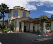
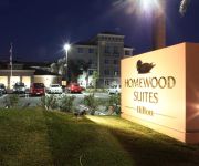
Homewood Suites by Hilton Oxnard-Camarillo CA
Courtyard Oxnard Ventura
Residence Inn Camarillo
Hilton Garden Inn Oxnard-Camarillo
BEST WESTERN CAMARILLO INN
Hampton Inn - Suites Camarillo
Good Nite Inn Camarillo
BELLA CAPRI INN
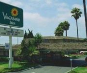
VAGABOND INN OXNARD
Videos from this area
These are videos related to the place based on their proximity to this place.
Lockheed EC-121 Super Constellation Take-off from Camarillo 1/14/12
Lockheed EC-121T Warning Star Super Constellation (Connie) , AF Serial No. 53-0548 After 15+ years on the ground and a 7 year restoration Effort this Cold War Era United States Air Force...
Long Beach (KLGB) - Camarillo (KCMA) Cross Country Flight, T182T Skylane
This is a flight from Long Beach to Camarillo, California. Since the two airports are further than 50 nautical miles away, the flight is considered to be a cross country flight. This is only...
Camarillo Duathlon June 2012
Camarillo Duathlon June 2012 with Team Twenty Four Seven and Team Ready for Wine.
Wings Over Camarillo Commemorative Air Force Warbirds airshow
Highlights of the sights and sounds of the annual 'Wings Over Camarillo' warbirds airshow, in Camarillo, CA (an hour outside Los Angeles)- the home of the famous Commemorative Air Force (formerly.
Samsung NX30 video test - Red Bull stunt copter + Camarillo Air Show - 8/22/14
I created this video with the YouTube Video Editor (http://www.youtube.com/editor) (because it was easy, so why not). (Although it doesn't provide nice audio cuts and fades.) This was all...
Summer's B-Day Sky Dive Video (Skydive Coastal California)
First skydiving trip to celebrate birthday month 2013!
Bullet's NEW Sweater
Meet Bullet. A 3 year old Pit Bull who came into the shelter after having been shot 3 times. The veterinary staff managed to remove all bullet fragments except 2. They also needed to amputate...
Videos provided by Youtube are under the copyright of their owners.
Attractions and noteworthy things
Distances are based on the centre of the city/town and sightseeing location. This list contains brief abstracts about monuments, holiday activities, national parcs, museums, organisations and more from the area as well as interesting facts about the region itself. Where available, you'll find the corresponding homepage. Otherwise the related wikipedia article.
Camarillo Airport
Camarillo Airport is a public airport located three miles (5 km) west of the central business district of Camarillo, a city in Ventura County, California, United States. It is roughly equidistant from Los Angeles, CA and Santa Barbara, CA although it is inland. The airport has one runway and exclusively serves privately operated general aviation and executive aircraft with no scheduled commercial service.
Oxnard Air Force Base
For the civil use of this facility and airport information after 1969, see Camarillo Airport Oxnard Air Force Base (1940–1945, 1951–1970) is a former United States Air Force base located within current city limits, approximately 3 miles west of central Camarillo, California. A fighter training airfield during World War II, it was part of Air Defense Command during the Cold War as a fighter-interceptor base.
Oxnard Oil Field
The Oxnard Oil Field is a large and currently productive oil field in and adjacent to the city of Oxnard, in Ventura County, California in the United States. Its conventional oil reserves are close to exhaustion, with only an estimated one percent of the original oil recoverable with current technology remaining: 434,000 barrels out of an original 43.5 million.
Santa Clara Avenue Oil Field
The Santa Clara Avenue Oil Field is an oil field in Ventura County, California, about six miles southeast of the city of Ventura and four miles northeast of Oxnard. It is produced entirely from two walled drilling islands along Santa Clara Avenue, each containing multiple directionally drilled wells. The field is within an agricultural area being encroached on several sides by urban development.


