Safety Score: 2,7 of 5.0 based on data from 9 authorites. Meaning we advice caution when travelling to United States.
Travel warnings are updated daily. Source: Travel Warning United States. Last Update: 2024-08-13 08:21:03
Delve into Haines
Haines in Ventura County (California) is located in United States about 2,334 mi (or 3,755 km) west of Washington DC, the country's capital town.
Current time in Haines is now 05:46 PM (Tuesday). The local timezone is named America / Los Angeles with an UTC offset of -8 hours. We know of 12 airports close to Haines, of which 5 are larger airports. The closest airport in United States is Bob Hope Airport in a distance of 43 mi (or 70 km), East. Besides the airports, there are other travel options available (check left side).
Also, if you like playing golf, there are some options within driving distance. If you need a hotel, we compiled a list of available hotels close to the map centre further down the page.
While being here, you might want to pay a visit to some of the following locations: Ventura, Santa Barbara, Los Angeles, Bakersfield and Orange. To further explore this place, just scroll down and browse the available info.
Local weather forecast
Todays Local Weather Conditions & Forecast: 22°C / 71 °F
| Morning Temperature | 16°C / 61 °F |
| Evening Temperature | 18°C / 65 °F |
| Night Temperature | 16°C / 61 °F |
| Chance of rainfall | 0% |
| Air Humidity | 10% |
| Air Pressure | 1013 hPa |
| Wind Speed | Strong breeze with 18 km/h (11 mph) from South-West |
| Cloud Conditions | Clear sky, covering 1% of sky |
| General Conditions | Sky is clear |
Wednesday, 6th of November 2024
24°C (76 °F)
16°C (60 °F)
Sky is clear, fresh breeze, clear sky.
Thursday, 7th of November 2024
23°C (74 °F)
16°C (60 °F)
Sky is clear, gentle breeze, clear sky.
Friday, 8th of November 2024
23°C (74 °F)
16°C (60 °F)
Few clouds, gentle breeze.
Hotels and Places to Stay
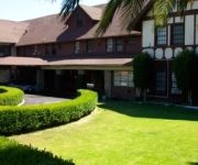
Glen Tavern Inn
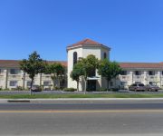
Ocean Gateway Inn
Santa Paula Inn
Videos from this area
These are videos related to the place based on their proximity to this place.
Landing at Santa Paula KSZP
Landing at Santa Paula KSZP Cessna 172 on brand new resurfaced runway. Notice there's no paint on the tarmac. It's like landing on downtown Main Street.
CampgroundViews.com - Ventura Ranch KOA at Steckel Park Santa Paula California CA
http://www.CampgroundViews.com takes user submitted videos combined with professional editing to provide tent and RV campers with a first person view of a campground or RV park. Ventura Ranch.
The Santa Paula Experience book in 3D
For the first time in well over 100 years, 3-D images of Santa Paula California will be published. This collection in now bound in book form. With subject matter spanning from the East to...
EMT Emergency Maneuver Training Santa Paula Airport California
Trip to Santa Paula Airport California in 2002 for an EMT Emergency Maneuver Training. The Airplane is an American Champion Super Decathlon N5503H with 180 Horse Power! See some Aerobatics.
en santa paula danzando al santo nino de atocha danza 3 d mayo
de pozo de gamboa zac en riverside ca.....
Santa Paula Skatepark James and Austin
James Howard and Austin Hanchett are skating at Santa Paula Skatepark. All Aspects Apparel and Steelo Grip Tape.
Landing at Santa Paula Airport (KSZP)
Pattern entry and landing at Santa Paula Airport in a C-182RG...
Santa Paula Lap In Pattern C206
Took a Cessna 206 for a lap in the pattern at Santa Paula Airport in Southern California.
500 W Santa Maria St #28, Santa Paula, CA 93060
One of a kind decorated 2 bed, 1 3/4 bath mobile home in a great location, no one behind you, mountain and sunset views. No paneling, all walls textured and painted. Some ceilings textured....
Videos provided by Youtube are under the copyright of their owners.
Attractions and noteworthy things
Distances are based on the centre of the city/town and sightseeing location. This list contains brief abstracts about monuments, holiday activities, national parcs, museums, organisations and more from the area as well as interesting facts about the region itself. Where available, you'll find the corresponding homepage. Otherwise the related wikipedia article.
Santa Paula, California
Santa Paula is a city within Ventura County, California, United States. The population was 29,321 at the 2010 census, up from 28,598 at the 2000 census. It has been dubbed the "Citrus Capital of the World. " As the initial headquarters of the Union Oil Company of California, Santa Paula was one of the early centers of California's enormous petroleum industry.
KOXR
KOXR is a radio station licensed to Oxnard, California. It broadcasts a traditional ranchera music format featuring mariachi groups of Mexico. It is an affiliate of the Radio Lazer network. After years of being a variety format station, KOXR switched to a Spanish-language radio format in the early 1990s. Long before the call letter was used for a commercial radio station, it was used for Oxnard Airport.
KKZZ
KKZZ is a Spanish language news/talk formatted radio station licensed to Santa Paula, California. It has had numerous formats since originally signing on as KSPA in 1948, including country (as KQIQ), all-news (as KAAP), and Spanish language (as KUNX). It used the KKZZ call letters for a long period as an adult standards station in the 1990s. In recent years some of its programs were a simulcast of nearby KVTA-1520.
Santa Paula Hospital
Santa Paula Hospital (SPH) is a hospital in Santa Paula, California, USA. The hospital is a campus of the Ventura County Medical Center. SPH has 145 full-time employees, 30 shared patient beds, and 19 private patient rooms.
Santa Paula High School
Santa Paula High School is one of two schools in the Santa Paula Union High School District. It is located in Santa Clara Valley in Santa Paula, California. It is home of the Cardinals.
Rancho Santa Paula y Saticoy
Rancho Santa Paula y Saticoy was a 17,773-acre Mexican land grant in the Santa Clara River Valley, in present day Ventura County, California, and granted in 1843 by Governor Manuel Micheltorena to Manuel Jimeno Casarin. The rancho lands include the present day cities of Saticoy and Santa Paula along the Santa Clara River.
Saticoy Oil Field
The Saticoy Oil Field is an oil and gas field in Ventura County, California, in the United States. The field is a long narrow band paralleling the Santa Clara River near the town of Saticoy. Discovered in 1955, it is one of the smaller but productive fields found in the region after most of the large fields had already been operational for decades.


