Safety Score: 2,7 of 5.0 based on data from 9 authorites. Meaning we advice caution when travelling to United States.
Travel warnings are updated daily. Source: Travel Warning United States. Last Update: 2024-08-13 08:21:03
Discover Dulah
Dulah in Ventura County (California) is a city in United States about 2,348 mi (or 3,778 km) west of Washington DC, the country's capital city.
Local time in Dulah is now 10:54 AM (Thursday). The local timezone is named America / Los Angeles with an UTC offset of -8 hours. We know of 12 airports in the vicinity of Dulah, of which 5 are larger airports. The closest airport in United States is Santa Barbara Municipal Airport in a distance of 28 mi (or 46 km), West. Besides the airports, there are other travel options available (check left side).
Also, if you like golfing, there are a few options in driving distance. Looking for a place to stay? we compiled a list of available hotels close to the map centre further down the page.
When in this area, you might want to pay a visit to some of the following locations: Ventura, Santa Barbara, Bakersfield, Los Angeles and Orange. To further explore this place, just scroll down and browse the available info.
Local weather forecast
Todays Local Weather Conditions & Forecast: 16°C / 61 °F
| Morning Temperature | 12°C / 54 °F |
| Evening Temperature | 16°C / 60 °F |
| Night Temperature | 15°C / 59 °F |
| Chance of rainfall | 0% |
| Air Humidity | 44% |
| Air Pressure | 1022 hPa |
| Wind Speed | Gentle Breeze with 6 km/h (4 mph) from East |
| Cloud Conditions | Clear sky, covering 0% of sky |
| General Conditions | Sky is clear |
Thursday, 21st of November 2024
16°C (61 °F)
15°C (59 °F)
Scattered clouds, gentle breeze.
Friday, 22nd of November 2024
14°C (58 °F)
14°C (58 °F)
Moderate rain, light breeze, overcast clouds.
Saturday, 23rd of November 2024
15°C (59 °F)
15°C (58 °F)
Overcast clouds, light breeze.
Hotels and Places to Stay
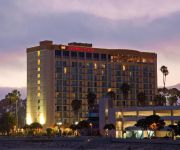
Crowne Plaza VENTURA BEACH
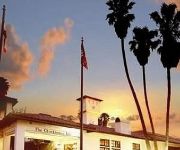
CLOCKTOWER INN
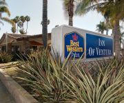
BEST WESTERN PLUS INN VENTURA
Motel 6 Ventura Downtown CA
Amanzi Hotel
VAGABOND INN VENTURA
Travelers Beach Inn
White Caps Motel
Crystal Lodge Motel
WYNDHAM GARDEN VENTURA PIERPO
Videos from this area
These are videos related to the place based on their proximity to this place.
Ventura Hillsides Conservancy MLK Day Clean-Up 2015
Ventura Hillsides Conservancy Martin Luther King Day Volunteer Clean-Up. For more information go to www.venturahillsides.org.
Gun Safes at the Ventura Gun show
http://www.deansafe.com/ Gun Safes at the Ventura Gun show. The Dean safe booth at the Ventura gun show just before the doors opened. This is a fun show you should give it a try. We service...
Amtrak Pacific Surfliner and Coast Starlight in Ventura, CA
A quick day trip up to Ventura to watch the Coast Starlight roll through town.
2012 Battle for the Coast: LADD vs. Jet City
Just a sampling of jams from the April 21, 2012, 20 min. preliminary mini-bout. LADD: Los Angeles Derby Dolls Ri-Ettes JCRG: Jet City Rollergirls Carnevil Final Score: JCRG 5 LADD 162.
2012 Battle for the Coast: VCDD vs. SCR
Just a sampling of jams from the April 21, 2012, 20 min. preliminary mini-bout. VCDD: Ventura County Derby Darlins Vendolls SCR: Sac City Rollers Capital Punishers Final Score: SCR...
Videos provided by Youtube are under the copyright of their owners.
Attractions and noteworthy things
Distances are based on the centre of the city/town and sightseeing location. This list contains brief abstracts about monuments, holiday activities, national parcs, museums, organisations and more from the area as well as interesting facts about the region itself. Where available, you'll find the corresponding homepage. Otherwise the related wikipedia article.
Emma Wood State Beach
Emma Wood State Beach is a protected beach in California, USA, located west of the city of Ventura. Named after Emma Catherine Wood, the beach borders the estuary at the mouth of the Ventura River. The 112-acre park was established in 1957. Emma Wood State Beach is popular for fishing, swimming, and surfing. The park features a seaside RV-only campground.
KHAY
KHAY is a commercial radio station located in Ventura, California, broadcasting to the Oxnard-Ventura, California area on 100.7 FM. KHAY airs a country music format branded as "K-HAY". The station originally signed on in 1962 as KVEN-FM and simulcasted the AM station of the same call letters for most of the next eleven years before becoming automated country KHAY in 1973. KHAY and KVEN remain as sister stations.
KFYV
KFYV (105.5 FM, "Live 105.5") is a commercial radio station located in Ojai, California, broadcasting to the Oxnard-Ventura, California, area. KFYV airs a Top 40 music format. It is owned by Gold Coast Broadcasting LLC.
KOCP
KOCP (95.9 FM, "Rewind 95.9") is a commercial radio station located in Camarillo, California, broadcasting to the Oxnard-Ventura, California, area. KOCP plays a 70s-80s classic hits music format. It is owned by Gold Coast Broadcasting LLC.
Rincon Oil Field
The Rincon Oil Field is a large oil field on the coast of southern California, about ten miles northwest of the city of Ventura, and about 20 miles east-southeast of the city of Santa Barbara. It is the westernmost onshore field in a series of three fields which follow the Ventura Anticline, an east-west trending feature paralleling the Transverse Ranges.
Rancho Cañada de San Miguelito
Rancho Cañada de San Miguelito was a 8,877-acre Mexican land grant in present day Ventura County, California given in 1846 by Governor Pío Pico to Ramón Rodríguez. The name means valley of San Miguelito. The grant extended between the Pacific coast and the west bank of the Ventura River. On the east bank of the Ventura River was Rancho Cañada Larga o Verde, and to the south was Rancho San Miguel and present day Ventura.
San Miguelito Oil Field
The San Miguelito Oil Field is a large and currently productive oil field in the hills northwest of the city of Ventura in southern California in the United States. The field is close to the coastline, with U.S. Highway 101 running past at the base of the hills, and is sandwiched between the larger Ventura Oil Field to the east and the Rincon Oil Field, which is partially offshore, to the north and northwest.
KUHD-LP
KUHD-LP, (channel 6), is a low power television station in Ventura, California, owned by Obidia Porras. Because the station broadcasts an analog signal on channel 6, its audio can be received at 87.75 MHz FM. The station has a construction permit to move its city of license to Camarillo, California, with a new transmitter in the UHF band on channel 44. The station would also carry a digital signal, as opposed to the current analog broadcast.


