Safety Score: 2,7 of 5.0 based on data from 9 authorites. Meaning we advice caution when travelling to United States.
Travel warnings are updated daily. Source: Travel Warning United States. Last Update: 2024-08-13 08:21:03
Explore Kiska
Kiska in Tehama County (California) is located in United States about 2,382 mi (or 3,833 km) west of Washington DC, the country's capital.
Local time in Kiska is now 06:01 AM (Thursday). The local timezone is named America / Los Angeles with an UTC offset of -8 hours. We know of 11 airports in the wider vicinity of Kiska, of which 4 are larger airports. The closest airport in United States is Redding Municipal Airport in a distance of 31 mi (or 50 km), North. Besides the airports, there are other travel options available (check left side).
There is one Unesco world heritage site nearby. It's Redwood National and State Parks in a distance of 91 mi (or 146 km), North. Also, if you like golfing, there are multiple options in driving distance. If you need a place to sleep, we compiled a list of available hotels close to the map centre further down the page.
Depending on your travel schedule, you might want to pay a visit to some of the following locations: Red Bluff, Willows, Redding, Oroville and Colusa. To further explore this place, just scroll down and browse the available info.
Local weather forecast
Todays Local Weather Conditions & Forecast: 10°C / 50 °F
| Morning Temperature | 10°C / 50 °F |
| Evening Temperature | 10°C / 49 °F |
| Night Temperature | 9°C / 48 °F |
| Chance of rainfall | 50% |
| Air Humidity | 92% |
| Air Pressure | 1019 hPa |
| Wind Speed | Fresh Breeze with 15 km/h (10 mph) from North-West |
| Cloud Conditions | Overcast clouds, covering 100% of sky |
| General Conditions | Heavy intensity rain |
Thursday, 21st of November 2024
12°C (54 °F)
11°C (52 °F)
Heavy intensity rain, fresh breeze, overcast clouds.
Friday, 22nd of November 2024
10°C (51 °F)
7°C (44 °F)
Moderate rain, gentle breeze, overcast clouds.
Saturday, 23rd of November 2024
7°C (45 °F)
6°C (43 °F)
Moderate rain, gentle breeze, overcast clouds.
Hotels and Places to Stay
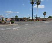
Gateway Inn
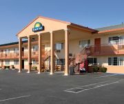
DAYS INN RED BLUFF
Videos from this area
These are videos related to the place based on their proximity to this place.
235 Belle Mill Rd, Red Bluff, CA 96080
http://235bellemill.epropertysites.com?rs=youtube Located next to Applebees - great location for a commercial business! Property has tentatively been approve...
Sacramento River 12/11/14 flood stage
The Sacramento River reaches flood stage in Red Bluff CA after overnight downpours.
Toxic Rocket pilot Glen Wilson makes a lane change
Glen Wilson had his hands full with this pass. Shot at the 2006 Nitro Nationals in Red Bluff, CA. The Toxic team campaigned the Kaase hull design for a couple of years with minimal success....
EMG-6 Test Flight #3
In this video we look at a compilation of the events that took place during test flight number 3. The initial test flights are being conducted by towing the aircraft aloft using a four wheeler...
EMG-6 Towing
In this video we are correlating some of the data related to the tow rope pressures within the tow vehicle and the information on the aircraft related to tow speeds, rate of climb, altitude...
EMG-6 Wing Runner
In this short video clip we look at the talent and effort required to act as a wing runner for a ground launch operation of the EMG-6. Our wing runner in this video is 14-year-old Austin Golden.
EMG-6 Landing using the nose skid
In this short clip we show the EMG-6 landing in no wind conditions using the nose skid as a brake. We had recently changed the main wheel from the larger wheel down to the smaller size will...
EMG-6 Flight #29 Flight Data
In this video we have shown just the instrument cam. This will give a overview of a typical flight. The aircraft is configured with the airspeed indicator on the left side of the instrument...
Videos provided by Youtube are under the copyright of their owners.
Attractions and noteworthy things
Distances are based on the centre of the city/town and sightseeing location. This list contains brief abstracts about monuments, holiday activities, national parcs, museums, organisations and more from the area as well as interesting facts about the region itself. Where available, you'll find the corresponding homepage. Otherwise the related wikipedia article.
Gerber-Las Flores, California
Gerber-Las Flores is a former census-designated place (CDP) in Tehama County, California, United States. The population was 1,389 at the 2000 census.
Rancho Las Flores
Rancho Las Flores was a 13,316-acre Mexican land grant in present day Tehama County, California given in 1844 by Governor Manuel Micheltorena to William Chard. The name means "ranch of the flowers". The grant was on west side of the Sacramento River and was bounded by Rancho Barranca Colorado and Coyote Creek on the north and by Rancho Saucos and Elder Creek on the south, and encompassed present day Gerber and Proberta.


