Safety Score: 2,7 of 5.0 based on data from 9 authorites. Meaning we advice caution when travelling to United States.
Travel warnings are updated daily. Source: Travel Warning United States. Last Update: 2024-08-13 08:21:03
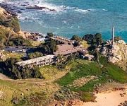
Delve into Walsh Landing
Walsh Landing in Sonoma County (California) is located in United States about 2,466 mi (or 3,969 km) west of Washington DC, the country's capital town.
Current time in Walsh Landing is now 11:42 PM (Friday). The local timezone is named America / Los Angeles with an UTC offset of -8 hours. We know of 8 airports close to Walsh Landing, of which 4 are larger airports. The closest airport in United States is Fort Bragg Airport in a distance of 69 mi (or 111 km), North-West. Besides the airports, there are other travel options available (check left side).
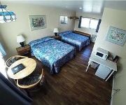
Also, if you like playing golf, there are some options within driving distance. We encountered 3 points of interest near this location. If you need a hotel, we compiled a list of available hotels close to the map centre further down the page.
While being here, you might want to pay a visit to some of the following locations: Santa Rosa, Ukiah, Lakeport, San Rafael and Napa. To further explore this place, just scroll down and browse the available info.
Local weather forecast
Todays Local Weather Conditions & Forecast: 12°C / 54 °F
| Morning Temperature | 9°C / 49 °F |
| Evening Temperature | 8°C / 47 °F |
| Night Temperature | 6°C / 42 °F |
| Chance of rainfall | 2% |
| Air Humidity | 73% |
| Air Pressure | 1015 hPa |
| Wind Speed | Gentle Breeze with 6 km/h (4 mph) from East |
| Cloud Conditions | Clear sky, covering 0% of sky |
| General Conditions | Light rain |
Saturday, 23rd of November 2024
9°C (49 °F)
10°C (50 °F)
Moderate rain, gentle breeze, overcast clouds.
Sunday, 24th of November 2024
10°C (51 °F)
9°C (48 °F)
Light rain, light breeze, overcast clouds.
Monday, 25th of November 2024
10°C (49 °F)
8°C (46 °F)
Light rain, calm, overcast clouds.
Hotels and Places to Stay
Timber Cove
Fort Ross Lodge
Ocean Cove Lodge Bar & Grill
Videos from this area
These are videos related to the place based on their proximity to this place.
West Sonoma Coast
This video is about the Western Sonoma Coast wine region of Sonoma County where the rugged Pacific Coast meets towering Redwoods and vineyards produce world class Pinot Noir and ...
SOLD! 22044 Ninive Drive, Timber Cove, California 95450
http://www.bodegabayhomes.com/properties/ninive22044/ninive22044.htm Located on 2.2 acres of ocean bluff overlooking spectacular Pacific Ocean and the coastline. Established Jenner vacation...
King Ridge GranFondo 2010 - Meyers Grade
Riding along Seaview and the descending toward the coast on Meyers Grade during Levi Leipheimer's King Ridge Gran Fondo 2010.
Costal - Timber Cove Inn California aerial cinematography
Filmed while staying at Timber Cove Inn north of San Francisco on the coast of California. Shot on a GoPro Hero 4 Black on a zenmuse h3-3d gimbal on a phantom 2 using a 7 inch FPV monitor....
Русская Америка Форт Росс.m2p
Автор Леонид Кайзер. Дорога в Форт Росс и внутри форта. Fort Rosse самое южное русское поселение в северной Амери...
A Virtual Tour of Fort Ross State Historic Park
0:00 - Interior of Fort Ross 0:25 - Watchhouse 1:43 - Blockhouse 1:55 - View of the California Coast from the Blockhouse 2:37 - View of the California Coast outside Fort Ross Includes a panorama...
Suited up after diving in the ocean
I kind of resemble a well fed seal. Yes, I got to learn how to swim fast to escape sharks.
Rockfish and Lingcod Fishing Trip
My buddies and I went out on a camping/fishing trip this past weekend and had a blast! We all caught our first ever keeper Lings and I caught my first ever ...
Videos provided by Youtube are under the copyright of their owners.
Attractions and noteworthy things
Distances are based on the centre of the city/town and sightseeing location. This list contains brief abstracts about monuments, holiday activities, national parcs, museums, organisations and more from the area as well as interesting facts about the region itself. Where available, you'll find the corresponding homepage. Otherwise the related wikipedia article.
Stillwater Cove
Stillwater Cove is an inlet between the museum and town of Fort Ross, California and Salt Point State Park. This cove has beautiful views, a beach marked as having dangerous currents, and nearby plentiful red abalone. A loading zone but no parking is available at the cove. On one side are the public campgrounds of Stillwater Cove Regional Park and on the other is a ranch offering rustic lodging. More luxurious accommodations are available, in either direction, slightly farther away.
Salt Point State Park
Salt Point State Park is a state park located at {{#invoke:Coordinates|coord}}{{#coordinates:38.5752|-123.313||||||| | |name= }} in Sonoma County, California, United States. The park covers 6,000 acres on the coast of Northern California with 20 miles of hiking trails and over six miles (10 km) of a rough rocky coast line including Salt Point which protrudes into the Pacific Ocean. The park also features the first underwater preserves in California.
Stillwater Cove Regional Park
Stillwater Cove Regional Park is a regional park north of Jenner, California, U.S.A. that is maintained by the Sonoma County Regional Parks Department. It covers an area of 363 acres . It is located at {{#invoke:Coordinates|coord}}{{#coordinates:38.548|-123.2953|source:gnis-235483_region:US-CA|||||| |primary |name= }}, near the mouth of Stockhoff Creek. Access is by means of State Route 1. The park address is 22455 Highway 1, Jenner, CA.
Gerstle Cove State Marine Reserve
Gerstle Cove State Marine Reserve (SMR) is a marine protected area that lies onshore from Salt Point State Park, within the Salt Point State Marine Conservation Area, in Sonoma County on California’s north central coast. The marine protected area covers 0.1 square miles. Gerstle Cove SMR prohibits the take of all living resources.


