Safety Score: 2,7 of 5.0 based on data from 9 authorites. Meaning we advice caution when travelling to United States.
Travel warnings are updated daily. Source: Travel Warning United States. Last Update: 2024-08-13 08:21:03
Delve into Sereno Del Mar
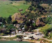
Sereno Del Mar in Sonoma County (California) with it's 126 habitants is a city located in United States about 2,458 mi (or 3,955 km) west of Washington DC, the country's capital town.
Current time in Sereno Del Mar is now 06:25 AM (Monday). The local timezone is named America / Los Angeles with an UTC offset of -8 hours. We know of 8 airports closer to Sereno Del Mar, of which 4 are larger airports. The closest airport in United States is Metropolitan Oakland International Airport in a distance of 65 mi (or 105 km), South-East. Besides the airports, there are other travel options available (check left side).
Also, if you like playing golf, there are some options within driving distance. We saw 3 points of interest near this location. In need of a room? We compiled a list of available hotels close to the map centre further down the page.
Since you are here already, you might want to pay a visit to some of the following locations: Santa Rosa, Lakeport, San Rafael, Ukiah and Napa. To further explore this place, just scroll down and browse the available info.
Local weather forecast
Todays Local Weather Conditions & Forecast: 12°C / 53 °F
| Morning Temperature | 4°C / 39 °F |
| Evening Temperature | 8°C / 46 °F |
| Night Temperature | 4°C / 39 °F |
| Chance of rainfall | 0% |
| Air Humidity | 41% |
| Air Pressure | 1023 hPa |
| Wind Speed | Gentle Breeze with 8 km/h (5 mph) from South-East |
| Cloud Conditions | Few clouds, covering 14% of sky |
| General Conditions | Few clouds |
Monday, 18th of November 2024
12°C (53 °F)
10°C (50 °F)
Light rain, gentle breeze, overcast clouds.
Tuesday, 19th of November 2024
11°C (52 °F)
11°C (52 °F)
Moderate rain, moderate breeze, overcast clouds.
Wednesday, 20th of November 2024
12°C (53 °F)
12°C (54 °F)
Moderate rain, moderate breeze, overcast clouds.
Hotels and Places to Stay
The Jenner Inn
Bodega Coast Inn And Suites
INN AT THE TIDES
BODEGA BAY LODGE
VILLAGE INN AND RESTAURANT
Monte Rio Cottages
Bodega Harbor Inn
BODEGA BAY INN
JENNER VACATION RENTALS
HIGHLAND DELL
Videos from this area
These are videos related to the place based on their proximity to this place.
Bodega Bay
A trip to Bodega Bay on the new bike. Got back from the Army and spent quality time with the Mrs.
Kitesurfing near Bodega Bay, California (1 of 2)
Shots of a man kitesurfing at Salmon Creek, near Bodega Bay on the Sonoma Coast, April 9, 2008.
Kitesurfing near Bodega Bay, California (2 of 2)
Shots of a man kitesurfing at Salmon Creek, near Bodega Bay on the Sonoma Coast, April 9, 2008.
Russian River storm
Seabirds waiting out an early January '08 blow at the mouth of the Russian River, 70 miles north of San Francisco.
California Coastal Trail
This video features scenes from many years of Coastwalk California's hikes along the California Coastal Trail. Coastwalk continues its efforts to complete the Trail, and you can learn more...
California Coastal Trail - Coastwalk
Coastwalk California Coastal Trail discussion before board meeting on Oct 21st.
Sonoma Coast
http://www.sonomauncorked.com/wine-country-places/sonoma-coast/ http://www.sonomauncorked.com A para glider catches the updraft off the rugged Sonoma Coast Cliffs near Goat Rock Beach.
Videos provided by Youtube are under the copyright of their owners.
Attractions and noteworthy things
Distances are based on the centre of the city/town and sightseeing location. This list contains brief abstracts about monuments, holiday activities, national parcs, museums, organisations and more from the area as well as interesting facts about the region itself. Where available, you'll find the corresponding homepage. Otherwise the related wikipedia article.
Duncans Point
Duncans Point is a cape on the Pacific Coast of northern California in the United States. It is located in Sonoma County at {{#invoke:Coordinates|coord}}{{#coordinates:38.393|-123.0947|source:gnis-222718_region:US-CA_type:landmark|||||| |primary |name= }}, approximately 45 miles northwest of San Francisco and approximately 20 miles west of Santa Rosa. The point lies about halfway between Bodega Head (to the south) and Goat Rock (to the north). It is easily reached from State Route 1.
Sonoma Coast State Marine Conservation Area
Sonoma Coast State Marine Conservation Area is a protected area along the coast of northern California, part of the North Central Coast Study Region. It is bounded by the mean high tide line, the 3-fathom depth contour, and several points along 3 miles of coast between Mussel Point and Schoolhouse Beach in Sonoma County. Within this Area, the recreational taking of all marine aquatic plants and some invertebrates is prohibited. Commercial taking of giant kelp and bull kelp is also prohibited.
Rancho Bodega
Rancho Bodega was a 35,487-acre Mexican land grant in present day Sonoma County, California given in 1844 by Governor Manuel Micheltorena to Stephen Smith. Bodega takes its name from the Peruvian explorer Juan Francisco de la Bodega y Quadra who discovered Bodega Bay in 1775. The grant extended along the Pacific coast from the Russian River to the north and Estero Americano to the south, and included present day Bodega Bay.


