Safety Score: 2,7 of 5.0 based on data from 9 authorites. Meaning we advice caution when travelling to United States.
Travel warnings are updated daily. Source: Travel Warning United States. Last Update: 2024-08-13 08:21:03
Delve into Toland Landing
Toland Landing in Solano County (California) is a city located in United States about 2,394 mi (or 3,853 km) west of Washington DC, the country's capital town.
Current time in Toland Landing is now 08:50 PM (Thursday). The local timezone is named America / Los Angeles with an UTC offset of -8 hours. We know of 8 airports closer to Toland Landing, of which 4 are larger airports. The closest airport in United States is Metropolitan Oakland International Airport in a distance of 36 mi (or 58 km), South-West. Besides the airports, there are other travel options available (check left side).
Also, if you like playing golf, there are some options within driving distance. We saw 7 points of interest near this location. In need of a room? We compiled a list of available hotels close to the map centre further down the page.
Since you are here already, you might want to pay a visit to some of the following locations: Fairfield, Martinez, Stockton, Sacramento and Napa. To further explore this place, just scroll down and browse the available info.
Local weather forecast
Todays Local Weather Conditions & Forecast: 14°C / 57 °F
| Morning Temperature | 15°C / 58 °F |
| Evening Temperature | 13°C / 56 °F |
| Night Temperature | 13°C / 55 °F |
| Chance of rainfall | 30% |
| Air Humidity | 82% |
| Air Pressure | 1015 hPa |
| Wind Speed | Moderate breeze with 11 km/h (7 mph) from North-West |
| Cloud Conditions | Overcast clouds, covering 100% of sky |
| General Conditions | Heavy intensity rain |
Friday, 22nd of November 2024
15°C (59 °F)
9°C (49 °F)
Moderate rain, gentle breeze, clear sky.
Saturday, 23rd of November 2024
8°C (47 °F)
10°C (51 °F)
Light rain, gentle breeze, overcast clouds.
Sunday, 24th of November 2024
11°C (52 °F)
11°C (51 °F)
Light rain, gentle breeze, overcast clouds.
Hotels and Places to Stay
Antioch Executive Inn
Economy Inn Antioch
Americas Best Value Inn - Antioch / Bay Area
Days Inn And Suites Antioch
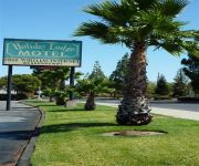
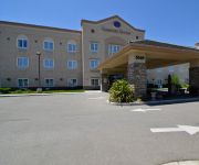
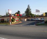
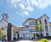
BEST WESTERN PLUS DELTA HOTEL
Vista Royal Inn
RIO SANDS LODGE
RAMADA ANTIOCH
Videos from this area
These are videos related to the place based on their proximity to this place.
Autumn Lake Dental - About Us
Located in Oakley, CA. Visit us at www.OakleyFamilyDentistry.com or call us to setup a dental appointment 925-575-9504.
Coast Guard Station Rio Vista receives Kimball Award
RIO VISTA, Calif. - The crew of Station Rio Vista was presented the Sumner I. Kimball Readiness Award by Rear Adm. Paul F. Zukunft, commanding officer Eleventh Coast Guard District, June 10,...
Windmills at Rio Vista, CA and Rio Vista bridge over Sacramento River
Wind turbines in the Montezuma Hills near Rio Vista, California. 4k footage from dji inspire 1.
Simpson Percherons in Rio Vista Bass Festival Parade 2006
Beautiful Simpson Percherons which participate in the Bass Festival parade each year. (http://www.bassfestival.com/) A Simpson Percheron team won first place, North American Six Horse Hitch...
Trilogy Rio Vista Motorcycle Club Leads the 4th of July Parade 2014
The Windy City Riders lead the 2014 4th of July Parade through the streets of Trilogy @ Rio Vista, CA.
Pole Vualting in Rio Vista 2
Olympian pole vault hopefuls training in Rio Vista May 2007. Her personal best.
Videos provided by Youtube are under the copyright of their owners.
Attractions and noteworthy things
Distances are based on the centre of the city/town and sightseeing location. This list contains brief abstracts about monuments, holiday activities, national parcs, museums, organisations and more from the area as well as interesting facts about the region itself. Where available, you'll find the corresponding homepage. Otherwise the related wikipedia article.
Sherman Island (California)
Sherman Island is an island in the Sacramento-San Joaquin River Delta at the confluence of the two rivers in Sacramento County, California, two kilometres northeast of Antioch. The 5,500 ha island is the meeting point of Sacramento-, Solano-, and Contra Costa-Counties, and is bordered on the north and northwest by the Sacramento River, on the northeast by Three Mile Slough, and on the east, and south west by the San Joaquin River.


