Safety Score: 2,7 of 5.0 based on data from 9 authorites. Meaning we advice caution when travelling to United States.
Travel warnings are updated daily. Source: Travel Warning United States. Last Update: 2024-08-13 08:21:03
Explore Hammond Ranch
Hammond Ranch in Siskiyou County (California) is located in United States about 2,375 mi (or 3,822 km) west of Washington DC, the country's capital.
Local time in Hammond Ranch is now 03:35 PM (Tuesday). The local timezone is named America / Los Angeles with an UTC offset of -8 hours. We know of 8 airports in the wider vicinity of Hammond Ranch. The closest airport in United States is Montague-Yreka Rohrer Field in a distance of 25 mi (or 41 km), North. Besides the airports, there are other travel options available (check left side).
There is one Unesco world heritage site nearby. It's Redwood National and State Parks in a distance of 21 mi (or 33 km), East. Also, if you like golfing, there are multiple options in driving distance. If you need a place to sleep, we compiled a list of available hotels close to the map centre further down the page.
Depending on your travel schedule, you might want to pay a visit to some of the following locations: Yreka, Redding, Weaverville, Klamath Falls and Medford. To further explore this place, just scroll down and browse the available info.
Local weather forecast
Todays Local Weather Conditions & Forecast: 8°C / 46 °F
| Morning Temperature | 4°C / 40 °F |
| Evening Temperature | 4°C / 39 °F |
| Night Temperature | 2°C / 35 °F |
| Chance of rainfall | 0% |
| Air Humidity | 40% |
| Air Pressure | 1025 hPa |
| Wind Speed | Light breeze with 5 km/h (3 mph) from South |
| Cloud Conditions | Overcast clouds, covering 100% of sky |
| General Conditions | Overcast clouds |
Tuesday, 5th of November 2024
10°C (50 °F)
5°C (41 °F)
Sky is clear, light breeze, clear sky.
Wednesday, 6th of November 2024
14°C (58 °F)
7°C (45 °F)
Sky is clear, calm, clear sky.
Thursday, 7th of November 2024
13°C (56 °F)
7°C (45 °F)
Broken clouds, light breeze.
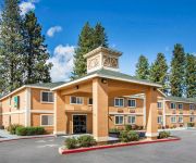
Hotels and Places to Stay
BEST WESTERN PLUS TREE HOUSE
Sis Q Inn
Town House Motel
Comfort Inn Mount Shasta Area
Quality Inn & Suites Weed
MOTEL 6 WEED
Videos from this area
These are videos related to the place based on their proximity to this place.
Union Pacific Freight Train at Mt Shasta Oct 2011
Mt Shasta CA - Uphill freight headed to Hinkle via Black Butte, Weed and Dorris.
Mount Shasta Biking
SHASTA DESTINATION MANAGEMENT-- http://www.Shasta-Vacation-Rentals.Com http://www.ShastaDestinationManagement.Com/About_us.html Traveling Hwy 5 to or from Oregon, majestic 14162...
The Gallery in Mount Shasta | Upstairs Experience
Located in beautiful Mount Shasta, California, USA. The Gallery Experience on the second floor contains some of the largest displays of original art for sale from master artists mostly from...
Northbound Amtrak Coast Starlight #14 Highballs Through Mt. Shasta, California
It's dawn and light snows are falling this morning as Amtrak's northbound Coast Starlight #14 rolls through the City of Mount Shasta on April 10th, 2009 at 6:35AM with GE P42DC's #63 and #197...
Sacremento Headwaters - Mt. Shasta, CA
This spring in the Mt. Shasta City Park is the main spring and start of the Sacramento River. Clean cold water flows out of the base of Mt. Shasta. For more information on this and similar...
Weed Fire
Weed Boles Fire Corner of Boles St / S Weed Blvd. I work at the College of the Siskiyous in Weed, and many of my friends lost their homes. It was a scary time. Praise God that lives were spared.
Boles Fire Weed, CA Weed High School
BolesFire Weed, CA -Video # 27: 9/16/2014 7:52 AM Flag flying high at Weed High School.
Boles Fire Weed CA Hillside Drive Weed Elementary School
BolesFire Weed, CA -Video # 26: 9/16/2014 7:38 AM Hillside Drive starting at Weed Elementary and heading East.
Boles Fire Weed, CA Sad Whirly Gigs
Sad little whirly gigs - all that is left standing of this home - blowing in the same constant wind that pushed this fire thru the town of weed.
Videos provided by Youtube are under the copyright of their owners.
Attractions and noteworthy things
Distances are based on the centre of the city/town and sightseeing location. This list contains brief abstracts about monuments, holiday activities, national parcs, museums, organisations and more from the area as well as interesting facts about the region itself. Where available, you'll find the corresponding homepage. Otherwise the related wikipedia article.
College of the Siskiyous
College of the Siskiyous (COS) is a public two-year community college with campus is located in Weed and Yreka in Siskiyou County in Northern California. It is part of the California Community Colleges System, serving as the northernmost college in the state of California and the only college in Siskiyou County. The college is in the service area of California State University, Chico and one of only ten community colleges in California that provide on-campus dormitories for students.


