Safety Score: 2,7 of 5.0 based on data from 9 authorites. Meaning we advice caution when travelling to United States.
Travel warnings are updated daily. Source: Travel Warning United States. Last Update: 2024-08-13 08:21:03
Discover Country Aire Mobile Home Park
Country Aire Mobile Home Park in Shasta County (California) is a place in United States about 2,383 mi (or 3,835 km) west of Washington DC, the country's capital city.
Current time in Country Aire Mobile Home Park is now 02:43 AM (Monday). The local timezone is named America / Los Angeles with an UTC offset of -8 hours. We know of 10 airports near Country Aire Mobile Home Park, of which two are larger airports. The closest airport in United States is Benton Field in a distance of 4 mi (or 6 km), West. Besides the airports, there are other travel options available (check left side).
There is one Unesco world heritage site nearby. It's Redwood National and State Parks in a distance of 58 mi (or 93 km), North. Also, if you like playing golf, there are a few options in driving distance. We encountered 4 points of interest in the vicinity of this place. If you need a hotel, we compiled a list of available hotels close to the map centre further down the page.
While being here, you might want to pay a visit to some of the following locations: Redding, Red Bluff, Weaverville, Willows and Yreka. To further explore this place, just scroll down and browse the available info.
Local weather forecast
Todays Local Weather Conditions & Forecast: 9°C / 49 °F
| Morning Temperature | 2°C / 36 °F |
| Evening Temperature | 7°C / 45 °F |
| Night Temperature | 3°C / 37 °F |
| Chance of rainfall | 0% |
| Air Humidity | 54% |
| Air Pressure | 1021 hPa |
| Wind Speed | Light breeze with 4 km/h (2 mph) from East |
| Cloud Conditions | Clear sky, covering 7% of sky |
| General Conditions | Sky is clear |
Monday, 18th of November 2024
8°C (46 °F)
7°C (45 °F)
Moderate rain, gentle breeze, overcast clouds.
Tuesday, 19th of November 2024
6°C (43 °F)
6°C (42 °F)
Heavy intensity rain, gentle breeze, overcast clouds.
Wednesday, 20th of November 2024
6°C (44 °F)
6°C (43 °F)
Heavy intensity rain, light breeze, overcast clouds.
Hotels and Places to Stay
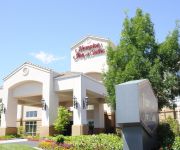
Hampton Inn - Suites Redding
Holiday Inn REDDING
Hope Inn Redding
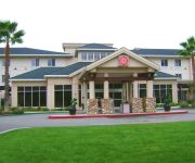
Hilton Garden Inn Redding
RED LION REDDING
La Quinta Inn and Suites Redding
RED LION INN REDDING
BEST WESTERN PLUS HILLTOP INN
TownePlace Suites Redding
HOWARD JOHNSON REDDING
Videos from this area
These are videos related to the place based on their proximity to this place.
Sundial Bridge next to Turtle Bay in Redding, California
Up, over and around a very unique pedestrian bridge in Redding, California with my DJI Phantom quadcopter with a GoPro camera mounted.
2011 Redding Air Show
The 2011 Redding Air Show in Redding, Calif. featured the USAF Thunderbirds on 9/24/11.
T&F Property Management Redding Reviews | (530) 226-5300 | 5 Star Reviews - Redding CA
T&F Property Management Redding Reviews | (530) 226-5300 | 5 Star Reviews - Redding CA http://www.TandF.us Becky has managed my property for the last couple of years and oh what a relief it...
RV Roadtrip Diary USA - Part 13 of 15 - Sundial Bridge Redding
Book your own holiday from http://goo.gl/4b90J Follow Rohan and Paul and the mischief they get up to as they travel through some of the most beautiful parts of America and the Californian...
Redding's Custom Short Run Embroidery Shop Review
http://reddingembroidery.com (530) 246-2878 Finding short run custom embroidery for small personal projects or small business in Redding CA. is tough unless you know about Willow Tree Embroidery ...
Sundial Bridge, Redding CA
A short flight around Sundial Bridge in Redding CA Flight Data Log: http://www.flytrex.com/mission/quadcopter-uss-defiant-chuck-hutchins-CmHBPaaa/
Fly Fishing Lower Sacramento River with Walter - 10/6/13 - Redding, CA
Fly Fishing the Lower Sacramento River in Redding, CA on Sunday 10/6/13 with Walter, and he strips in one of the biggest Rainbow Trout he has caught on the river. Fishing rig consisted of indicator...
Redding Ca to WhiskeyTown Lake Brandy Creek beach time lapse
Taking a short trip to Whiskytown lake parking lot. Nice view along the way. This is a video from my old channel, AccordingtoAdam1826, that was closed due to uncertain circumstances. We are...
Simpson University Science and Nursing Building Construction - Steel Framing
Time-Lapse video of Simpson University's new Science and Nursing building. November 2013. This is a preview of the full time-lapse video, produced by Kronovu for Simpsopn University. Simpson...
Library Hours
Provides information on library hours for the Simpson University library. Describes seasonal changes and where to reference schedule changes and exceptions.
Videos provided by Youtube are under the copyright of their owners.
Attractions and noteworthy things
Distances are based on the centre of the city/town and sightseeing location. This list contains brief abstracts about monuments, holiday activities, national parcs, museums, organisations and more from the area as well as interesting facts about the region itself. Where available, you'll find the corresponding homepage. Otherwise the related wikipedia article.
Redding, California
Redding is a city in Upstate California, located on Interstate 5 halfway between the Mexico and Canada borders, with the Sacramento River coursing through it. It is the county seat of Shasta County, California, USA. With a population of 89,861 as of the 2010 Census, Redding is the largest city in the Shasta Cascade region and is the fourth largest city in the Sacramento Valley behind Sacramento, Elk Grove, and Roseville.
Sundial Bridge at Turtle Bay
The Sundial Bridge (also known as the Sundial Bridge at Turtle Bay) is a cantilever spar cable-stayed bridge for bicycles and pedestrians that spans the Sacramento River in Redding, California, United States and forms a large sundial. It was designed by Santiago Calatrava and completed in 2004 at a cost of US$23,500,000. The bridge has become iconic for Redding.
Turtle Bay Exploration Park
Turtle Bay Exploration Park, located in Redding, California, is a museum complex that interprets the relationship between humans and nature. The attractions include a botanical garden, a natural history and science museum, a "camp" for nature, history and science education programs, and seasonal animal programs.
KQMS (AM)
KQMS (1400 AM, "NewsTalk 1400") is an American News/Talk radio station based in Redding, California. The station is now owned by Mapleton Communications of Los Angeles, which also owns its five sister stations in Redding and four stations in Chico, California. It is generally known as a conservative talk radio station, since all of its main radio shows except for Coast To Coast AM are considered to be conservative shows. KQMS-AM first signed on the air as a music station in the 1940s.
KNRO
KNRO is a radio station that carries a sports format. Licensed to Redding, California, USA, the station serves the Redding and Red Bluff areas. The station is owned by Mapleton License of Redding, LLC and features programing from Fox Sports Radio.
Mistletoe School
Mistletoe School is a public elementary school, built in 1961, with 584 students in grades K-8 located at 1225 Mistletoe Ln. , Redding, California 96002 in Shasta County and is part of the Enterprise Elementary School District. The school mascot is a bulldog. {{#invoke:Coordinates|coord}}{{#coordinates:40|34|41|N|122|20|58|W|region:US-CA_type:edu_source:GNIS |primary |name= }}
Enterprise, Shasta County, California
Enterprise was an unincorporated community in Shasta County, California. It was annexed into the city of Redding, California back in the 1970s. It lies at an elevation of 538 feet (164 m).
Bethel Church (Redding, California)
Bethel Church is a charismatic megachurch that was established in Redding, California as an Assemblies of God congregation in 1954, and has since grown to an estimated weekly attendance of over 3,000 people. The Bethel School of Supernatural Ministry was founded by the church in 1998.


