Safety Score: 2,7 of 5.0 based on data from 9 authorites. Meaning we advice caution when travelling to United States.
Travel warnings are updated daily. Source: Travel Warning United States. Last Update: 2024-08-13 08:21:03
Discover Colache Town
The district Colache Town of Watsonville in Santa Cruz County (California) is a district in United States about 2,417 mi west of Washington DC, the country's capital city.
Looking for a place to stay? we compiled a list of available hotels close to the map centre further down the page.
When in this area, you might want to pay a visit to some of the following locations: Salinas, Santa Cruz, Hollister, San Jose and Redwood City. To further explore this place, just scroll down and browse the available info.
Local weather forecast
Todays Local Weather Conditions & Forecast: 14°C / 57 °F
| Morning Temperature | 6°C / 43 °F |
| Evening Temperature | 10°C / 50 °F |
| Night Temperature | 6°C / 43 °F |
| Chance of rainfall | 0% |
| Air Humidity | 39% |
| Air Pressure | 1021 hPa |
| Wind Speed | Gentle Breeze with 8 km/h (5 mph) from South-East |
| Cloud Conditions | Overcast clouds, covering 86% of sky |
| General Conditions | Overcast clouds |
Tuesday, 19th of November 2024
14°C (56 °F)
9°C (48 °F)
Overcast clouds, light breeze.
Wednesday, 20th of November 2024
13°C (56 °F)
9°C (49 °F)
Overcast clouds, light breeze.
Thursday, 21st of November 2024
14°C (58 °F)
10°C (50 °F)
Overcast clouds, light breeze.
Hotels and Places to Stay
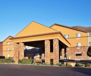
Holiday Inn Express & Suites WATSONVILLE
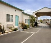
National 9 Motel
AMERICAS BEST VALUE INN
BW ROSE GARDEN INN
Rodeway Inn Watsonville
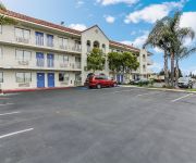
MOTEL 6 WATSONVILLE MONTEREY AREA
Comfort Inn Watsonville
Videos from this area
These are videos related to the place based on their proximity to this place.
Boudoir Photography Santa Cruz, Watsonville, Monterey, Salinas, Hollister, CA
Santa Cruz Boudoir Photographer. We are boudoir photographers in Monterey, CA, Boudoir Photographer Salinas, CA, Boudoir Photographer Hollister, Watsonville Boudoir photographer, and San Jose...
Live from the Fields: Strawberries. Watsonville, CA
Markon Live From the Fields video about strawberry quality in Watsonville, California. Strawberry quality is better than expected after last week's record-breaking heat wave. Weather has stabilized...
Boudoir Photography, Watsonville, Monterey, Santa Cruz, Salinas, San Francisco, CA
www.sanfranciscopinups.com (831) 768-1015 Boudoir Photographer Watsonville, CA. Our services include boudoir photography, pin up photography, maternity boudoir photography and Fine Art Nude.
Pinup Photographer Watsonville, CA
www.sanfranciscopinups.com (831) 768-1015 Pinup Photographer Watsonville, CA. Our photo studio specializes in pinup photography, boudoir photography Watsonville, maternity boudoir ...
Fake Hammerhead on Cessna near Watsonville, CA
Some tricks on small Cessna plane perfromed by Karl. It was actually a lazy 8 and some zero g after that. Recorded by GoPro3 Black.
Engagement Photography Watsonville, Monterey, Salinas, Hollister, Santa Cruz
Engagement Photographer Watsonville, CA. www.montanezphoto.com We also cover the following areas: Monterey Engagement Photography, Salinas Engagement Photography, Hollister ...
GRUDGE MATCH! El Pistolero vs Persian Prince PWR Watsonville
July 28th, 2013 in Watsonville, Ca. Pistolero took on Persian Prince in a Grudge Match! For more information visit our website at www.prowrestling-revolution.com.
108 Crespi CI #108, Watsonville - Wonderful triple wide mobile home
Wonderful triple wide mobile home,spacious,clean and ready for you to call home.This unit features a large master bedroom with large walk in closet,a master bathroom that offers a separate...
CampgroundViews.com - Mt. Madonna County Park Watsonville California CA Campground
http://www.CampgroundViews.com takes user submitted videos combined with professional editing to provide tent and RV campers with a first person view of a campground or RV park. Mt. Madonna...
Watsonville Wedding Photographers | Watsonville Wedding Photography | Watsonville CA Photographer
Watsonville Wedding Photographers , Watsonville Wedding Photographer , Watsonville Wedding Photography , http://www.ManuelOrtegaPhoto.com , Wedding Photographers Watsonville, Watsonville ...
Videos provided by Youtube are under the copyright of their owners.
Attractions and noteworthy things
Distances are based on the centre of the city/town and sightseeing location. This list contains brief abstracts about monuments, holiday activities, national parcs, museums, organisations and more from the area as well as interesting facts about the region itself. Where available, you'll find the corresponding homepage. Otherwise the related wikipedia article.
Elkhorn, California
Elkhorn is a census-designated place (CDP) in Monterey County, California, United States. Elkhorn was a stop on the Southern Pacific Railroad 13 miles northwest of Prunedale, at an elevation of 10 feet (3 m). The population of Elkhorn was 1,565 at the 2010 census, down from 1,591 at the 2000 census. Elkhorn was named after the elk in the area that have since gone extinct. Because Elkhorn is not incorporated, not all residents call the place they live Elkhorn.
Las Lomas, California
Las Lomas (formerly, Hall) is a census-designated place (CDP) in Monterey County, California, United States. Las Lomas is located 7 miles north-northwest of Prunedale, at an elevation of 43 feet (13 m). The population was 3,024 at the 2010 census, down from 3,078 at the 2000 census.
Pajaro, California
Pajaro is a census-designated place (CDP) in Monterey County, California, United States. Pajaro is located on the south bank of the Pajaro River 5 miles northeast of its mouth, at an elevation of 26 feet (8 m). The population was 3,070 at the 2010 census, down from 3,384 at the 2000 census. The school district is in Santa Cruz County. The town, the name of which is derived from pájaro, is in the Pajaro Valley on the Pajaro River, which divides the city from Watsonville and Santa Cruz County.
Amesti, California
Amesti is a census-designated place (CDP) in Santa Cruz County, California, United States. The population was 3,478 at the 2010 census. Amesti is named for José Amesti, a Basque who came to California in 1822, and who was the grantee of Rancho Los Corralitos.
Aptos Hills-Larkin Valley, California
Aptos Hills-Larkin Valley is a census-designated place (CDP) in Santa Cruz County, California, United States. The population was 2,381 at the 2010 census.
Corralitos, California
Corralitos is a census-designated place (CDP) in Santa Cruz County, California, United States. The population was 2,326 at the 2010 census.
Freedom, California
Freedom is a census-designated place (CDP) in Santa Cruz County, California, United States. The population was 3,070 at the 2010 census.
Interlaken, California
Interlaken is a census-designated place (CDP) in Santa Cruz County, California, United States. The population was 7,321 at the 2010 census.
Watsonville, California
Watsonville is a city in Santa Cruz County, California, United States. The population was 51,199 according to the 2010 census. Located on the central coast of California, the economy centers predominantly around the farming industry. It is known for growing strawberries, apples, lettuce and a host of other vegetables. Watsonville is home to people of varied ethnic backgrounds.
Zmudowski State Beach
Zmudowski State Beach is a beach near Moss Landing in Monterey County, California, United States, operated by the California Department of Parks and Recreation. It is a popular fishing area, featuring perch, kingfish, sole, flounder, halibut, bocaccio (tomcod), jacksmelt, lingcod, cabezon, salmon, steelhead, and occasional rockfish. The beach features the Pajaro River estuary, where a natural preserve has been set aside. The sandy beach is also popular with bird watchers and equestrians.
Watsonville Municipal Airport
Watsonville Municipal Airport is a public airport located three miles (5 km) northwest of the central business district (CBD) of Watsonville, a city in Santa Cruz County, California, USA. The airport covers 330 acres and has two runways. The largest aircraft to ever land at Watsonville were 05-5141 and 05-5143, C-17 Globemaster IIIs from March ARB, CA.
Monterey Bay Academy Airport
Monterey Bay Academy Airport is located near the city of Watsonville in Santa Cruz County, California, USA. This private use airport is owned by the Seventh-day Adventist Church and located on the campus of the Monterey Bay Academy, site of the former Camp McQuaide.
Sunset State Beach
Sunset State Beach is a beach approximately 1.5 mile (2.5 km) long, near Watsonville, California in Santa Cruz County. It is operated by the California Department of Parks and Recreation. It is surrounded by large agricultural fields west of the city of Watsonville. North of Sunset Beach is Manresa State Beach.
Area code 831
The map to the right is now clickable; click on an area code to go to the page for that area code. The area code in red is Area Code 831; all others in blue are California area codes. Error: Image is invalid or non-existent. North American area code 831 is a California area code which covers Salinas, Hollister, Monterey, Santa Cruz and the northern Central Coast. It was created in a split from area code 408 on July 11, 1998.
Monterey Bay Academy
Monterey Bay Academy (MBA) is a private school in Santa Cruz County, California.
Saint Francis Central Coast Catholic High School
Saint Francis Central Coast Catholic High School is a Catholic School located in Watsonville, California. The school was named after Saint Francis of Assisi and Saint Francis de Sales, and is operated by an independent corporation that is a partnership between the Salesian Society and the Roman Catholic Diocese of Monterey.
KAPU-LP
KAPU-LP is a radio station broadcasting a Hawaiian Music format. Licensed to serve Watsonville, California, USA, the station is currently owned by Ohana De Watsonville. Starting its broadcast in September 2004, KAPU-LP claims to be the only radio station on the U.S. mainland broadcasting a Hawaiian Music format 24 hours a day.
Rancho Vega del Rio del Pajaro
Rancho Vega del Rio del Pajaro was a 4,310-acre Spanish land concession in present day Monterey County, California given in 1821 by Pablo Vicente de Solá to Antonio Maria Castro. The grant was confirmed by Mexican Governor José Figueroa in 1833. The name means "a meadow along the Pajaro River". The rancho lands bordered the Pajaro River and include the present day Vega and Watsonville.
Rancho Salsipuedes
Rancho Salsipuedes was a 31,201-acre Mexican land grant in present day Santa Cruz County, California. Two leagues were granted in 1834 by Governor José Figueroa to Francisco de Haro. Eight leagues were granted in 1840 by Governor Juan Alvarado to Manuel Casarin. The name means "leave if you can" in Spanish. Salsipuedes encommpasses the mountainous area west of Gilroy, straddling the Santa Clara County - Santa Cruz County line (only about 5,400 acres are in Santa Clara County).
Rancho San Andrés
Rancho San Andrés was a 8,911-acre Mexican land grant in present day Santa Cruz County, California given in 1833 by Governor José Figueroa to José Joaquín Castro. The grant on Monterey Bay extended from La Selva Beach on the north to Watsonville Slough on the south. Rancho Aptos of his son Rafael Castro formed the north boundary of the grant.
Rancho Bolsa de San Cayetano
Rancho Bolsa de San Cayetano was a 8,896-acre Mexican land grant in present day Monterey County, California given in 1824 by Governor Luís Antonio Argüello to Ygnacio Ferrer Vallejo, and confirmed to his eldest son, José de Jesús Vallejo, by Governor José Figueroa in 1834. The name means "pocket of St. Cayetano". Pocket usually refers to land surrounded by slough - in this case the Elkhorn Slough.
Rancho Bolsa del Pajaro
Rancho Bolsa del Pajaro was a 5,496-acre Mexican land grant in present day Santa Cruz County, California given in 1837 by Governor Juan B. Alvarado to Sebastian Rodríguez. The name means "pocket of the Pajaro". Pocket usually refers to land surrounded by slough - in this case the Watsonville Slough. The grant extended from Monterey Bay to present day Watsonville with the Pajaro River as its southern boundary.
Rancho Los Carneros (Littlejohn)
Rancho Los Carneros was a 4,482-acre Mexican land grant in present day Monterey County, California given in 1834 by Governor José Figueroa to David Littlejohn. The name means "sheep". The grant was east of Elkhorn Slough and encompassed present day Elkhorn.
Rancho Los Corralitos
Rancho Los Corralitos was a 15,440-acre Mexican land grant in present day Santa Cruz County, California given in 1823 by Governor Luis Antonio Argüello, with a confirmatory grant in 1844 by Governor Manuel Micheltorena to José Amesti. "Los Corralitos" means "the little corrals" in Spanish. The grant extended along Corralitos Creek north of Watsonville, and encompassed present day Corralitos and Amesti.
Monsbey College
Monsbey College is a private vocational college offering over five programs, including Certified Nursing Assistant, Home Health Aide, Pharmacy Technician, Medical Assistant, and Medical terminology . Its main campus is located in Watsonville, California. The college opened in 2008. As is true with most vocational colleges, the a majority of its students attend part-time. A main attraction to the college is the low cost and efficient training under those with years of experience.


